Camp Bay Road
11 reports at 5 addresses in Port Levy, the first in 2017, the latest 2026. 11 separate days somebody filed something about it.
Where it runs
Each report dot is the average of the spots reports were filed from, where reporters stood on Camp Bay Road, not the street’s surveyed line. The strong outline is Port Levy.
From the air, then
Sourced from Canterbury Maps and partners. LINZ, CC BY 3.0 NZ. Each frame is cut from Environment Canterbury’s historic imagery MapServer for that decade, only where the Footprints layer names a CC BY survey (NZAM-covered spots stay out). RetroLens holds more Crown aerials →
The addresses on it
- 444 Camp Bay Road, 6 reports
- 257 Camp Bay Road, 2 reports
- 440B Camp Bay Road, 1 report
- 436 Camp Bay Road, 1 report
- 343-257 Camp Bay Road, 1 report
What got reported
- Trees & parks, 5 reports
- Roads & footpaths, 3 reports
- Everything else, 2 reports
- Water & drains, 1 report
Year by year
- 2017, 1 report
- 2021, 1 report
- 2022, 1 report
- 2023, 1 report
- 2024, 1 report
- 2025, 3 reports
The named ground
the council’s own structure register, bridges, boardwalks and steps standing nearby, the open map’s record.
Its file in the papers
Papers Past records that surfaced when the archive searched for the street’s name, they answered the search; whether they are about this street is a reader’s call, at the link.
- Page 9 Advertisements Column 2 (Lyttelton Times, 01 May 1852) · Lyttelton Times,
- Page 12 Advertisements Column 2 (Lyttelton Times, 15 May 1852) · Lyttelton Times,
- Untitled (Akaroa Mail and Banks Peninsula Advertiser, 30 October 1877) · Akaroa Mail and Banks Peninsula Advertiser,
- Page 3 Advertisements Column 2 (Akaroa Mail and Banks Peninsula Advertiser, 12 March 1878) · Akaroa Mail and Banks Peninsula Advertiser,
- COLONEL SCRATO LEY'S REPORT. (Star, 12 July 1880) · Star,
- CANTERBURY CATHOLIC LITERARY SOCIETY. (New Zealand Tablet, 13 January 1888) · New Zealand Tablet,
- THE NEW ZEALANDER AT HOME. (Otago Witness, 04 September 1890) · Otago Witness,
- EASTER HOLIDAYS ON THE PENINSULA. (Akaroa Mail and Banks Peninsula Advertiser, 15 April 1892) · Akaroa Mail and Banks Peninsula Advertiser,
- THE MOUNTED RIFLES. (Akaroa Mail and Banks Peninsula Advertiser, 20 April 1892) · Akaroa Mail and Banks Peninsula Advertiser,
- Local & General. (Star, 11 March 1893) · Star,
- THE VOLUNTEERS. (Star, 01 April 1893) · Star,
- THE VOLUNTEERS. (Star, 03 April 1893) · Star,
- AN INTERESTING CAREER. (Star, 16 January 1900) · Star,
- LAND AND WATER. (Otago Witness, 18 January 1905) · Otago Witness,
- BANKS PENINSULA RABBIT BOARD OF TRUSTEES. (Akaroa Mail and Banks Peninsula Advertiser, 01 April 1913) · Akaroa Mail and Banks Peninsula Advertiser,
- LOCAL AND GENERAL. (Akaroa Mail and Banks Peninsula Advertiser, 21 May 1915) · Akaroa Mail and Banks Peninsula Advertiser,
- The Akaroa Mail. TUESDAY, MAY 30, 1916. (Akaroa Mail and Banks Peninsula Advertiser, 30 May 1916) · Akaroa Mail and Banks Peninsula Advertiser,
- MOUNT HERBERT COUNTY COUNCIL. (Akaroa Mail and Banks Peninsula Advertiser, 13 November 1917) · Akaroa Mail and Banks Peninsula Advertiser,
- LOCAL AND GENERAL. (Akaroa Mail and Banks Peninsula Advertiser, 05 November 1918) · Akaroa Mail and Banks Peninsula Advertiser,
- YOUTH HOSTELS (Evening Post, 11 August 1932) · Evening Post,
As it was reported


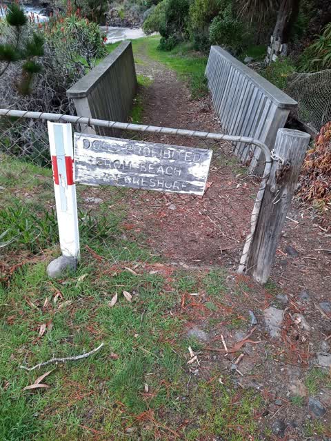
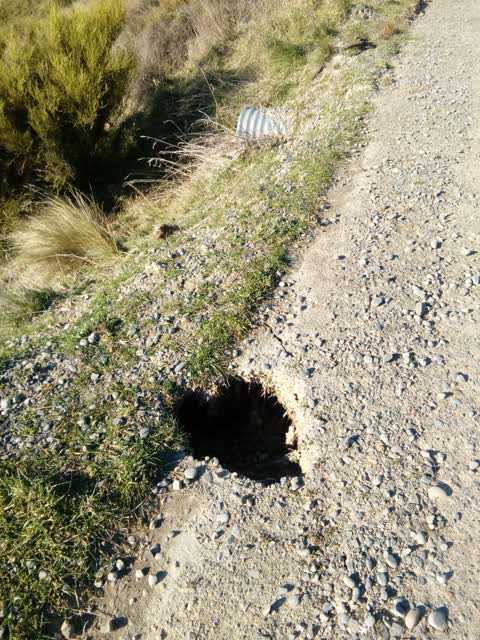
The latest on it
- Roads - General, 343-257 Camp Bay Road,
- Road Signage, 257 Camp Bay Road,
- General Request, 444 Camp Bay Road,
- Park - General Request, 444 Camp Bay Road,
- Public Toilet, 444 Camp Bay Road,
- General Request, 444 Camp Bay Road,
- Public Toilet, 444 Camp Bay Road,
- Sewer - Leak / Blockage, 436 Camp Bay Road,
- Overgrown Vegetation, 444 Camp Bay Road,
- Parks, 440B Camp Bay Road,
- Roading/Streets, 257 Camp Bay Rd,
Questions, answered briefly
In Port Levy, Christchurch, New Zealand.
11 reports at 5 addresses, most often trees & parks (5), roads & footpaths (3), everything else (2).
2017, the record covers 11 separate days somebody filed something about it, through 2026.
Every street the archive knows → · Port Levy → · This street as a feed →