120 Blighs Road, Strowan
56 reports on record since June 2019 · 41 with photographs. The most-reported address on Blighs Road. Indicative rating valuation and school zones, hazards, bin day and what stood here before.
What gets reported here
Photographed here 41 on record




Reported here
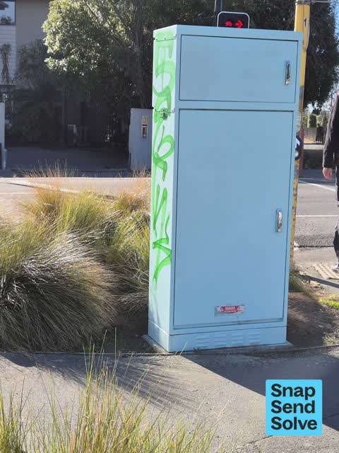
 Graffiti on a traffic light pole or cabinet, or wa —
 on traffic signals control box Blighs Rd level crossing
 Graffiti on a fence, building or structure —
 graffiti all down the railway line near blighs road
 Accessibility —
 Hole in pavement for cycleway sensor/ pedestrian walkway.
 General Request —
 abandoned trolley - SaveMore (not on abandoned trolley list)
 Roads - General —
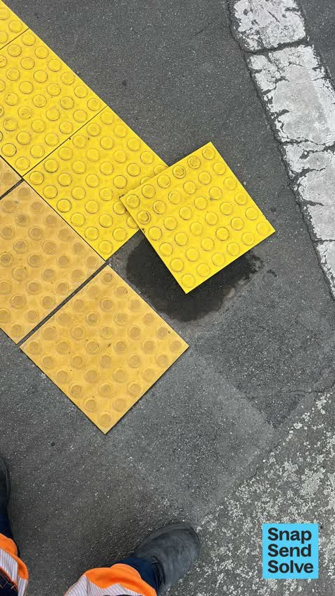
 Tile at railway crossing has come unstuck could cause slip trips and falls lots of children and elderly in this area.
 Pavement - Damaged —
 Sink hole in pavement
 Graffiti on a traffic light pole or cabinet, or wa —
 traffic signals at blighs Rd level crossing
 Pavement - Damaged —
 Pavement hazardous to walk and cycle on. Surface has subsided, creating a hole. Also, cycle sensor in imbedded and weeds growing tall. L
 Pavement - Damaged —
 Ground under pavement subsided causing a tripping hazard to the pathway.
 Water Leak —
 Water meter leaking
- Traffic Signals —
Blighs road railway crossing barrier arms have been down for the last hour and railway signals have been continuous. Traffic is backed up bo
- Pavement - Damaged —
Sink hole in footpath
 Graffiti on a traffic light pole or cabinet, or wa —
 There are a number of these boxes at intersections in the Bryndwr Fendalton area that have had unsightly graffiti for quite a few weeks. T
 Dumped Rubbish —
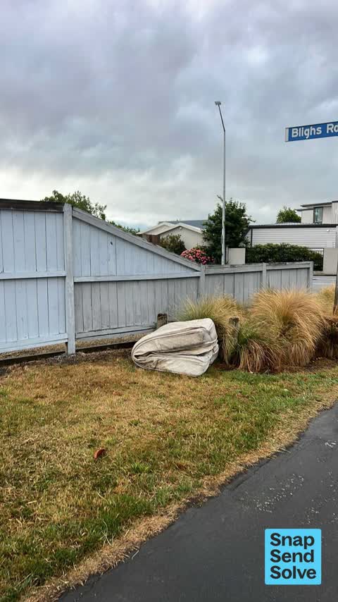
 Mattress dumped
 Graffiti somewhere else —
 Traffic lights control box.
 Pavement - General —
 Mattress on cycleway
 Dumped Rubbish —
 Fly-tipping mattress
 Litter —
 Queen size bed mattress has been dumped here,
 Dumped Rubbish —
 Dumped mattress by intersection of railside path and Bligh's rd
 Dumped Rubbish —
 Previously under the over bridge at the back of Waiamari school has been moved closer to Blighs Rd
 Dumped Rubbish —
 Another trolley of rubbish has been added
 Dumped Rubbish —
 Someone has dumped a big pile of rubbish inside a trolley and left it here, rubbish is overflowing out of the trolley and spilling onto the
 Dumped Rubbish —
  Dumped Rubbish —
  Dumped Rubbish —
 Lots of dumped rubbish inside two abandoned trolleys. On the bike/walk way near the traffic lights.
 Dumped Rubbish —
 2 trolleys piled high with rubbish have been abandoned where the railway path meets Blighs road in Strowan.
 Graffiti somewhere else —
 Traffic signals control box at Blighs Road
 Graffiti somewhere else —
 On yellow warning sign at Blighs Road level crossing
 Dumped Rubbish —
 Rubbish dumped in cycleway Bligh's Rd. Also 2shopping trolleys to return.
 Graffiti —
 This is the control box for the pedestrian crossing on Blighs Rd where the footpath cycle way crosses the rd (adjacent to the railway track.
 Graffiti —
  Graffiti —
 On yellow warning sign Blighs Rd level crossing
 Graffiti —
 Traffic signals control box at Blighs Rd level crossing
 Graffiti —
 Sign at railway intersection kiwi rail
- Graffiti —
- Graffiti —
- Graffiti —
- Graffiti —
- Graffiti —
- Graffiti —
- Graffiti —
- Graffiti —
- Graffiti —
- Graffiti —
- Graffiti —
 Graffiti —
  Graffiti —
  Graffiti —
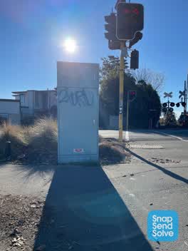
 Railway crossing control box?
 Graffiti —
 Traffic light control box
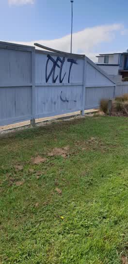 Graffiti —
 Fence on walkway just south of Blighs rd level crossing
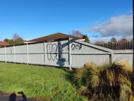 Graffiti —
 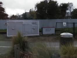 Graffiti —
 at rail way line signs outside 122 blighs rd
Roading/Streets —
bike sensors don't work in either direction on railway path crossing Bligh's Rd. I've noticed this over multiple weeks and seen other peopl
- Roading/Streets —
At cycle crossing, the cycle sensor on south side of crossing is not working.
Roading/Streets —
Traffic lights don't trigger on the south side heading north. Push button doesn't work either on the south side.
- Roading/Streets —
At cycle crossing, the cycle sensor on south side of crossing is not working.
Also reported on Blighs Road
- 68 Blighs Road — 19 reports
- 131 Blighs Road — 16 reports
- 1 Blighs Road — 10 reports
- 135 Blighs Road — 9 reports
- 121 Blighs Road — 9 reports
- 88 Blighs Road — 7 reports
- 55 Blighs Road — 7 reports
- 115 Blighs Road — 7 reports
The street’s crash record
NZTA’s record names Blighs Road in 26 crashes that hurt somebody since 2006 — 2 seriously hurt, nobody killed.
The green nearby
- St James Park — 307 m to the edge · Sports ground · 4 ha
Parks within half a kilometre, measured to the boundary — the council’s open data.
On the doorstep
- The Bellevue — 216 m away · Business
- Hao Eatery — 268 m away · Restaurants
- Lilac Rose Boutique Bed and Breakfast — 276 m away · B&Bs
- Christchurch Fine Violins — 300 m away · Musical Instrument
Businesses within four hundred metres, measured at the pin — OpenStreetMap and the council directories.
The tracks through here
- Walk and bike track through Strowan — 10 m to the line · walk · bike
- Walk and bike track through Strowan — 52 m to the line · walk · bike
- Walk and bike track through Strowan — 54 m to the line · walk · bike
- Walk and bike track through Strowan — 298 m to the line · walk · bike
- Walk and bike track through Strowan — 303 m to the line · walk · bike
Tracks whose line passes within half a kilometre, measured to the line itself — the council’s open data.
The named ground
Named water within 500 m of this address, measured to the line or the edge — the open map’s record.
Renting nearby
new bonds in Strowan ran about $620 a week — $70 above the city median of $550 — the suburb page keeps the rent record →.
The civic layer
This ground votes in Fendalton ward — the Fendalton-Waimairi-Harewood community board. Ward lines don’t always follow suburb lines; this one is measured at the pin, not the suburb’s centre.
What stood on this ground → · On the map → · From the air — the Crown’s aerials back to 1936; search the address on RetroLens →
Questions, answered briefly
56 council reports on record since June 2019 — most often graffiti (23), dumped rubbish (11), roading/streets (4).
Strowan, Christchurch — on Blighs Road.
Nothing on the heritage register at this exact spot — the record around this ground →
St James Park — 307 m to its edge, 4 ha.