135 Tennyson Street, Sydenham
22 reports on record since December 2018 · 21 with photographs. The street’s heaviest record is 137 Tennyson Street — 46 reports on file. Indicative rating valuation and school zones, hazards, bin day and what stood here before.
What gets reported here
Photographed here 21 on record


Reported here
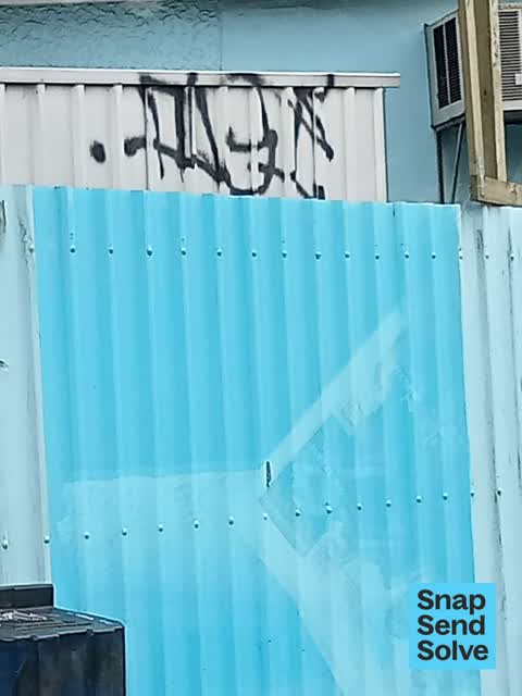
 Graffiti on a fence, building or structure —
 Graffiti above fence
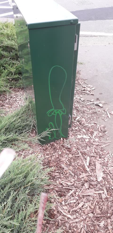
 Graffiti on a fence, building or structure —
 Graffiti on signage
 Graffiti on a road, footpath or bridge —
  Dumped Rubbish —
  Graffiti on a fence, building or structure —
  Graffiti somewhere else —
  Damaged Street Sign —
 For some reason this articulated truck decided to left turn off the bridge onto Eastern Terrace, forcing traffic to have to reverse up. This
 Graffiti somewhere else —
 On bridge
 Graffiti on a sign, mural or public art —
 Graffiti on stop sign at Tennyson Street and Eastern Terrace intersection (stop sign is on the arm of Eastern Terrace approaching Tennyson S
- Graffiti —
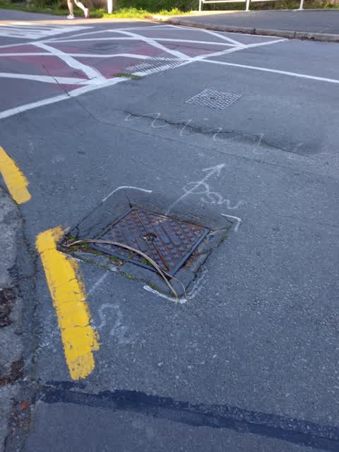
 Pothole —
 Pothole surrounding fire hydrant Fire hydrant needs to be painted yellow
 Graffiti —
 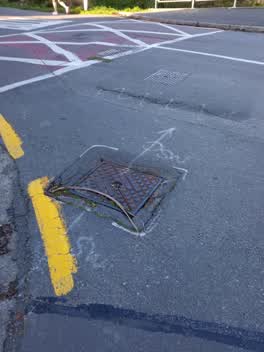 Roading/Streets —
 Dangerous intersection for left turning cyclists. Spray paint doesn't fix the problem.
Roading/Streets —
very bumpy area with uneven road. very dangerous for bikes turning into Eastern Terrace from Tennison Street
Graffiti —
Graffiti —
On traffic control box?
Graffiti —
Water Supply —
Leaking Toby at 142 tennison street
Graffiti —
Graffiti —
Graffiti —
Graffiti —
Also reported on Tennyson Street
- 137 Tennyson Street — 46 reports
- 154 Tennyson Street — 28 reports
- 111 Tennyson Street — 17 reports
- 98 Tennyson Street — 13 reports
- 119 Tennyson Street — 12 reports
- 31 Tennyson Street — 11 reports
- 97 Tennyson Street — 10 reports
- 84 Tennyson Street — 10 reports
The street’s crash record
NZTA’s record names Tennyson Street in 24 crashes that hurt somebody since 2006 — 4 seriously hurt, nobody killed.
The green nearby
- Heathcote Riverbank True Left — 18 m to the edge · 4 ha
- St Martins Park — 216 m to the edge · Sports ground · 2 ha
- Palatine Native Reserve — 221 m to the edge
- Beckenham Park — 338 m to the edge · Sports ground · 5 ha
- Mabel Howard Reserve — 385 m to the edge
Parks within half a kilometre, measured to the boundary — the council’s open data.
On the doorstep
- Saint Martins Croquet Club — 280 m away · Sports centres
- St Martins Bowls — 283 m away · Clubs
- Saint Martins Bowling Club — 330 m away · Sports centres
Businesses within four hundred metres, measured at the pin — OpenStreetMap and the council directories.
The bus nearby
- Gamblins Rd near Ngaio St — 353 m away · the Orbiter (clockwise)
- Gamblins Rd near Ngaio St — 388 m away · the Orbiter (anticlockwise)
The closest Metro stops, within four hundred and fifty metres.
The tracks through here
- Walk and bike track through Sydenham — 25 m to the line · walk · bike
- Walk and bike track through Sydenham — 32 m to the line · walk · bike
- Walk and bike track through Sydenham — 50 m to the line · walk · bike
- Walk and bike track through Sydenham — 51 m to the line · walk · bike
- Walk and bike track through Sydenham — 60 m to the line · walk · bike
Tracks whose line passes within half a kilometre, measured to the line itself — the council’s open data.
The named ground
Named water within 500 m of this address, measured to the line or the edge — the open map’s record.
Renting nearby
new bonds in Sydenham ran about $518 a week — $32 below the city median of $550 — the suburb page keeps the rent record →.
The civic layer
This ground votes in Heathcote ward — the Spreydon-Cashmere-Heathcote community board. Ward lines don’t always follow suburb lines; this one is measured at the pin, not the suburb’s centre.
What stood on this ground → · On the map → · From the air — the Crown’s aerials back to 1936; search the address on RetroLens →
Questions, answered briefly
22 council reports on record since December 2018 — most often graffiti (9), graffiti on a fence, building or structure (3), roading/streets (2).
Sydenham, Christchurch — on Tennyson Street.
Nothing on the heritage register at this exact spot — the record around this ground →
Heathcote Riverbank True Left — 18 m to its edge, 4 ha.