297 Moorhouse Avenue, Sydenham
19 reports on record since February 2020 · 16 with photographs. The street’s heaviest record is 166 Moorhouse Avenue — 36 reports on file. Indicative rating valuation and school zones, hazards, bin day and what stood here before.
What gets reported here
Photographed here 16 on record




Reported here
 Damaged Street Sign —
 P60 signage not visible.
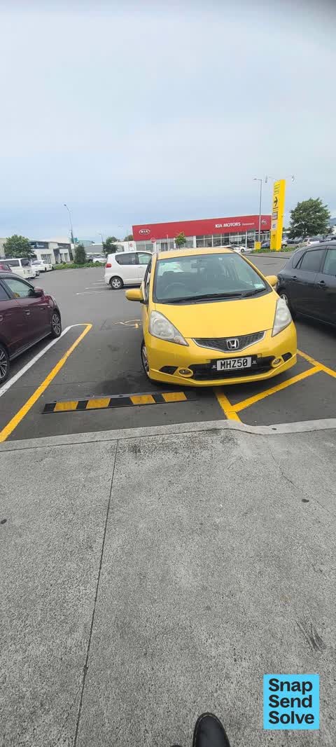
 Hazard — vehicle —
 Person without mobility parking lanyard parked almost fully over the access ramp - made it difficult for me to access in manual wheelchair a
 Graffiti on a road, footpath or bridge —
 Graffiti on side wall and sign of Moorhouse Avenue bridge.CBD,Pak n Save entrance / exit, on to slip road. Thanks.
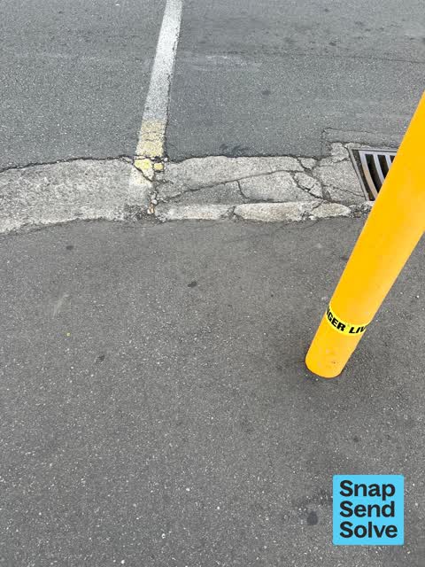
 Poles and Signage - General —
 steel pole and tagging and tagging stickers
 Hazard — vehicle —
 Notice car was parked in mobility spot badly without mobility permit driver came back to his car while I was taking photos I informed him he
 Graffiti on a fence, building or structure —
 Graffiti on bridge approach, Moorhouse Avenue, slip road, opposite Pak n Save entrance/exit.
 Street Gutters / Storm Water —
 Gutter looks like it is blocked or backflowing (?) by 297 Moorhouse Avenue.
 Damaged Street Sign —
 Sign is falling off of brackets on streetlight
 Pavement - Damaged —
 Pothole in driveway entrance requires leveling filling & sealing
 Pavement - Damaged —
 Missing berm to replace & weed removal required
 Pavement - Damaged —
 Missing berm to replace
- Graffiti —
- Graffiti —
- Graffiti —
 Graffiti —
  Graffiti —
 Black and white paint tags on bridge wall and road sign on Moorhouse Avenue east of Colombo Street by Pak n Save carpark.
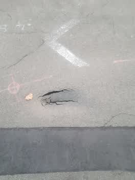 Roading/Streets —
 Hit this pothole on my scooter. Dislocated my are and chipped my tooth. Please urgently fix
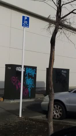 Graffiti —
 Graffiti —
Also reported on Moorhouse Avenue
- 166 Moorhouse Avenue — 36 reports
- 386 Moorhouse Avenue — 29 reports
- 373 Moorhouse Avenue — 28 reports
- 392 Moorhouse Avenue — 19 reports
- 372 Moorhouse Avenue — 17 reports
- 367 Moorhouse Avenue — 16 reports
- 450 Moorhouse Avenue — 14 reports
- 287 Moorhouse Avenue — 14 reports
The street’s crash record
NZTA’s record names Moorhouse Avenue in 211 crashes that hurt somebody since 2006 — 5 people killed, 32 seriously hurt.
The green nearby
- Carlyle Reserve — 211 m to the edge
- Science Alive Reserve — 258 m to the edge
- Gasson Reserve — 292 m to the edge
- Wilson Park — 446 m to the edge
- Washington Way Reserve — 485 m to the edge · Sports ground
Parks within half a kilometre, measured to the boundary — the council’s open data.
On the doorstep
- Liquorland Moorhouse — 40 m away · Bottle stores
- Moorhouse PAK N Save — 40 m away · Supermarkets
- Pak'n Save Moorhouse — 54 m away · Supermarkets
- PAK'nSave — 77 m away · Supermarkets
Businesses within four hundred metres, measured at the pin — OpenStreetMap and the council directories.
The bus nearby
- Moorhouse Slip Nth near Colombo St — 145 m away · route 140
- Moorhouse near Manchester St — 158 m away · route 140
The closest Metro stops, within four hundred and fifty metres.
The tracks through here
- Walk and bike track through Sydenham — 35 m to the line · walk · bike
- Walk and bike track through Sydenham — 35 m to the line · walk · bike
- Walk and bike track through Sydenham — 70 m to the line · walk · bike
- Walk and bike track through Sydenham — 177 m to the line · walk · bike
- Walk and bike track through Sydenham — 177 m to the line · walk · bike
Tracks whose line passes within half a kilometre, measured to the line itself — the council’s open data.
The named ground
Named places within 1.5 km of this address — the open map’s record.
Renting nearby
new bonds in Sydenham ran about $518 a week — $32 below the city median of $550 — the suburb page keeps the rent record →.
What was here — New City Hotel and Setting
203 m away · located to ±20 m · the place’s own record →
On the register. Nothing researched here yet.
The civic layer
This ground votes in Central ward — the Papanui-Innes-Central community board. Ward lines don’t always follow suburb lines; this one is measured at the pin, not the suburb’s centre.
What stood on this ground → · On the map → · From the air — the Crown’s aerials back to 1936; search the address on RetroLens →
Questions, answered briefly
19 council reports on record since February 2020 — most often graffiti (7), pavement - damaged (3), hazard — vehicle (2).
Sydenham, Christchurch — on Moorhouse Avenue.
The heritage register names a place at or beside it — New City Hotel and Setting.
Carlyle Reserve — 211 m to its edge.