392 Moorhouse Avenue, Sydenham
19 reports on record since December 2017 · 16 with photographs. The street’s heaviest record is 166 Moorhouse Avenue — 36 reports on file. Indicative rating valuation and school zones, hazards, bin day and what stood here before.
What gets reported here
Photographed here 16 on record

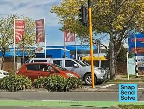


Reported here
 Graffiti on a traffic light pole or cabinet, or wa —
 Graffiti on traffic signal cabinet, corner Moorhouse Avenue/ Gasson Street CBD ChCh.Thanks. Please notify me when this SSS is solved. Than
 Graffiti on a traffic light pole or cabinet, or wa —
 Graffiti ( black) on traffic signal cabinet, corner Moorhouse Avenue/Gasson Street CBD ChCh.Thanks. Please notify me when this SSS is solve
 Graffiti on a traffic light pole or cabinet, or wa —
 Graffiti, (black) on traffic signal cabinet, Moorhouse Avenue corner Gasson Street CBD Christchurch. Thanks. Please notify me when this SSS
 Traffic Signals —
 At the corner of Moorhouse / Gasson, when heading northbound from Gasson onto Madras St, the right arrows do not work when turning from Gass
 Graffiti on a traffic light pole or cabinet, or wa —
 Traffic signals box Moorhouse Ave by Gasson St. Near NPD. Had wet paint sticker still on it.
- Graffiti on a traffic light pole or cabinet, or wa —
Graffiti ( blue,black) on traffic signal cabinet, Moorhouse Avenue/ Gasson Street corner CBD. Thanks. No photo as I was driving. Please no
 Graffiti on a traffic light pole or cabinet, or wa —
 Graffiti ( silver) on traffic signal cabinet corner Moorhouse Avenue/ Gasson Street corner CBD Christchurch.Thanks Please notify me when th
 Graffiti on a traffic light pole or cabinet, or wa —
 Moorhouse Ave, outside NPD - Graffiti on street light post
 Graffiti on a traffic light pole or cabinet, or wa —
 Graffiti on a traffuc signal cabinet, 392 Moorhouse Avenue CBD / corner Gasson Street Sydenham. Thanks. Please notify me of update on my S
- Bus Shelter Issue —
Smashed bus shelter morehouse road outside burger King
 Graffiti on a fence, building or structure —
 Black, green and yellow paint tags on 3 adjacent anonymous assets facing the footpath at 392 Moorhouse Avenue.
 Graffiti on a fence, building or structure —
 White paint tag (plus sticky tags) on green steel lamp pole by NPD on Moorhouse Avenue.
 Graffiti on a cabinet, pole or railway asset —
 EKOE black paint tag on anonymous metal asset by 392 Moorhouse Avenue facing the footpath.
 Graffiti —
 Multiple paint tags on these two anonymous metal assets facing the footpath by 392 Moorhouse Avenue.
- Graffiti —
 Graffiti —
 Black and light blue paint tags on steel rubbish bin lid by Nissan on Moorhouse Avenue.
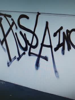 Graffiti —
 rear of NPD site been tagged over the weekend
Graffiti —
on the footpath outside NPD Moorhouse, close to corner of Moorhouse and Gasson Streets
Roading/Streets —
Tyre dumped
Also reported on Moorhouse Avenue
- 166 Moorhouse Avenue — 36 reports
- 386 Moorhouse Avenue — 29 reports
- 373 Moorhouse Avenue — 28 reports
- 297 Moorhouse Avenue — 19 reports
- 372 Moorhouse Avenue — 17 reports
- 367 Moorhouse Avenue — 16 reports
- 450 Moorhouse Avenue — 14 reports
- 287 Moorhouse Avenue — 14 reports
The street’s crash record
NZTA’s record names Moorhouse Avenue in 211 crashes that hurt somebody since 2006 — 5 people killed, 32 seriously hurt.
The green nearby
- Gasson Reserve — 27 m to the edge
- Science Alive Reserve — 60 m to the edge
- Washington Way Reserve — 222 m to the edge · Sports ground
- Wilson Park — 365 m to the edge
- Carlyle Reserve — 403 m to the edge
Parks within half a kilometre, measured to the boundary — the council’s open data.
The civic shelf nearby
- St Asaph — 459 m away · Car park
Libraries, halls and the rest within half a kilometre — the council’s open data.
On the doorstep
- npd — 29 m away · Petrol stations
- NPD 24/7 Fuel — 30 m away · Car washes
- Hang Seng Foodbar — 51 m away · Fast food
- Nissan — 72 m away · Car dealers
Businesses within four hundred metres, measured at the pin — OpenStreetMap and the council directories.
The bus nearby
- Moorhouse Ave near Manchester St — 62 m away · route 27, route 84, route 85, route 95, route 140
- Moorhouse near Manchester St — 111 m away · route 140
The closest Metro stops, within four hundred and fifty metres.
The tracks through here
- Walk and bike track through Sydenham — 16 m to the line · walk · bike
- Walk and bike track through Sydenham — 16 m to the line · walk · bike
- Walk and bike track through Sydenham — 191 m to the line · walk · bike
- Walk and bike track through Sydenham — 295 m to the line · walk · bike
- Walk and bike track through Sydenham — 383 m to the line · walk · bike
Tracks whose line passes within half a kilometre, measured to the line itself — the council’s open data.
The named ground
Named places within 1.5 km of this address — the open map’s record.
The remembered names nearby
- Rail Workers Memorial This Site Is Dedicated to Rail — 92 m away ·
RAIL WORKERS MEMORIAL THIS SITE IS DEDICATED TO RAIL WORKERS WHO WERE KILLED OR SERIOUSLY
· 2008
Inscribed plaques within two hundred and fifty metres — the register’s pins, not surveyed spots. The whole roll is at /plaques.
Renting nearby
new bonds in Sydenham ran about $518 a week — $32 below the city median of $550 — the suburb page keeps the rent record →.
What was here — Former Grosvenor Hotel and Setting
86 m away · 367 Moorhouse Avenue · located to ±15 m · the place’s own record →
On the register. Nothing researched here yet.
What was here — MED Substation and Setting
214 m away · 99A Gasson Street · located to ±5 m · the place’s own record →
On the register. Nothing researched here yet.
The civic layer
This ground votes in Heathcote ward — the Spreydon-Cashmere-Heathcote community board. Ward lines don’t always follow suburb lines; this one is measured at the pin, not the suburb’s centre.
What stood on this ground → · On the map → · From the air — the Crown’s aerials back to 1936; search the address on RetroLens →
Questions, answered briefly
19 council reports on record since December 2017 — most often graffiti on a traffic light pole or cabinet, or wa (8), graffiti (5), graffiti on a fence, building or structure (2).
Sydenham, Christchurch — on Moorhouse Avenue.
The heritage register names 2 places at or beside it — Former Grosvenor Hotel and Setting, MED Substation and Setting.
Gasson Reserve — 27 m to its edge.