2 Ilam Road, Upper Riccarton
13 reports on record since January 2018 · 8 with photographs. The street’s heaviest record is 39 Ilam Road — 48 reports on file. Indicative rating valuation and school zones, hazards, bin day and what stood here before.
What gets reported here
Photographed here 8 on record


Reported here
- Dumped Rubbish —
box of Rubbish
- Damaged Road —
pot hole
 General Request —
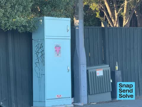
 Paint on signal box
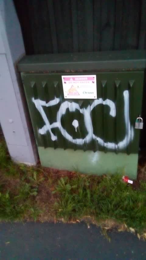
 Graffiti on a fence, building or structure —
  Graffiti somewhere else —
  Street Cleaning —
 Smashed bottle in cycleway
 Graffiti somewhere else —
 - Animal - Deceased —
Dead cat guts hanging out on footpath by the intersection:(
 Road Signage —
 Sign in middle of footpath had to get out of my car to assist a disabled person around it, Absolutely shocking and total disregard for peopl
 Graffiti somewhere else —
 Riccarton Rd m, south cnr of Ilam Rd - traffic light pole
- Graffiti —
- Roading/Streets —
Lots of broken bottles on the south bound cycleway and footpaths on Ilam Rd between university and Riccardo rd. Also temporary rd signs remo
Parks —
Also reported on Ilam Road
- 39 Ilam Road — 48 reports
- 54 Ilam Road — 17 reports
- 46 Ilam Road — 17 reports
- 11 Ilam Road — 15 reports
- 35 Ilam Road — 14 reports
- 45 Ilam Road — 12 reports
- 47 Ilam Road — 11 reports
- 27 Ilam Road — 11 reports
The street’s crash record
NZTA’s record names Ilam Road in 33 crashes that hurt somebody since 2006 — 2 seriously hurt, nobody killed.
The green nearby
- Auburn Reserve — 156 m to the edge · 1 ha
- Milnebank Reserve — 220 m to the edge
- Middleton Park — 327 m to the edge · Sports ground · 5 ha
Parks within half a kilometre, measured to the boundary — the council’s open data.
On the doorstep
- Takurua Vets — 31 m away · Vets
- 298 Westside Motor Lodge — 65 m away · Motels
- Ascot Vale Motor Lodge — 81 m away · Motels
- Elite Physio — 89 m away · Physio
Businesses within four hundred metres, measured at the pin — OpenStreetMap and the council directories.
The bus nearby
- Riccarton Rd near Field Tce — 53 m away · route 3, route 5, route 86, route 130, the Orbiter (anticlockwise)
- Riccarton Rd near Middleton Rd — 118 m away · route 5, route 86, route 100, route 130, the Orbiter (clockwise)
The closest Metro stops, within four hundred and fifty metres.
The tracks through here
- Walk and bike track through Upper Riccarton — 9 m to the line · walk · bike
- Walk and bike track through Upper Riccarton — 16 m to the line · walk · bike
- Walk and bike track through Upper Riccarton — 16 m to the line · walk · bike
- Walk and bike track through Upper Riccarton — 384 m to the line · walk · bike
- Walk and bike track through Upper Riccarton — 407 m to the line · walk · bike
Tracks whose line passes within half a kilometre, measured to the line itself — the council’s open data.
The named ground
the council’s own structure register — bridges, boardwalks and steps standing nearby — the open map’s record.
What was here — Dwelling and Setting, Midway
87 m away · 7 Middleton Road · located to ±20 m · the place’s own record →
On the register. Nothing researched here yet.
The civic layer
This ground votes in Riccarton ward — the Halswell-Hornby-Riccarton community board. Ward lines don’t always follow suburb lines; this one is measured at the pin, not the suburb’s centre.
What stood on this ground → · On the map → · From the air — the Crown’s aerials back to 1936; search the address on RetroLens →
Questions, answered briefly
13 council reports on record since January 2018 — most often graffiti somewhere else (3), street cleaning (1), roading/streets (1).
Upper Riccarton, Christchurch — on Ilam Road.
The heritage register names a place at or beside it — Dwelling and Setting, Midway.
Auburn Reserve — 156 m to its edge, 1 ha.