39 Ilam Road, Upper Riccarton
48 reports on record since December 2021 · 37 with photographs. The most-reported address on Ilam Road. Indicative rating valuation and school zones, hazards, bin day and what stood here before.
What gets reported here
- Water Leak — 30
- Dumped Rubbish — 4
- Flooding — 3
- Water Supply — 1
- Water General — 1
- Water Fountain — 1
Photographed here 37 on record


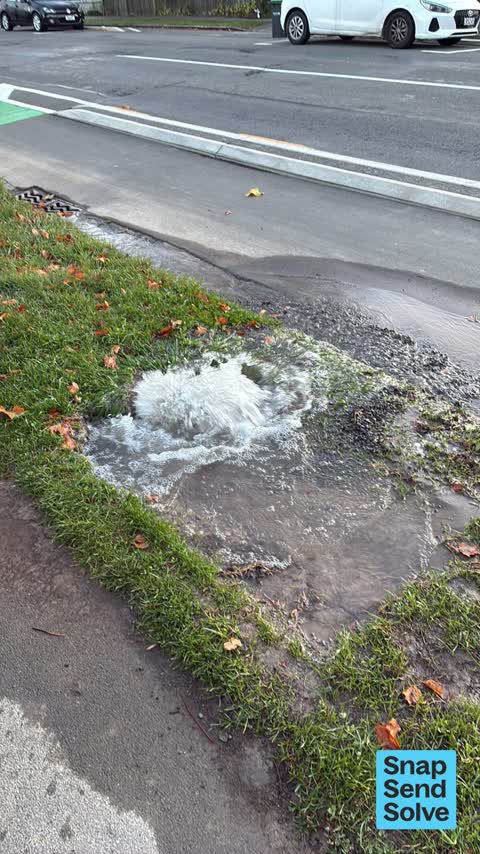


Reported here
 Water Leak —
 Water leak
 Overgrown Vegetation —
 Overgrown vegetation.
 Water Leak —
 Oh no, leak no 31, repaired yesterday getting worse today.
 Water Leak —
 Yes, no.30 leak here and a real gusher this morning. At $4000 a leak x 30 =$120,000 for this Ten metre section of Ilam rd over the last year
 Water Leak —
 New repair appears to have failed already
 Water Leak —
 Hundreds of people without water for the second time this week
 Water Fountain —
 The water issue on side rd
 Water Leak —
 Oh dear, gone again, no 25? Over the last year here?
 Water Leak —
 We might as well call this a permanent water feature at this stage…
 Water Leak —
 Getting ridiculous now,, reporting weekly for at least a month. What’s going on?? Time to contact local MP about CCC wasting money on subpar
 Flooding —
 Water leaks
 Water Leak —
 Again…complaint coming to council, this is ridiculous, every week now! Fix it properly!
 Water Leak —
 Major gusher here again. Only one week since last repair.
 Water Leak —
 New leak in this short section in Ilam rd . This is the 20th leak on 10 m of mains with in one year.
 Water Leak —
 Water leak in berm. Decent amount going into stormwater drain.
 Water Leak —
 Water leak AGAIN! Probably best to fix it properly as happens every few weeks
 Flooding —
 Water flowing on the street
 Water Leak —
 And this repair has gone for the fifth time.
 Dumped Rubbish —
  Street Gutters / Storm Water —
 Another water leak on this section of pipe.
 Fallen Tree —
 Water mains leaking
 Water Leak —
 This area has been repaired several times as has spring a leak again
 Water Leak —
 Water bubbling up but foamy
 Water General —
 Major leak streaming from the berm
 Flooding —
 Looks like a leaky pipe
 Water Leak —
 Another failed repair here. A gusher
 Water Leak —
 Yes, this one’s gone too!
 Water Leak —
 New Gusher here,that makes three leaks with in 50 metres. This whole section on Ilam rd is rotting. Look at your records. I count 12 leaks i
 Water Leak —
 Repair done two weeks ago starting to leak
 Sewer - Leak / Blockage —
 Water leak. It is bubbling out. Storm water. Needs to be fixed promptly.
 Water Leak —
 Water main repaired two weeks ago.
 Dumped Rubbish —
  Dumped Rubbish —
 - Water Leak —
- Dumped Rubbish —
- Water Leak —
- Water Leak —
- Water Leak —
- Water Leak —
- Water Leak —
- Water Leak —
- Water Leak —
- Street Cleaning —
- Litter —
 Street Light Outage —
  Roading/Streets —
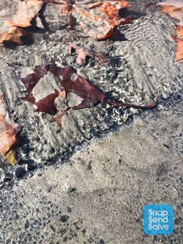
 Water bubbling up under driveway 39 Ilam Road. Creating sand and water puddling in driveway and onto the cycle path. Quite dangeous for cycl
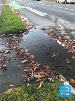 Water Leak —
 Another great repair- not
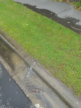 Water Supply —
Also reported on Ilam Road
- 54 Ilam Road — 17 reports
- 46 Ilam Road — 17 reports
- 11 Ilam Road — 15 reports
- 35 Ilam Road — 14 reports
- 2 Ilam Road — 13 reports
- 45 Ilam Road — 12 reports
- 47 Ilam Road — 11 reports
- 27 Ilam Road — 11 reports
The street’s crash record
NZTA’s record names Ilam Road in 33 crashes that hurt somebody since 2006 — 2 seriously hurt, nobody killed.
The green nearby
- Milnebank Reserve — 215 m to the edge
- Auburn Reserve — 391 m to the edge · 1 ha
- Siska Reserve — 434 m to the edge
Parks within half a kilometre, measured to the boundary — the council’s open data.
On the doorstep
- Campus Corner Dairy — 211 m away · Dairies & convenience
- Captain Ben's — 211 m away · Fast food
- Foo San — 213 m away · Restaurants
- Foo San Restaurant — 213 m away · Restaurants
Businesses within four hundred metres, measured at the pin — OpenStreetMap and the council directories.
The bus nearby
- Ilam Rd near Kirkwood Ave — 74 m away · route 3, route 100
- Riccarton Rd near Field Tce — 321 m away · route 3, route 5, route 86, route 130, the Orbiter (anticlockwise)
The closest Metro stops, within four hundred and fifty metres.
The tracks through here
- Walk and bike track through Upper Riccarton — 10 m to the line · walk · bike
- Walk and bike track through Upper Riccarton — 321 m to the line · walk · bike
- Walk and bike track through Upper Riccarton — 321 m to the line · walk · bike
- Walk and bike track through Upper Riccarton — 395 m to the line · walk · bike
- Walk and bike track through Upper Riccarton — 409 m to the line · walk · bike
Tracks whose line passes within half a kilometre, measured to the line itself — the council’s open data.
The named ground
Named water within 500 m of this address, measured to the line or the edge — the open map’s record.
The civic layer
This ground votes in Riccarton ward — the Halswell-Hornby-Riccarton community board. Ward lines don’t always follow suburb lines; this one is measured at the pin, not the suburb’s centre.
What stood on this ground → · On the map → · From the air — the Crown’s aerials back to 1936; search the address on RetroLens →
Questions, answered briefly
48 council reports on record since December 2021 — most often water leak (30), dumped rubbish (4), flooding (3).
Upper Riccarton, Christchurch — on Ilam Road.
Nothing on the heritage register at this exact spot — the record around this ground →
Milnebank Reserve — 215 m to its edge.