The river bend
The Ōtākaro through town is a heritage walk of its own, the boatsheds, the rotunda, the bridges the register lists one by one. Follow the bank from Antigua Street to the Armagh Street bridge.
The walk, as a line
Straight between pins, the streets run longer. Every numbered pin opens that place’s own record.
The stops, in order
- Antigua Boatsheds and Setting, 2 Cambridge Terrace · Heritage NZ list 1825 · 33 unread leads
The Antigua Boatsheds, still hiring boats out; the oldest continuous thing on this bank.
- Edmonds Band Rotunda Area including Rotunda, Shelter, Balustrades, Landing and Lamp Standards and Setting, 230 Cambridge Terrace · Heritage NZ list 1865 · 26 unread leads
The Edmonds Band Rotunda, rotunda, shelter, balustrades, lamps and all; the listing names every piece.
- Rhododendron Island and Setting, 78 Cambridge Terrace · 40 unread leads
Rhododendron Island, the river’s own garden, listed as ground.
- Bridge of Remembrance and Setting, 88 Cambridge Terrace · Heritage NZ list 289 · 43 unread leads · a Wikipedia entry
The Bridge of Remembrance again, from the river side this time.
- Former Market Place Bridge/Hamish Hay Bridge and Setting · 4 unread leads
The Hamish Hay Bridge, the market-place bridge, oldest in the roll here.
- Armagh Street Bridge and Setting · Heritage NZ list 1830 · 22 unread leads · a Wikipedia entry
The Armagh Street bridge, the last listed crossing on the bend.
What the register built on the way
Council structures within about 30 m of the stop-to-stop line, the bridges, steps and shelters the route passes. Site names are the register’s own.
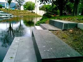 A set of steps at Park Of Remembrance, 3 steps · built 2016
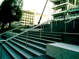 A set of steps at Park Of Remembrance, 18 steps · built 2016
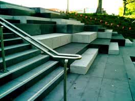 A set of steps at Park Of Remembrance, 9 steps · built 2016
 A boat ramp at Victoria Square, 11.3 m long · built 2018
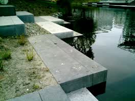 A viewing platform at Park Of Remembrance, built 2016 1 m off the line
- A viewing platform at Park Of Remembrance, built 2016 1 m off the line
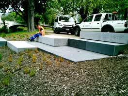 A set of steps at Park Of Remembrance, 1 steps · built 2016 1 m off the line
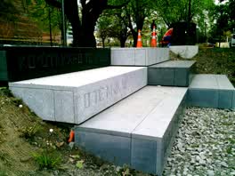 A set of steps at Park Of Remembrance, 3 steps · built 2016 3 m off the line
The reports along it
16,308 council reports pinned within 150 m of the line, most often Graffiti & vandalism and Roads & footpaths, 13,454 with a photograph. A pin is where a reporter stood, not a claim about the place itself.
 Graffiti on a fence, building or structure
 Pavement - General
 Street Gutters / Storm Water
 Graffiti on a fence, building or structure
 Poles and Signage - General
 General Request
 General Request
 Graffiti on a fence, building or structure
 Graffiti on a fence, building or structure
 Pavement - Damaged
 Graffiti on a fence, building or structure
 Hazard, vehicle
Questions, answered briefly
The Ōtākaro through town is a heritage walk of its own, the boatsheds, the rotunda, the bridges the register lists one by one. 6 listed places, 2.8 km as the line runs, Central city.
Antigua Boatsheds and Setting (2 Cambridge Terrace) to Armagh Street Bridge and Setting, the order is a suggestion, not the only way round.
Every one, each pin is a row in the district plan’s heritage schedule, and each opens the place’s own sourced record here.
2.8 km measured straight between the pins, the streets run longer, and the stops deserve a pause each.
The record behind this
Every stop is a row in the district plan’s heritage schedule, held here as the register’s own layer. The order and the notes are ours, the listings are the council’s and Heritage New Zealand’s. "Setting" is the register’s word for the ground a listing covers.
The rest of the register here: Central City
The same ground today: Christchurch Central City
More walks over this ground: The square and its ring · The boulevard
This page as markdown: /walks/the-river-bend.md · the route as data: /walks/the-river-bend.geojson · on the live map: the walks layer.