The boulevard
Worcester Street from the Bridge of Remembrance to Rolleston Avenue, the street the civic city stacked itself along: council, church, club, college. Flat, straight, under two kilometres.
The walk, as a line
Straight between pins, the streets run longer. Every numbered pin opens that place’s own record.
The stops, in order
- Bridge of Remembrance and Setting, 88 Cambridge Terrace · Heritage NZ list 289 · 43 unread leads · a Wikipedia entry
The Bridge of Remembrance, the war memorial arch the whole street is aimed at.
- Former Municipal Chambers and Setting, 159 Oxford Terrace · Heritage NZ list 1844 · 41 unread leads
The former Municipal Chambers, where the council sat before the square’s south side.
- Worcester Street Bridge and Setting · Heritage NZ list 1833 · 20 unread leads
The Worcester Street bridge itself is listed, the crossing, not just what it carries.
- Christchurch Club and Setting, 154 Worcester Street · Heritage NZ list 292 · 57 unread leads · a Wikipedia entry
The Christchurch Club, the oldest of the men’s clubs still standing.
- Former Trinity Congregational Church and Setting, 124 Worcester Street · Heritage NZ list 306 · 39 unread leads · a Wikipedia entry
Former Trinity Congregational Church, the Gothic pile on the corner.
- Clock Tower Block and Setting, 2 Worcester Street · 41 unread leads
The Clock Tower block, the Arts Centre’s front door on the boulevard.
- Hydraulic Laboratory, School of Engineering, and Setting, 28 Worcester Street · 43 unread leads
The hydraulic laboratory, the School of Engineering’s working remnant.
- Registry and Setting, 40 Worcester Street · 41 unread leads
The Registry, the university’s own record-keeper, listed.
What the register built on the way
Council structures within about 30 m of the stop-to-stop line, the bridges, steps and shelters the route passes. Site names are the register’s own.
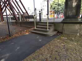 A set of steps at Avon Riverbank Central City, 5 steps · built 1899
- A boardwalk at Rauora Park, built 2017 1 m off the line
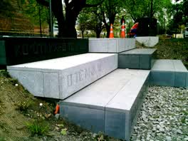 A set of steps at Park Of Remembrance, 3 steps · built 2016 2 m off the line
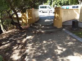 A set of steps at Avon Riverbank Central City, 3 steps · built 1899 3 m off the line
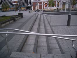 A set of steps at Godley Statue Reserve, 3 m long · built 2009 3 m off the line
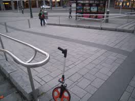 A ramp at Godley Statue Reserve, 8 m long · built 2009 4 m off the line
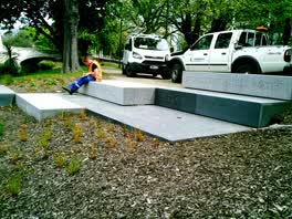 A set of steps at Park Of Remembrance, 1 steps · built 2016 6 m off the line
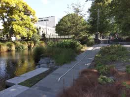 A ramp at Avon Riverbank Central City, 18 m long · built 2016 7 m off the line
The reports along it
13,785 council reports pinned within 150 m of the line, most often Graffiti & vandalism and Roads & footpaths, 11,367 with a photograph. A pin is where a reporter stood, not a claim about the place itself.
 Graffiti on a playground or in a park
 Pavement - General
 Pavement - Damaged
 Street Gutters / Storm Water
 Graffiti on a fence, building or structure
 Graffiti on a fence, building or structure
 Graffiti on a fence, building or structure
 Graffiti on a fence, building or structure
 Graffiti on a fence, building or structure
 Fallen Tree
 Fallen Tree
 Graffiti on a playground or in a park
Questions, answered briefly
Worcester Street from the Bridge of Remembrance to Rolleston Avenue, the street the civic city stacked itself along: council, church, club, college. 8 listed places, 2.2 km as the line runs, Central city.
Bridge of Remembrance and Setting (88 Cambridge Terrace) to Registry and Setting (40 Worcester Street), the order is a suggestion, not the only way round.
Every one, each pin is a row in the district plan’s heritage schedule, and each opens the place’s own sourced record here.
2.2 km measured straight between the pins, the streets run longer, and the stops deserve a pause each.
The record behind this
Every stop is a row in the district plan’s heritage schedule, held here as the register’s own layer. The order and the notes are ours, the listings are the council’s and Heritage New Zealand’s. "Setting" is the register’s word for the ground a listing covers.
The rest of the register here: Central City
The same ground today: Christchurch Central City
More walks over this ground: The square and its ring
This page as markdown: /walks/worcester-boulevard.md · the route as data: /walks/worcester-boulevard.geojson · on the live map: the walks layer.