117 Smith Street, Woolston
81 reports on record since June 2016 · 71 with photographs. The street’s heaviest record is 180 Smith Street — 218 reports on file. Indicative rating valuation and school zones, hazards, bin day and what stood here before.
What gets reported here
Photographed here 71 on record



Reported here the newest 80 of 81
 Graffiti on a playground or in a park —
 graffiti on bollard at entrance to Linwood Park walkway off Smith Street.
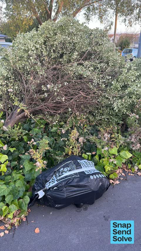
 Dumped Rubbish —
 Dumped rubbish
 Graffiti on a fence, building or structure —
 By Smith entrance to Linwood Park
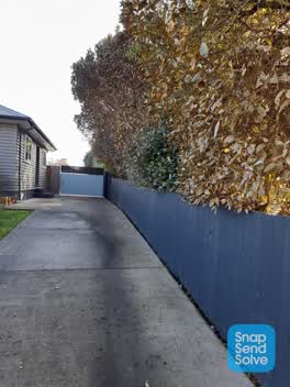
 Overgrown Vegetation —
 overgrown vegetation is hanging over the driveway. 1 of the trees is covered by some sort of bugs, these trees are on the council side of th
 Graffiti on a fence, building or structure —
 graffiti
 Water Leak —
 Water leak
 Graffiti on a road, footpath or bridge —
 Graffiti
 Pavement - Damaged —
 Hole on pathway
 Graffiti on a road, footpath or bridge —
 graffiti on path next to Orion power building on path by Linwood waterway at Smith st entrance.
 Graffiti on a road, footpath or bridge —
 Graffiti on path through Linwood Park next to substation building in Smith Street.
 Vandalism - General —
 More graffiti in linwood park.
 Dumped Rubbish —
 More rubbish dumped at the entrance to linwood park from Smith street
 Graffiti on a fence, building or structure —
 Graffiti on back of Network building Linwood Park
 Graffiti on a playground or in a park —
 Tree bending over and graffiti
 Graffiti somewhere else —
 Graffiti on the Cannel by the sixth Street entrance way to Linwood Park
 Dumped Rubbish —
 Dumped clothing and rubbish
 Graffiti somewhere else —
  Graffiti somewhere else —
 Several poles into park along walk way on path have graffiti on poles
 Graffiti somewhere else —
  Graffiti —
 On back wall of pump building
 Graffiti —
  Graffiti —
 See photos
 Graffiti —
 Graffitti on the back of the connectics building next to Linwood Pools
- Dumped Rubbish —
- Fallen Tree —
- Graffiti —
- Rubbish and Bins - General —
- Graffiti —
- Graffiti —
- Graffiti —
- Graffiti —
- Trees - General —
- General - Abandoned Trolley —
 Facility - General Request —
 Hi something has gone wrong with this net
 Parks —
 Overgrown vegetation & rats. My driveway does not dry out due to the trees and they do limit the amount of sunshine coming into the house a
 Street Light Outage —
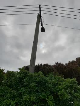
 Led light out in Alleyway beside Linwood tennis courts
 Parks —
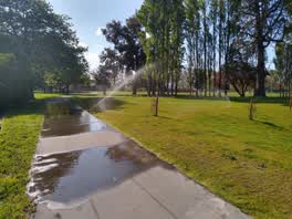
 Water is spraying all over the path and soaking pedestrians and cyclists.
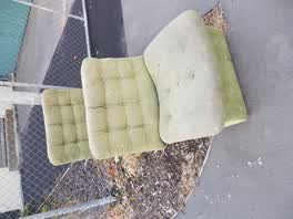 Rubbish/Recycling —
 Graffiti —
Right along fence line from hargood street
Graffiti —
Right along fence line from hargood street
Graffiti —
Entry to park off hargood street
Roading/Streets —
Failed light
Parks —
Bush removed from trees
Graffiti —
Street sign
Graffiti —
Along back fence in off Smith street
Graffiti —
Smith street entrance
Graffiti —
On fence off Smith street
Graffiti —
Along fence line from Smith street
Graffiti —
On New fence post in park from Smith street
Graffiti —
Along walk way from Smith street into park
Graffiti —
Along back wall on path from Smith street entrance
Graffiti —
Along back fence leading into park from Smith street
Graffiti —
Alley between Smith St and Linwood Park
Graffiti —
Post at Smith street entrance
Graffiti —
Footpath and fence
Graffiti —
Same fence in off Smith street
Graffiti —
On same fence as yesterday
Graffiti —
Back fence of Linwood park
Graffiti —
Linwood park back fence
Graffiti —
Fence Smith street
Graffiti —
Just along on fence
Graffiti —
Fence and lower fence
Graffiti —
Footpath off Smith street entrance to park
Graffiti —
Just inside gate off Smith street
Graffiti —
Path from Smith street end
Graffiti —
Off Smith street walkway
Graffiti —
Cycle path near Smith st
Graffiti —
Smith Street end on wall
Graffiti —
Northern side grey fence leading into park from smith st
Graffiti —
Fence
Graffiti —
Lower boards
Graffiti —
Graffiti —
Along fence off Smith st
Graffiti —
Kids back to school. Back fence by Smith St
Graffiti —
Along entire fence line
Graffiti —
Graffiti —
Graffiti —
Graffiti on fence at smith street entrance to linwood park right next to orion substation
Graffiti —
Graffiti —
Graffiti on fence on pathway to linwood park from smith street
1 more on record — the live page pages them.
Also reported on Smith Street
- 180 Smith Street — 218 reports
- 140 Smith Street — 45 reports
- 119 Smith Street — 38 reports
- 8 Smith Street — 35 reports
- 19P Smith Street — 29 reports
- 141 Smith Street — 26 reports
- 18 Smith Street — 13 reports
- 130 Smith Street — 12 reports
The street’s crash record
NZTA’s record names Smith Street in 18 crashes that hurt somebody since 2006 — 3 seriously hurt, nobody killed.
The green nearby
- Linwood Park — you are in it · Sports ground · 9 ha
- Linwood Nursery — 10 m to the edge · 1 ha
- Linwood Esplanade Reserve — 285 m to the edge
- Arran Playground — 418 m to the edge
Parks within half a kilometre, measured to the boundary — the council’s open data.
The civic shelf nearby
- Linwood Service Centre — 459 m away · Service centre
Libraries, halls and the rest within half a kilometre — the council’s open data.
On the doorstep
- Linwood Pool: Te Pou Toetoe — 187 m away · Sports centres
- Linwood Ave Rotary Market — 318 m away · Markets
- On The Go — 394 m away · Car repair
Businesses within four hundred metres, measured at the pin — OpenStreetMap and the council directories.
The bus nearby
- Eastgate Mall (Linwood Ave) — 306 m away · route 140
The closest Metro stops, within four hundred and fifty metres.
The tracks through here
- Walk and bike track through Woolston — 14 m to the line · walk · bike
- Walk and bike track through Woolston — 82 m to the line · walk · bike
- Walk and bike track through Woolston — 97 m to the line · walk · bike
- Walk and bike track through Woolston — 142 m to the line · walk · bike
- Walk and bike track through Woolston — 253 m to the line · walk · bike
Tracks whose line passes within half a kilometre, measured to the line itself — the council’s open data.
The named ground
the council’s own structure register — bridges, boardwalks and steps standing nearby — the open map’s record.
The remembered names nearby
- Christchurch City Council / Parks and Recreation Depot — 154 m away ·
CHRISTCHURCH CITY COUNCIL / PARKS AND RECREATION DEPOT / OFFICIALLY OPENED BY / THE MAYOR
· 1899 - This Tree Was Planted to Commemorate the Coronation — 173 m away ·
This tree was planted to commemorate the coronation of H.M. Elizabeth II 1953
· 2009
Inscribed plaques within two hundred and fifty metres — the register’s pins, not surveyed spots. The whole roll is at /plaques.
Renting nearby
new bonds in Woolston ran about $511 a week — $39 below the city median of $550 — the suburb page keeps the rent record →.
The civic layer
This ground votes in Linwood ward — the Coastal-Burwood-Linwood community board. Ward lines don’t always follow suburb lines; this one is measured at the pin, not the suburb’s centre.
What stood on this ground → · On the map → · From the air — the Crown’s aerials back to 1936; search the address on RetroLens →
Questions, answered briefly
81 council reports on record since June 2016 — most often graffiti (49), graffiti somewhere else (4), dumped rubbish (4).
Woolston, Christchurch — on Smith Street.
Nothing on the heritage register at this exact spot — the record around this ground →
Linwood Park — the address is inside it, 9 ha.