564 Ferry Road, Woolston
33 reports on record since January 2016 · 26 with photographs. The street’s heaviest record is 502 Ferry Road — 59 reports on file. Indicative rating valuation and school zones, hazards, bin day and what stood here before.
What gets reported here
- Graffiti — 9
- Graffiti on a fence, building or structure — 7
- Parks — 4
- Water Supply — 2
- Dumped Rubbish — 2
- Water General — 1
Photographed here 26 on record


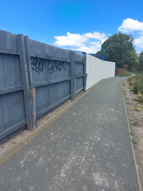
Reported here
 Graffiti on a fence, building or structure —
 graffiti
 Graffiti on a fence, building or structure —
 multiple graffiti on wall at river reserve
 Graffiti on a fence, building or structure —
 graffiti
 Graffiti on a fence, building or structure —
 graffiti on back fence along walkway track
 Graffiti on a fence, building or structure —
 graffiti on tin fence
 Graffiti on a fence, building or structure —
 tagging
 Overgrown Vegetation —
 Vegetation along the riverbank, east of the Radley St Bridge is overgrown. Probably become a fire hazard as it dries out.
 Graffiti on a fence, building or structure —
 Graffiti on lamp post pole
 Damaged Road —
 Deep dangerous hole in road outside motel
 Park - General Request —
 Laura Kent Reserve (Radley Street bridge to Riley Crescent) - please spray along path edge. Weeds creeping onto the pathway. Please send to
 Litter —
 Litter in the river
- Dumped Rubbish —
- Dumped Rubbish —
- Water General —
- Graffiti —
- Vandalism - General —
- Animal - General —
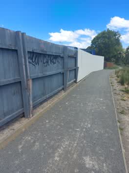 Graffiti —
 Graffiti on fence on footpath on Woolston walk near Radley st.
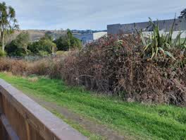 Parks —
 Riverbank is overgrown still....I don't really expect anything to happen but it's only been 7 years. Nice to see gardeners on the other side
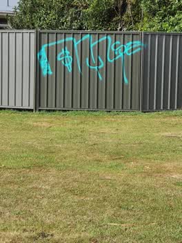 Graffiti —
 Parks —
the riverbank is overgrown with weeds and is a fire hazard
Flooding —
leaking meter box
Parks —
Connal Reserve. BlackBerry all along riverbank, needs cut out.
Parks —
riverbank and walking track is overgrown and needs tidying
Graffiti —
graffiti on the corner of ferry road and radley street
Graffiti —
Water Supply —
Meter box is leaking
Graffiti —
Graffiti —
Graffiti —
Roading/Streets —
Vehicle parked on the footpath
- Water Supply —
We have a water leak at the meter.
Graffiti —
at the intersection of Radley and hargood
Also reported on Ferry Road
- 502 Ferry Road — 59 reports
- 690 Ferry Road — 43 reports
- 689 Ferry Road — 40 reports
- 583 Ferry Road — 32 reports
- 800 Ferry Road — 30 reports
- 608 Ferry Road — 30 reports
- 560 Ferry Road — 30 reports
- 543 Ferry Road — 27 reports
The street’s crash record
NZTA’s record names Ferry Road in 192 crashes that hurt somebody since 2006 — 5 people killed, 43 seriously hurt.
The green nearby
- Connal Reserve — 4 m to the edge · 1 ha
- Christchurch Quay Reserve — 34 m to the edge · 1 ha
- Laura Kent Reserve — 209 m to the edge
- Woolston Park — 285 m to the edge · Sports ground · 5 ha
- Thistledown Reserve — 318 m to the edge
Parks within half a kilometre, measured to the boundary — the council’s open data.
On the doorstep
- Arcadia Motel — 31 m away · Motels
- Waitomo Woolston — 75 m away · Petrol stations
- A-one Food Mart — 104 m away · Dairies & convenience
- McDonald's — 144 m away · Fast food
Businesses within four hundred metres, measured at the pin — OpenStreetMap and the council directories.
The bus nearby
The closest Metro stops, within four hundred and fifty metres.
The tracks through here
- Walk and bike track through Woolston — 20 m to the line · walk · bike
- Walk and bike track through Woolston — 37 m to the line · walk · bike
- Walk and bike track through Woolston — 50 m to the line · walk · bike
- Walk and bike track through Woolston — 196 m to the line · walk · bike
- Walk and bike track through Woolston — 272 m to the line · walk · bike
Tracks whose line passes within half a kilometre, measured to the line itself — the council’s open data.
The named ground
Named water within 500 m of this address, measured to the line or the edge; the council’s own structure register — bridges, boardwalks and steps standing nearby — the open map’s record.
The remembered names nearby
- Christchurch Quay Est — 162 m away ·
CHRISTCHURCH QUAY EST. 1851
· 2009 - Woolston Proclaimed a Borough July 27th 1893 ‘may IT — 171 m away ·
WOOLSTON PROCLAIMED A BOROUGH JULY 27TH 1893 ‘MAY IT PROSPER’ JOHN RICHARDSON MAYOR
· 2009 - Limestone Landed Here Was … for Use by Tanneries and Brick… — 187 m away ·
Limestone landed here was … for use by tanneries and brick…
· 2009
Inscribed plaques within two hundred and fifty metres — the register’s pins, not surveyed spots. The whole roll is at /plaques.
Renting nearby
new bonds in Woolston ran about $511 a week — $39 below the city median of $550 — the suburb page keeps the rent record →.
What was here — Woolston Borough Monument and Setting
171 m away · located to ±2 m · the place’s own record →
On the register. Nothing researched here yet.
The civic layer
This ground votes in Linwood ward — the Coastal-Burwood-Linwood community board. Ward lines don’t always follow suburb lines; this one is measured at the pin, not the suburb’s centre.
What stood on this ground → · On the map → · From the air — the Crown’s aerials back to 1936; search the address on RetroLens →
Questions, answered briefly
33 council reports on record since January 2016 — most often graffiti (9), graffiti on a fence, building or structure (7), parks (4).
Woolston, Christchurch — on Ferry Road.
The heritage register names a place at or beside it — Woolston Borough Monument and Setting.
Connal Reserve — 4 m to its edge, 1 ha.