693 Ferry Road, Woolston
22 reports on record since September 2016 · 19 with photographs. The street’s heaviest record is 502 Ferry Road — 59 reports on file. Indicative rating valuation and school zones, hazards, bin day and what stood here before.
What gets reported here
Photographed here 19 on record






Reported here
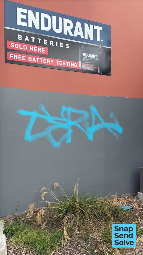
 Graffiti on a fence, building or structure —
 graffiti on water back flow preventer
 Graffiti on a fence, building or structure —
 graffiti on water back flow preventer box
 Street Gutters / Storm Water —
 Storm water grate trip hazard
 Graffiti on a fence, building or structure —
 Tagging on wall
 Graffiti on a fence, building or structure —
 Tagging on gate facing ferry road
 Graffiti on a fence, building or structure —
 graffiti on east facing wall
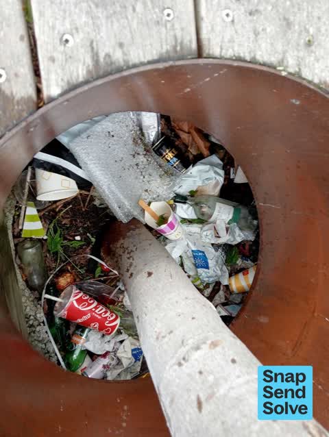
 Litter —
 There are two seats with trees with a hole in the middle both holes are filled with rubbish
 Graffiti on a fence, building or structure —
 See pic
 Graffiti on a fence, building or structure —
  General Request —
  Water Leak —
  Graffiti somewhere else —
 Graffiti on gate
 Graffiti somewhere else —
  Graffiti somewhere else —
  Water Leak —
  Graffiti on a fence, building or structure —
 Graffiti on building, on library wall on our side of the library and graffiti on new world gate next to our building.
- Water Leak —
- Water Leak —
- Pavement - Damaged —
 Graffiti —
 Graffiti on wall
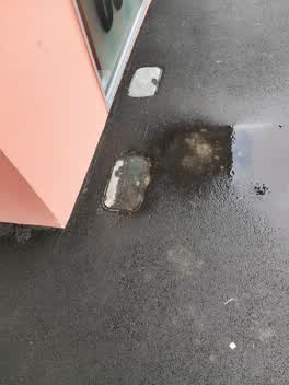 Roading/Streets —
 Graffiti —
Also reported on Ferry Road
- 502 Ferry Road — 59 reports
- 690 Ferry Road — 43 reports
- 689 Ferry Road — 40 reports
- 564 Ferry Road — 33 reports
- 583 Ferry Road — 32 reports
- 800 Ferry Road — 30 reports
- 608 Ferry Road — 30 reports
- 560 Ferry Road — 30 reports
The street’s crash record
NZTA’s record names Ferry Road in 192 crashes that hurt somebody since 2006 — 5 people killed, 43 seriously hurt.
The green nearby
- Glenroy Reserve — 140 m to the edge
- Connal Reserve — 166 m to the edge · 1 ha
- Charlotte Lane Park — 168 m to the edge
- Laura Kent Reserve — 215 m to the edge
- Radley Park — 219 m to the edge · 3 ha
Parks within half a kilometre, measured to the boundary — the council’s open data.
On the doorstep
- Woolston Auto Surgery — 11 m away · Car repair
- Wool Street Bar & Grill — 32 m away · Restaurants
- T-House Souvlaki Takeaway — 34 m away · Fast food
- Sushi Kim — 35 m away · Fast food
Businesses within four hundred metres, measured at the pin — OpenStreetMap and the council directories.
The bus nearby
The closest Metro stops, within four hundred and fifty metres.
The tracks through here
- Walk and bike track through Woolston — 15 m to the line · walk · bike
- Walk and bike track through Woolston — 207 m to the line · walk · bike
- Walk and bike track through Woolston — 222 m to the line · walk · bike
- Walk and bike track through Woolston — 275 m to the line · walk · bike
- Walk and bike track through Woolston — 319 m to the line · walk · bike
Tracks whose line passes within half a kilometre, measured to the line itself — the council’s open data.
The named ground
Named water within 500 m of this address, measured to the line or the edge; the council’s own structure register — bridges, boardwalks and steps standing nearby — the open map’s record.
Renting nearby
new bonds in Woolston ran about $511 a week — $39 below the city median of $550 — the suburb page keeps the rent record →.
What was here — Commercial Building and Setting
174 m away · 650 Ferry Road · located to ±26 m · the place’s own record →
On the register. Nothing researched here yet.
The civic layer
This ground votes in Linwood ward — the Coastal-Burwood-Linwood community board. Ward lines don’t always follow suburb lines; this one is measured at the pin, not the suburb’s centre.
What stood on this ground → · On the map → · From the air — the Crown’s aerials back to 1936; search the address on RetroLens →
Questions, answered briefly
22 council reports on record since September 2016 — most often graffiti on a fence, building or structure (8), water leak (4), graffiti somewhere else (3).
Woolston, Christchurch — on Ferry Road.
The heritage register names a place at or beside it — Commercial Building and Setting.
Glenroy Reserve — 140 m to its edge.