11 Deans Avenue, Addington
29 reports on record since September 2016 · 19 with photographs. The street’s heaviest record is 3 Deans Avenue — 39 reports on file. Indicative rating valuation and school zones, hazards, bin day and what stood here before.
What gets reported here
Photographed here 19 on record


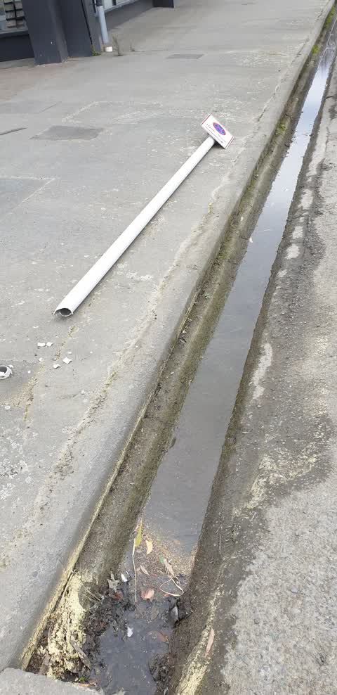
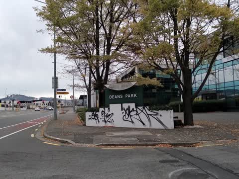
Reported here
 Overgrown Vegetation —
 overgrown vegetation
 Road Signage —
 Sign directs bike traffic to building site
 Graffiti on a sign, mural or public art —
 KP tag back of stop sign Lester lane
 Graffiti on a traffic light pole or cabinet, or wa —
  Graffiti on a fence, building or structure —
  Graffiti on a fence, building or structure —
  Graffiti somewhere else —
 Fence and sign on fence Deans Ave near Lester lane
 Graffiti somewhere else —
 On "Pride" utility box Deans Ave by Lester lane
 Water Pollution - Sediment —
 Still polluted. A disgrace that this has. It been dealt with.
 Graffiti on a sign, mural or public art —
 Corner Lester lane
- Graffiti —
- Graffiti —
- Graffiti —
- Dumped Rubbish —
- Pavement - General —
- Graffiti —
- Graffiti —
- Graffiti —
 Roading/Streets —
 Lester lane outside tile warehouse
 Graffiti —
 Roading/Streets —
this footpath really needs attention
Roading/Streets —
This area still floods and is unsafe, forcing people into the road in and after bad weather. has been reported several time, the last being
- Roading/Streets —
There is a pile of nails on the road in the left turn lane from Moorhouse/Blenheim onto Dean's Ave. Looks like they have fallen off a builde
Roading/Streets —
This intersection is on a state highway and Canterbury st Lyttelton 8082 It a death waiting to happen,with the amount of heavy traffic a day
Graffiti —
Graffiti —
Roading/Streets —
Once fibre has been laid, can this whole stretch of footpath be sealed? It frequently floods, gathers mud and is treacherous to walk along.
- Roading/Streets —
Twisted my ankle whilst walking along the footpath along Deans Ave. I was trying to avoid all the potholes/mud/puddles as the path is unseal
Roading/Streets —
Massive safety issue
Also reported on Deans Avenue
- 3 Deans Avenue — 39 reports
- 25 Deans Avenue — 37 reports
- 55 Deans Avenue — 36 reports
- 53 Deans Avenue — 20 reports
- 27 Deans Avenue — 6 reports
- 65 Deans Avenue — 5 reports
- 49 Deans Avenue — 5 reports
- 35 Deans Avenue — 4 reports
The street’s crash record
NZTA’s record names Deans Avenue in 38 crashes that hurt somebody since 2006 — 5 seriously hurt, nobody killed.
The green nearby
- Hagley Park South — 34 m to the edge · Sports ground · 71 ha
- Christchurch Railway Station Reserve — 353 m to the edge · Botanic
- Mountfort Park — 474 m to the edge · Botanic
Parks within half a kilometre, measured to the boundary — the council’s open data.
On the doorstep
- NZ Blood — 148 m away · Blood Donation
- mtf Finance — 180 m away · Company
- WSP — 212 m away · Business
- The Good Street Deli — 216 m away · Restaurants
Businesses within four hundred metres, measured at the pin — OpenStreetMap and the council directories.
The bus nearby
- Lincoln Rd near Dickens St — 400 m away · route 7, route 120
- Lincoln Rd near Hazeldean Rd — 401 m away · route 7
The closest Metro stops, within four hundred and fifty metres.
The tracks through here
- Walk and bike track through Addington — 19 m to the line · walk · bike
- Walk and bike track through Addington — 71 m to the line · walk · bike
- Walk and bike track through Addington — 137 m to the line · walk · bike
- Walk and bike track through Addington — 237 m to the line · walk · bike
- Walk and bike track through Addington — 260 m to the line · walk · bike
Tracks whose line passes within half a kilometre, measured to the line itself — the council’s open data.
The named ground
Named water within 500 m of this address, measured to the line or the edge; Named places within 1.5 km of this address — the open map’s record.
Renting nearby
new bonds in Addington ran about $502 a week — $48 below the city median of $550 — the suburb page keeps the rent record →.
The civic layer
This ground votes in Riccarton ward — the Halswell-Hornby-Riccarton community board. Ward lines don’t always follow suburb lines; this one is measured at the pin, not the suburb’s centre.
What stood on this ground → · On the map → · From the air — the Crown’s aerials back to 1936; search the address on RetroLens →
Questions, answered briefly
29 council reports on record since September 2016 — most often graffiti (9), roading/streets (8), graffiti somewhere else (2).
Addington, Christchurch — on Deans Avenue.
Nothing on the heritage register at this exact spot — the record around this ground →
Hagley Park South — 34 m to its edge, 71 ha.