44 Ruskin Street, Addington
15 reports on record since August 2017 · 14 with photographs. The street’s heaviest record is 41 Ruskin Street — 24 reports on file. Indicative rating valuation and school zones, hazards, bin day and what stood here before.
What gets reported here
Photographed here 14 on record


Reported here
 Dumped Rubbish —
 Dumped pallet
 Graffiti on a sign, mural or public art —
 Tags on both sides of 20 sign by 44 Ruskin Street.
 Facility - General Request —
 Grass verge outside Ruskin reserve needs mowing - why is this not done when the reserve is mown?
 Graffiti on a fence, building or structure —
 Graffiti on fence and traffic sign
 Park - General Request —
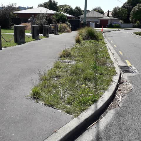
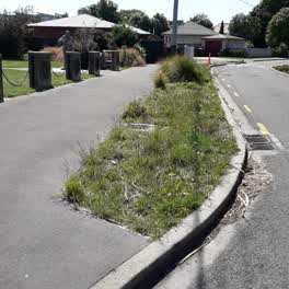
 I have long been intrigued by this piece of garden on the edge of Ruskin Reserve. It has a couple of tussocks in it and the rest is weeds.
 Graffiti on a fence, building or structure —
 Graffiti on fence next to Ruskin reserve
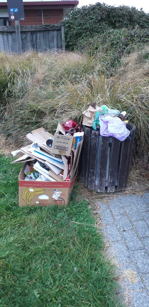
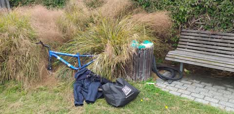
 Dumped Rubbish —
  Dumped Rubbish —
  Dumped Rubbish —
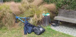
 A pile of rubbish has been dumped in the garden at the edge of Ruskin Reserve just beside the house to the east of the reserve on Ruskin St.
- Rubbish and Bins - General —
 Rubbish/Recycling —
 Ruskin reserve, a favourite rubbish dump
 Parks —
 Rubbish dumped in Ruskin Reserve
 Parks —
 Hi. I have long been intrigued by the section of garden opposite number 44 Ruskin Street, next to the little park in Addington. It has ver
Graffiti —
speed sign
Graffiti —
Also reported on Ruskin Street
- 41 Ruskin Street — 24 reports
- 71 Ruskin Street — 9 reports
- 69 Ruskin Street — 9 reports
- 60 Ruskin Street — 8 reports
- 55 Ruskin Street — 8 reports
- 21 Ruskin Street — 7 reports
- 18 Ruskin Street — 7 reports
- 61 Ruskin Street — 6 reports
The street’s crash record
NZTA’s record names Ruskin Street in 5 crashes that hurt somebody since 2006 — 1 seriously hurt, nobody killed.
The green nearby
- Ruskin Reserve — 9 m to the edge
- Baxters Drain — 84 m to the edge
- Addington Cemetery — 227 m to the edge · Botanic · 2 ha
- Antigua Reserve — 299 m to the edge
- Selwyn Reserve — 321 m to the edge
Parks within half a kilometre, measured to the boundary — the council’s open data.
On the doorstep
- Everybody's Butchery — 242 m away · Butchers
- Mainland Resene ColorShop — 270 m away · Paint
- Resure — 279 m away · Insurance
- 319 Addington Motel — 303 m away · Motels
Businesses within four hundred metres, measured at the pin — OpenStreetMap and the council directories.
The bus nearby
- Brougham St near Somerset Cres — 205 m away · route 120
- Brougham St near Kipling St — 229 m away · route 120
The closest Metro stops, within four hundred and fifty metres.
The tracks through here
- Walk and bike track through Addington — 246 m to the line · walk · bike
- Walk and bike track through Addington — 298 m to the line · walk · bike
- Walk and bike track through Addington — 424 m to the line · walk · bike
- Walk and bike track through Addington — 475 m to the line · walk · bike
Tracks whose line passes within half a kilometre, measured to the line itself — the council’s open data.
The named ground
Named water within 500 m of this address, measured to the line or the edge; Named places within 1.5 km of this address; the council’s own structure register — bridges, boardwalks and steps standing nearby — the open map’s record.
The remembered names nearby
- The Passionflowers, Reproduced Here From the Addington — 8 m away ·
The passionflowers, reproduced here from the Addington Cemetery, form part of the Literary
· 2008 - John Ruskin (1819–1900), Was the Pre-Eminent Critic — 8 m away ·
John Ruskin (1819–1900), was the pre-eminent critic of Victorian art and society. His phil
· 2008 - Ruskin Reserve plaque — 8 m away ·
(Decorative passionflower carving – no text)
· 2008
Inscribed plaques within two hundred and fifty metres — the register’s pins, not surveyed spots. The whole roll is at /plaques.
Renting nearby
new bonds in Addington ran about $502 a week — $48 below the city median of $550 — the suburb page keeps the rent record →.
The civic layer
This ground votes in Spreydon ward — the Spreydon-Cashmere-Heathcote community board. Ward lines don’t always follow suburb lines; this one is measured at the pin, not the suburb’s centre.
What stood on this ground → · On the map → · From the air — the Crown’s aerials back to 1936; search the address on RetroLens →
Questions, answered briefly
15 council reports on record since August 2017 — most often dumped rubbish (4), parks (2), graffiti on a fence, building or structure (2).
Addington, Christchurch — on Ruskin Street.
Nothing on the heritage register at this exact spot — the record around this ground →
Ruskin Reserve — 9 m to its edge.