261 Beach Road
4 council reports since July 2019, 3 carrying a photograph. The street’s heaviest record is 49 Beach Road, 28 reports on file.
The green nearby
- Britomart Memorial, 18 m to the edge · Botanic
- Green Point Park, 34 m to the edge · 4 ha
- Beach Road Park, 234 m to the edge
- Takapuneke Reserve, 313 m to the edge · Regional · 10 ha
- Clare Reserve, 439 m to the edge
Parks within half a kilometre, measured to the boundary, the council’s open data. The whole roll is at /parks.
The named ground
Named places within 1.5 km of this address; the council’s own structure register, bridges, boardwalks and steps standing nearby, the open map’s record.
The remembered names nearby
- To Mark 150 Years Since the Landing of Chief Police, 52 m away ·
TO MARK 150 YEARS SINCE THE LANDING OF CHIEF POLICE MAGISTRATE MICHAEL MURPHY AND NEW SOUT
· 2008 - Here on 11 August 1840 Captain Owen Stanley, 53 m away ·
HERE ON 11 AUGUST 1840 CAPTAIN OWEN STANLEY H.M.S. BRITOMART RAISED THE UNION JACK TO DEMO
· 2008 - Britomart Monument plaque, 54 m away ·
(Heavily weathered memorial – majority illegible)
· 2008
Inscribed plaques within two hundred and fifty metres, the register’s pins, not surveyed spots. The whole roll is at /plaques.
What gets reported here
Photographed here 3 on record

What’s on record
 Overgrown Vegetation, 9 Jan 2024
 Disgusting state of significant NZ memorial walkway
- Street Gutters / Storm Water, 19 Jul 2023
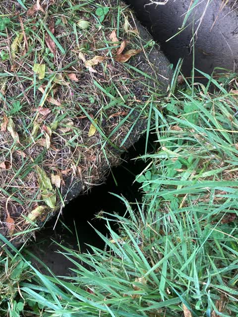
 Sewer - General, 6 Apr 2022
 Concrete cover moved and loose. Someone could fall into it, big drop.
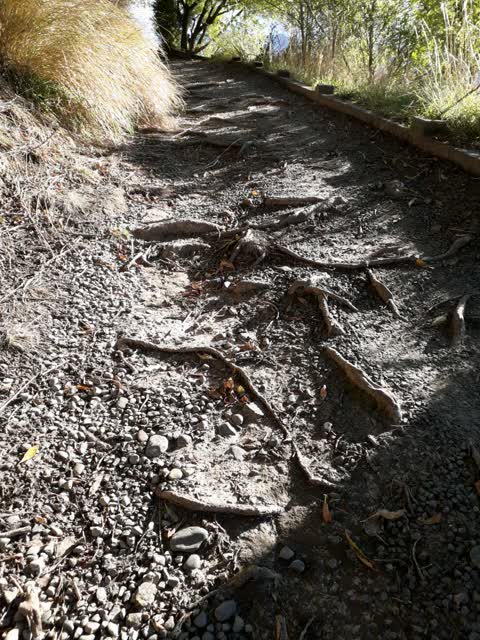
Parks, 13 Jul 2019
Can the community have work done on Britomart walkway, where uneven surface due to tree roots please
Elsewhere on Beach Road
- 49 Beach Road, 28 reports
- 259 Beach Road, 11 reports
- 83 Beach Road, 10 reports
- 82 Beach Road, 9 reports
- 221 Beach Road, 8 reports
- 273 Beach Road, 7 reports
- 11–49 Beach Road, 7 reports
- 77/87 Beach Road, 6 reports
The street’s crash record
NZTA’s record names Beach Road in 3 crashes that hurt somebody since 2006, 3 seriously hurt, nobody killed.
The civic layer
This ground votes in Banks Peninsula ward, the Banks Peninsula community board is its local layer. Ward lines don’t always follow suburb lines; this one is measured at the pin, not the suburb’s centre. The whole roll is at /wards.
Beach Road, the whole record → · Everything about Akaroa → · What stood on this ground → · On the map → · From the air, RetroLens holds the Crown’s aerials back to 1936; search the address there →
Questions, answered briefly
4 council reports on record since July 2019, most often street gutters / storm water (1), sewer - general (1), parks (1).
Akaroa, Christchurch, on Beach Road.
Nothing on the heritage register at this exact spot, the record around this ground →
Britomart Memorial, 18 m to its edge.