7 Oakfield Street
7 council reports since February 2016, 4 carrying a photograph. The most-reported address on Oakfield Street.
From the air, then
Sourced from Canterbury Maps and partners. LINZ, CC BY 3.0 NZ. Each frame is cut from Environment Canterbury’s historic imagery MapServer for that decade, only where the Footprints layer names a CC BY survey (NZAM-covered spots stay out). RetroLens holds more Crown aerials →
The green nearby
- Ashcroft Reserve, 92 m to the edge · playground, 4 pieces
- Burnside Park, 195 m to the edge · Sports ground · 29 ha · playground, 57 pieces
- Memorial Avenue Reserves, 441 m to the edge
- Lavendula Reserve, 492 m to the edge
- Witbrock Reserve, 494 m to the edge
Parks within half a kilometre, measured to the boundary, the council’s open data. The whole roll is at /parks.
On the doorstep
- Good Thai, 102 m away · Restaurants
- Kebabish NZ Restaurant & Takeaway, 103 m away · Restaurants
- Pierces Bakery - Burnside, 103 m away · Business
- Pure Indulgence, 103 m away · Beauty
Businesses within four hundred metres, measured at the pin, OpenStreetMap and the council directories.
The bus nearby
- Memorial Ave near Burnside Park, 188 m away · route 29
- Memorial Ave near Kendal Ave, 212 m away · route 29
The closest Metro stops, within four hundred and fifty metres.
The tracks through here
- Walk and bike track through Burnside, 77 m to the line · walk · bike
- Walk and bike track through Burnside, 141 m to the line · walk · bike
- Walk and bike track through Burnside, 248 m to the line · walk · bike
- Walk and bike track through Burnside, 443 m to the line · walk · bike
Tracks whose line passes within half a kilometre, the council’s open data.
Renting nearby
new bonds in Burnside ran about $641 a week, $91 above the city median of $550, the suburb page keeps the rent record →.
What gets reported here
Photographed here 4 on record
What’s on record
- Accessibility, 20 Jul 2026
My photo showing blackboard My My photo regarding the blackboards on the footpath at the Maidstone/Waimairi corner taken and sent 25/06/2026
- Rubbish and Bins - General, 10 Apr 2026
Again bins in Oakfield St have missed being emptied today. This time it is the red bin. The red truck emptied the bins on the opposite side
- Rubbish and Bins - General, 14 Mar 2026
Green bins in Oakfield Street were not emptied as usual yesterday - Friday March 13. Most households have left their bins out in the hope th
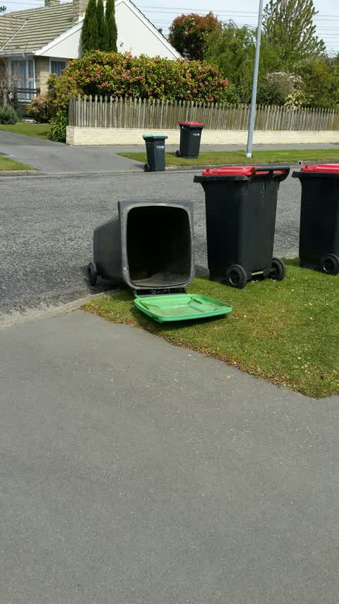
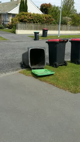 Rubbish and Bins - General, 16 Oct 2020
 Several collections recently have resulted in our green bin left as shown in the photo taken today. It was left like this last week too but
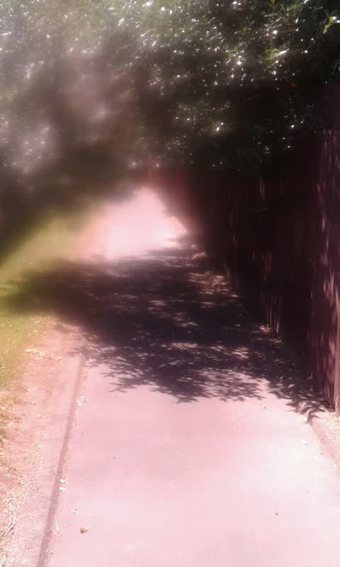
Parks, 30 Jan 2017
Walkway from Arlington St to Memorial Ave at end of Hartford St needs shtubs/trees trimed.Dangerous at pr.. .esent below eye level for even
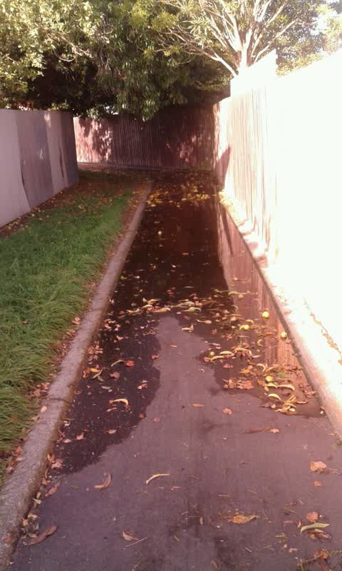
Roading/Streets, 26 Mar 2016
Alley between Memorial Ave and Arlington St not far from Kendal Ave.Flooding after rain, ponding.Since renovations of neighbour??. Grass ne
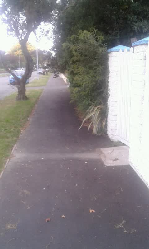
Roading/Streets, 11 Feb 2016
At 4 Oakfield st Burnside Over hanging trees/shrubs over footpath below head height very annoying especially on wet day
Elsewhere on Oakfield Street
- 25 Oakfield Street, 3 reports
- 4 Oakfield Street, 2 reports
- 9 Oakfield Street, 1 report
- 8 Oakfield Street, 1 report
- 30 Oakfield Street, 1 report
- 28 Oakfield Street, 1 report
- 20 Oakfield Street, 1 report
- 16 Oakfield Street, 1 report
The civic layer
This ground votes in Waimairi ward, the Fendalton-Waimairi-Harewood community board is its local layer. Ward lines don’t always follow suburb lines; this one is measured at the pin, not the suburb’s centre. The whole roll is at /wards.
Oakfield Street, the whole record → · Everything about Burnside → · What stood on this ground → · On the map → · From the air, RetroLens holds the Crown’s aerials back to 1936; search the address there →
Questions, answered briefly
7 council reports on record since February 2016, most often rubbish and bins - general (3), roading/streets (2), parks (1).
Burnside, Christchurch, on Oakfield Street.
Nothing on the heritage register at this exact spot, the record around this ground →
Ashcroft Reserve, 92 m to its edge.