Christchurch City Council
Christchurch City Council is a council office at 53 Hereford Street, Christchurch Central City.
Christchurch City Council Civic Offices
The only council office on the Christchurch record
Checked 1 Nov 2026
53 Hereford Street
Opening hours
| Monday – Friday | 8 am to 5 pm |
|---|---|
| Saturday – Sunday | Closed |
Hours change, especially over holidays: confirm with the business before a special trip. About 45 hours a week, by the map’s count.
Reviews
Getting there
The map loads only when you ask for it.
Straight-line distances from the pin, not walking routes.
Nearby
More nearby places 7
Environment Canterbury’s Canterbury Maps Parks layer, refreshed 2026-10-10. Distances are straight-line from the business pin, not walking routes.
The other doors Christchurch City Council runs, 7 on the roll
Also in Christchurch Central City
More businesses in Christchurch Central City 7
What the record holds 7 sourced facts
What the record holds
| Fact | What the source says | Source |
|---|---|---|
| Address | 53 Hereford Street, Christchurch 8013 | OpenStreetMap |
| Kind | Townhall | OpenStreetMap |
| Also known as | Te Hononga;CCC Building | OpenStreetMap |
| NZBN | 9429000003339, Local Government | NZBN register |
| Registered since | 14 June 2017 | NZBN register |
| Services | Wi-Fi | OpenStreetMap |
| Food registration | reg CCC002653/1, Template FCP, verified by CCC, expires 27 Sept 2027 | MPI food register |
Is this your business? Send hours, menu or photos, free and this page updates. chch.live’s maker builds simple sites for Christchurch businesses.
What the map says about it
Christchurch City Council Civic Offices
The ground it stands on
| Fact | What the source says | Source |
|---|---|---|
| District Plan zone | City centre zone | District Plan |
| Consent CRC100158 | Large Scale Burner, held by Ngai Tahu Limited & Civic Building Limited, to 17 Sept 2044, 8 m from the pin | ECan consents |
| Consent CRC100159.1 | Hazardous Storage, held by Ngai Tahu Limited & Civic Building Limited, to 14 Oct 2044, 14 m from the pin | ECan consents |
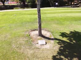 International Federation of University Women 22nd Triennial
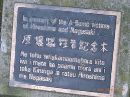 In Memory of the A‑bomb Victims of Hiroshima and Nagasaki
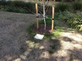 Avon Riverbank Central City plaque
The reports nearby
5,622 council reports pinned within 250 m of the premises, most often Graffiti & vandalism and Roads & footpaths, 4,691 with a photograph. A pin is where a reporter stood, not a claim about the place itself.
The 5,622 reports on file
 Graffiti on a sign, mural or public art
 Graffiti on a sign, mural or public art
 Rubbish and Bins - General
 Hazard, vehicle
 Rubbish and Bins - General
 Graffiti on a fence, building or structure
 Graffiti on a traffic light pole or cabinet, or wa
 Graffiti on a traffic light pole or cabinet, or wa
 Pavement - Damaged
 General Request
 Animal - General
 Traffic Signals
Questions, answered briefly
Read answers 6
A council office in Christchurch Central City, Christchurch.
53 Hereford Street, Christchurch Central City, on Hereford Street. On the map →
On OpenStreetMap.
Monday – Friday: 8 am to 5 pm; Saturday – Sunday: Closed, as mapped on OpenStreetMap.
the address’s own record holds 126 reports; 6 other premises within a short walk, nearest Civil Servant Cafe (8 m); the Hereford St near Montreal St bus stop is 68 m away: route 8; a shared path passes within 100 m; nearest park: Scott Statue Reserve (163 m).
The record behind this
This page is the union of what these public sources say, each fact above names the one it came from. A listing is a lead, not a promise the business still trades:
Sources: OpenStreetMap · Christchurch District Plan layers · Christchurch City Council off-street parking layer (CC BY 4.0) · Environment Canterbury’s active resource consents · Environment Canterbury’s Metro stop record · Christchurch City Council’s cycleway layer · New Zealand Business Number register · Ministry for Primary Industries food-business register
Read source notes 8
- OpenStreetMap, named premises drawn and kept current by its contributors (ODbL)
- Christchurch District Plan layers, zones, commercial centres and scheduled heritage items, from the council’s open data (CC BY 4.0)
- Christchurch City Council off-street parking layer (CC BY 4.0),
- Environment Canterbury’s active resource consents, recorded where the consented activity happens (CC BY 4.0)
- Environment Canterbury’s Metro stop record, distances measured here from the pin
- Christchurch City Council’s cycleway layer, lanes, separated paths and the named Major Cycle Routes (CC BY 4.0)
- New Zealand Business Number register, the public facts every NZBN entity files (legal name, status, registration date, industry), matched here by name and address
- Ministry for Primary Industries food-business register, the public Food Act registration for these premises, verified by the named agency, matched here by name and address
Map data © OpenStreetMap contributors (ODbL); council and ECan data under CC BY 4.0; Wikidata CC0. Something wrong? Fix it on OpenStreetMap or tell us. The whole directory lives at /businesses. This page as markdown: /business/christchurch-city-council-christchurch-central-city.md.