Ministry of Health
Ministry of Health is a government office at 48 Hereford Street, Christchurch Central City.
Checked 2 Nov 2026
48 Hereford Street
Opening hours
| Monday – Sunday | Open all day |
|---|
Hours change, especially over holidays: confirm with the business before a special trip. About 168 hours a week, by the map’s count.
Reviews
Getting there
The map loads only when you ask for it.
Straight-line distances from the pin, not walking routes.
Nearby
More nearby places 6
Environment Canterbury’s Canterbury Maps Parks layer, refreshed 2026-10-10. Distances are straight-line from the business pin, not walking routes.
The nearest other government
More nearby government 5
All 5 government in Christchurch Central City → · Every one in the city →
Also in Christchurch Central City
More businesses in Christchurch Central City 7
What the record holds
| Fact | What the source says | Source |
|---|---|---|
| Address | 48 Hereford Street, Christchurch 8013 | OpenStreetMap |
| Kind | Government | OpenStreetMap |
| Te reo Māori name | Manatū Hauora | OpenStreetMap |
Is this your business? Send hours, menu or photos, free and this page updates. chch.live’s maker builds simple sites for Christchurch businesses.
The ground it stands on
| Fact | What the source says | Source |
|---|---|---|
| District Plan zone | City centre zone | District Plan |
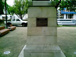 Citation for the Victoria Cross
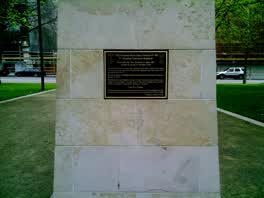 2835 Sergeant Henry James Nicholas VC MM
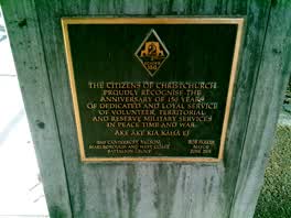 The Citizens of Christchurch / Proudly Recognise
The reports nearby
5,971 council reports pinned within 250 m of the premises, most often Graffiti & vandalism and Roads & footpaths, 5,015 with a photograph. A pin is where a reporter stood, not a claim about the place itself.
The 5,971 reports on file
 Animal - Deceased
 Graffiti on a fence, building or structure
 Graffiti on a traffic light pole or cabinet, or wa
 Graffiti on a traffic light pole or cabinet, or wa
 Graffiti on a fence, building or structure
 Graffiti on a road, footpath or bridge
 Graffiti on a sign, mural or public art
 Graffiti on a traffic light pole or cabinet, or wa
 Graffiti on a fence, building or structure
 Graffiti on a fence, building or structure
 Graffiti on a road, footpath or bridge
 Graffiti on a traffic light pole or cabinet, or wa
Questions, answered briefly
Read answers 7
A government office in Christchurch Central City, Christchurch.
48 Hereford Street, Christchurch Central City, on Hereford Street. On the map →
On OpenStreetMap.
Monday – Sunday: Open all day, as mapped on OpenStreetMap.
Ministry of Education (27 m), Canterbury District Health Board (382 m), Oranga Tamariki (521 m), every one in the city.
the address’s own record holds 76 reports; 6 other premises within a short walk, nearest Inati (26 m); the Hereford St near Montreal St bus stop is 107 m away: route 8; a shared path passes within 58 m; nearest park: Bridge Of Remembrance (124 m).
The record behind this
This page is the union of what these public sources say, each fact above names the one it came from. A listing is a lead, not a promise the business still trades:
Sources: OpenStreetMap · Christchurch District Plan layers · Christchurch City Council off-street parking layer (CC BY 4.0) · Environment Canterbury’s Metro stop record · Christchurch City Council’s cycleway layer
Read source notes 5
- OpenStreetMap, named premises drawn and kept current by its contributors (ODbL)
- Christchurch District Plan layers, zones, commercial centres and scheduled heritage items, from the council’s open data (CC BY 4.0)
- Christchurch City Council off-street parking layer (CC BY 4.0),
- Environment Canterbury’s Metro stop record, distances measured here from the pin
- Christchurch City Council’s cycleway layer, lanes, separated paths and the named Major Cycle Routes (CC BY 4.0)
Map data © OpenStreetMap contributors (ODbL); council and ECan data under CC BY 4.0; Wikidata CC0. Something wrong? Fix it on OpenStreetMap or tell us. The whole directory lives at /businesses. This page as markdown: /business/ministry-of-health-christchurch-central-city.md.