The Cuban
The Cuban is a bar or pub at 236 St Asaph Street, Christchurch Central City.
Checked 18 Oct 2026
The Cuban is now home to the Flying Burrito Brothers, a blissful homage to the dining style of Mexico. Visit for a true… Read full description ↓
One of 95 bars & pubs in Christchurch Central City, 37% of the city’s count
236 St Asaph Street
Reviews
Getting there
The map loads only when you ask for it.
Straight-line distances from the pin, not walking routes.
Nearby
More nearby places 7
Environment Canterbury’s Canterbury Maps Parks layer, refreshed 2026-10-10. Distances are straight-line from the business pin, not walking routes.
The nearest other bars & pubs
More nearby bars & pubs 5
All 95 bars & pubs in Christchurch Central City → · Every one in the city →
Also in Christchurch Central City
More businesses in Christchurch Central City 7
What the record holds 5 sourced facts
What the record holds
| Fact | What the source says | Source |
|---|---|---|
| Address | 236 St Asaph Street, Christchurch 8011 | OpenStreetMap |
| Kind | Bars & pubs | OpenStreetMap |
| Phone | 03 260 2605 | Find Christchurch, 2024 |
| Website | thecuban.co.nz | Find Christchurch, 2024 · its own site agrees |
| venuemanager@thecuban.co.nz | Find Christchurch, 2024 |
Is this your business? Send hours, menu or photos, free and this page updates. Know its hours? Add them on OpenStreetMap, the page picks them up overnight.
How the council’s directory described it
Read the full description council directory, about 2024
The Cuban is now home to the Flying Burrito Brothers, a blissful homage to the dining style of Mexico. Visit for a true Mexican dining experience, their food is fresh and locally sourced. Their Cantina ensembles cater to tastes of subtle, textured and hot, while their Latin drinks complete a well-stacked Tequileria. Takeaway and deliveries available.
— Find Christchurch, 2024. The business’s own words from about 2024, repeated as a lead, not checked.
The ground it stands on
| Fact | What the source says | Source |
|---|---|---|
| District Plan zone | Central City Mixed Use Zone | District Plan |
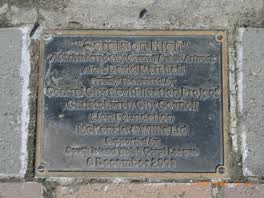 ‘corgis on High’ — Christchurch City Public Artwork
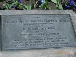 The First Public Water Supply Well Was Drilled Near This
What stood on St Asaph Street
From Canterbury Stories. This photograph names the street, not this business. The street page pairs it with a Street View pose verified outside Bohemian Bakery, 2024-06. The street’s then and now →
The reports nearby
5,388 council reports pinned within 250 m of the premises, most often Graffiti & vandalism and Roads & footpaths, 4,481 with a photograph. A pin is where a reporter stood, not a claim about the place itself.
 Dumped Rubbish
 Hazard, vehicle
 Hazard, vehicle
 Pest / Vermin
 Graffiti on a road, footpath or bridge
 Pavement - Damaged
 Street Cleaning
 Rubbish and Bins - General
 Litter
 Graffiti on a fence, building or structure
Questions, answered briefly
Read answers 7
A bar or pub in Christchurch Central City, Christchurch.
236 St Asaph Street, Christchurch Central City, on St Asaph Street. On the map →
On OpenStreetMap and in the council’s 2024 directory.
phone 03 260 2605 (Find Christchurch, 2024), its website (Find Christchurch, 2024), email venuemanager@thecuban.co.nz (Find Christchurch, 2024).
Chic Restaurant (53 m), Retropolitan Social Club (64 m), Celine's (69 m), every one in the city.
the address’s own record holds 25 reports; 6 other premises within a short walk, nearest The Flying Burrito Bros (11 m); the Manchester St near Welles St bus stop is 132 m away: route 27; a separated cycleway passes the door; nearest park: Excelsior Hotel Reserve (222 m).
The record behind this
This page is the union of what these public sources say, each fact above names the one it came from. A listing is a lead, not a promise the business still trades:
Sources: OpenStreetMap · Find Christchurch · Christchurch District Plan layers · Christchurch City Council off-street parking layer (CC BY 4.0) · Environment Canterbury’s Metro stop record · Christchurch City Council’s cycleway layer · The business’s own website
Read source notes 7
- OpenStreetMap, named premises drawn and kept current by its contributors (ODbL)
- Find Christchurch, the council’s business directory, a snapshot last touched about March 2024 (CC BY 4.0)
- Christchurch District Plan layers, zones, commercial centres and scheduled heritage items, from the council’s open data (CC BY 4.0)
- Christchurch City Council off-street parking layer (CC BY 4.0),
- Environment Canterbury’s Metro stop record, distances measured here from the pin
- Christchurch City Council’s cycleway layer, lanes, separated paths and the named Major Cycle Routes (CC BY 4.0)
- The business’s own website, read politely by chch.live for contact details the open record is missing, re-checked monthly
Map data © OpenStreetMap contributors (ODbL); council and ECan data under CC BY 4.0; Wikidata CC0. Something wrong? Fix it on OpenStreetMap or tell us. The whole directory lives at /businesses. This page as markdown: /business/the-cuban-christchurch-central-city.md.