104 Park Terrace, Christchurch Central City
25 reports on record since January 2021 · 10 with photographs. The street’s heaviest record is 82A Park Terrace — 58 reports on file. Indicative rating valuation and school zones, hazards, bin day and what stood here before.
What gets reported here
Photographed here 10 on record


Reported here
 Graffiti on a sign, mural or public art —
 Many poles have been tagged along Park Terrace again
 Graffiti on a sign, mural or public art —
 at base of large traffic sign.
 Graffiti on a fence, building or structure —
 Sprawls on fence of Ryman's empty section Park Terrace.
 Road Signage —
 Hello This sign has been hit and it's bent. The botanical Gardens part looks faded .Could consideration be given to look into this matter a
 Pavement - General —
 Broken glass over entire width of footpath
 Graffiti somewhere else —
 On seat, perimeter walkway North Hagley Park. Walking from footbridge to Near fenced off toilet? block. Vivid marker pen or similar, not ove
 Overgrown Vegetation —
 Blackberry has returned
- Trees - General —
- Graffiti —
- Graffiti —
- Graffiti —
- Graffiti —
- Graffiti —
- Overgrown Vegetation —
- Graffiti —
- Overgrown Vegetation —
- Graffiti —
- Graffiti —
- Graffiti —
- Graffiti —
- Graffiti —
- Graffiti —
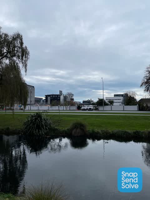
 Graffiti —
  Graffiti —
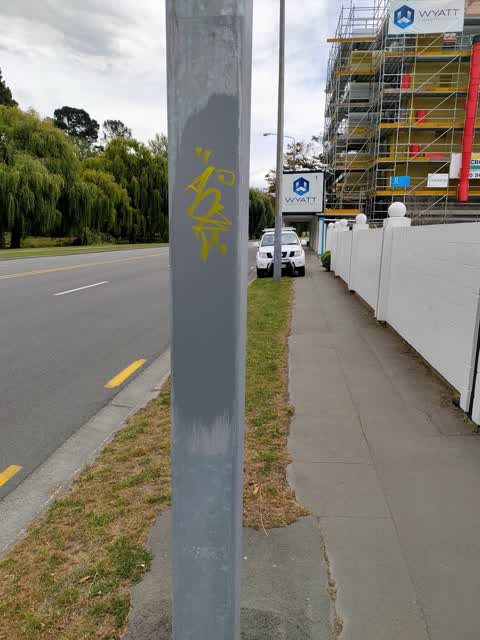
 All along the front of an empty section. I might not have the address quite right, but I have included a snap of the old name of the complex
 Graffiti —
Also reported on Park Terrace
- 82A Park Terrace — 58 reports
- 78 Park Terrace — 39 reports
- 34 Park Terrace — 31 reports
- 62 Park Terrace — 29 reports
- 42 Park Terrace — 28 reports
- 82 Park Terrace — 26 reports
- 28 Park Terrace — 24 reports
- 76 Park Terrace — 16 reports
The street’s crash record
NZTA’s record names Park Terrace in 27 crashes that hurt somebody since 2006 — 1 person killed, 0 seriously hurt.
The green nearby
- Hagley Park North — 4 m to the edge · Sports ground · 91 ha
- Little Hagley Park — 329 m to the edge · Botanic · 7 ha
- Carlton Mill Riverbank — 333 m to the edge
- Cranmer Square — 397 m to the edge · Botanic · 2 ha
- Victoria Triangles — 464 m to the edge
Parks within half a kilometre, measured to the boundary — the council’s open data.
On the doorstep
- Dorset House Backpacker Hostel — 114 m away · Hostels
- Sister Kong — 170 m away · Restaurants
- The Goldfinch — 170 m away · Restaurants
- Majestic at Mayfair — 175 m away · Restaurants
Businesses within four hundred metres, measured at the pin — OpenStreetMap and the council directories.
The bus nearby
- Park Tce near Peterborough St — 187 m away · route 8
- Park Tce near Peterborough St — 197 m away · route 8
The closest Metro stops, within four hundred and fifty metres.
The tracks through here
- Walk and bike track through Christchurch Central City — 4 m to the line · walk · bike
- Walk and bike track through Christchurch Central City — 7 m to the line · walk · bike
- Walk and bike track through Christchurch Central City — 52 m to the line · walk · bike
- Walk and bike track through Christchurch Central City — 139 m to the line · walk · bike
- Walk and bike track through Christchurch Central City — 202 m to the line · walk · bike
Tracks whose line passes within half a kilometre, measured to the line itself — the council’s open data.
The named ground
Named water within 500 m of this address, measured to the line or the edge; Named places within 1.5 km of this address; the council’s own structure register — bridges, boardwalks and steps standing nearby — the open map’s record.
The remembered names nearby
- Mischa Kuball / Solidarity Grid, 2013 / Sydney — 93 m away ·
Mischa Kuball / Solidarity Grid, 2013 / SYDNEY
· 2013 - Mischa Kuball / Solidarity Grid, 2015 / Christchurch — 116 m away ·
Mischa Kuball / Solidarity Grid, 2015 / CHRISTCHURCH / DORSET
· 2013 - Hagley Park North plaque — 118 m away ·
THE JOHN BURN BRIDGE / OPENED BY Cr JOHN BURN / CHAIRMAN, POLICY AND FINANCE COMMITTEE / 2
· 2009
Inscribed plaques within two hundred and fifty metres — the register’s pins, not surveyed spots. The whole roll is at /plaques.
Renting nearby
new bonds in Christchurch Central City ran about $508 a week — $42 below the city median of $550 — the suburb page keeps the rent record →.
What was here — Dwellings and Setting, Dorset Street Flats
110 m away · 8 Dorset Street · located to ±18 m · the place’s own record →
On the register. Nothing researched here yet.
What was here — Former Bishop's Chapel and Setting
126 m away · 100 Park Terrace · located to ±8 m · the place’s own record →
On the register. Nothing researched here yet.
What was here — Dwelling and Setting
153 m away · 122 Park Terrace · located to ±16 m · the place’s own record →
On the register. Nothing researched here yet.
What was here — Former Dwellings and Setting, Santa Barbara
241 m away · 169 Victoria Street · located to ±12 m · the place’s own record →
On the register. Nothing researched here yet.
The civic layer
This ground votes in Central ward — the Papanui-Innes-Central community board. Ward lines don’t always follow suburb lines; this one is measured at the pin, not the suburb’s centre.
What stood on this ground → · On the map → · From the air — the Crown’s aerials back to 1936; search the address on RetroLens →
Questions, answered briefly
25 council reports on record since January 2021 — most often graffiti (15), overgrown vegetation (3), graffiti on a sign, mural or public art (2).
Christchurch Central City, Christchurch — on Park Terrace.
The heritage register names 4 places at or beside it — Dwellings and Setting, Dorset Street Flats, Former Bishop's Chapel and Setting.
Hagley Park North — 4 m to its edge, 91 ha.