145 Gloucester Street
10 council reports since July 2018, 9 carrying a photograph. The street’s heaviest record is 267 Gloucester Street, 108 reports on file.
On the register here
- Theatre Royal Façade, Dome, Staircase and Setting, 145 Gloucester Street (19m)
- New Regent Street Shops and Setting, 17 New Regent Street (63m)
- Commercial Building Façade and Setting, Former A W Smith and Son's Central Garage/Mayfair-Cinerama Theatre, 115A Worcester Street (124m)
- ChristChurch Cathedral and Setting, 100 Cathedral Square (147m)
- Former Government Buildings and Setting, 26/28 Cathedral Square (152m)
From the air, then
Sourced from Canterbury Maps and partners. LINZ, CC BY 3.0 NZ. Each frame is cut from Environment Canterbury’s historic imagery MapServer for that decade, only where the Footprints layer names a CC BY survey (NZAM-covered spots stay out). RetroLens holds more Crown aerials →
The green nearby
- Cathedral Square, 119 m to the edge · Botanic
- Victoria Square, 184 m to the edge · Botanic · 2 ha
- Godley Statue Reserve, 200 m to the edge · Botanic
- Edmonds Band Rotunda, 210 m to the edge · Botanic
- City Mall, 278 m to the edge
Parks within half a kilometre, measured to the boundary, the council’s open data. The whole roll is at /parks.
The civic shelf nearby
- Turanga Library, 86 m away · Library
- Triangle, 343 m away · Car park
- Aldersgate, 445 m away · Car park
- Armagh Street, 452 m away · Car park
Libraries, halls and the rest within half a kilometre, the council’s open data.
On the doorstep
- Francesca's Italian Kitchen, 27 m away · Restaurants
- Opening Soon: Holiday Inn Express, 33 m away · Hotels
- Youngs Jewellers, 37 m away · Jewellery
- Isaac Theatre Royal, 38 m away · Cinemas & theatres
Businesses within four hundred metres, measured at the pin, OpenStreetMap and the council directories.
The bus nearby
- Manchester St Super Stop, 168 m away · route 1, route 5, route 7, route 8, route 27, route 29, route 44, route 86, route 91, route 92, route 95
- Manchester St Super Stop, 207 m away · route 1, route 5, route 7, route 8, route 27, route 29, route 44, route 86, route 91, route 92, route 95
The closest Metro stops, within four hundred and fifty metres.
The tracks through here
- Walk and bike track through Christchurch Central City, 114 m to the line · walk · bike
- Walk and bike track through Christchurch Central City, 121 m to the line · walk · bike
- Walk and bike track through Christchurch Central City, 175 m to the line · walk · bike
- Walk and bike track through Christchurch Central City, 235 m to the line · walk · bike
- Walk and bike track through Christchurch Central City, 266 m to the line · walk · bike
Tracks whose line passes within half a kilometre, the council’s open data.
The named ground
Named water within 500 m of this address, measured to the line or the edge; Named places within 1.5 km of this address; the council’s own structure register, bridges, boardwalks and steps standing nearby, the open map’s record.
The remembered names nearby
- Godley Statue Reserve plaque, 95 m away · 1899
- Godley Statue Reserve plaque, 96 m away · 1899
- Godley Statue Reserve plaque, 97 m away · 1899
Inscribed plaques within two hundred and fifty metres, the register’s pins, not surveyed spots. The whole roll is at /plaques.
Renting nearby
new bonds in Christchurch Central City ran about $508 a week, $42 below the city median of $550, the suburb page keeps the rent record →.
What gets reported here
Photographed here 9 on record


What’s on record
 Graffiti on a fence, building or structure, 21 Sept 2026
graffiti on concrete wall
 Road Signage, 18 Feb 2026
P5 at anytime sign facing the wrong way
 Trees - General, 22 Dec 2025
If the Christchurch City Council won't look after street trees, why do they sign off on spending thousands of dollars of Rate Payers hard ea
 Roads - General, 13 Apr 2025
Please add reflective markers to the street furniture so they can be seen in the dark
 Hazard, vehicle, 11 Dec 2023
The signs have not been put back correctly after the Gloucester Street upgrade. A 5 minute parking sign in missing and on the othersied of t
- Damaged Street Sign, 30 May 2023
 Hazard, vehicle, 14 Sept 2022
This car has been parking in the disabled carpark outside Francescas restaurant for many months now, and for long periods of time. It has a
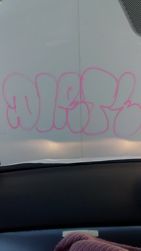
 Graffiti, 21 Dec 2021
press Building
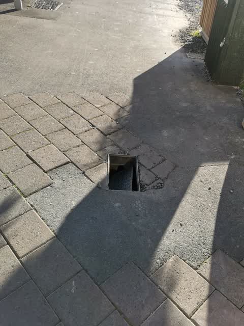
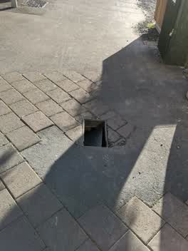 Roading/Streets, 11 Sept 2021
Lid is no longer covering hole, trip hazard
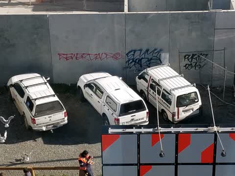
Graffiti, 26 Jul 2018
This is on a wall outside the new library
Elsewhere on Gloucester Street
- 267 Gloucester Street, 108 reports
- 89 Gloucester Street, 88 reports
- 278 Gloucester Street, 69 reports
- 194 Gloucester Street, 64 reports
- 146 Gloucester Street, 60 reports
- 195 Gloucester Street, 53 reports
- 332 Gloucester Street, 51 reports
- 192 Gloucester Street, 44 reports
The street’s crash record
NZTA’s record names Gloucester Street in 113 crashes that hurt somebody since 2006, 4 people killed, 18 seriously hurt.
The civic layer
This ground votes in Central ward, the Papanui-Innes-Central community board is its local layer. Ward lines don’t always follow suburb lines; this one is measured at the pin, not the suburb’s centre. The whole roll is at /wards.
Gloucester Street, the whole record → · Everything about Christchurch Central City → · What stood on this ground → · On the map → · From the air, RetroLens holds the Crown’s aerials back to 1936; search the address there →
Questions, answered briefly
10 council reports on record since July 2018, most often hazard, vehicle (2), graffiti (2), trees - general (1).
Christchurch Central City, Christchurch, on Gloucester Street.
The heritage register names 5 places at or beside it, Theatre Royal Façade, Dome, Staircase and Setting, New Regent Street Shops and Setting.
Cathedral Square, 119 m to its edge.