18 Manchester Street
5 council reports since October 2015, 5 carrying a photograph. The street’s heaviest record is 297-299 Manchester Street, 103 reports on file.
From the air, then
Sourced from Canterbury Maps and partners. LINZ, CC BY 3.0 NZ. Each frame is cut from Environment Canterbury’s historic imagery MapServer for that decade, only where the Footprints layer names a CC BY survey (NZAM-covered spots stay out). RetroLens holds more Crown aerials →
The green nearby
- Science Alive Reserve, 206 m to the edge
- Gasson Reserve, 226 m to the edge
- Carlyle Reserve, 276 m to the edge
- Wilson Park, 380 m to the edge
- Washington Way Reserve, 415 m to the edge · Sports ground
Parks within half a kilometre, measured to the boundary, the council’s open data. The whole roll is at /parks.
The civic shelf nearby
- St Asaph, 486 m away · Car park
Libraries, halls and the rest within half a kilometre, the council’s open data.
On the doorstep
- Miles Kia, 35 m away · Car dealers
- Lone Star, 68 m away · Restaurants
- Lone Star Manchester St, 69 m away · Restaurants
- Miles Škoda, 76 m away · Car dealers
Businesses within four hundred metres, measured at the pin, OpenStreetMap and the council directories.
The bus nearby
- Moorhouse near Manchester St, 104 m away · route 140
- Moorhouse Ave near Manchester St, 140 m away · route 27, route 84, route 85, route 95, route 140
The closest Metro stops, within four hundred and fifty metres.
The tracks through here
- Walk and bike track through Christchurch Central City, 4 m to the line · walk · bike
- Walk and bike track through Christchurch Central City, 56 m to the line · walk · bike
- Walk and bike track through Christchurch Central City, 56 m to the line · walk · bike
- Walk and bike track through Christchurch Central City, 254 m to the line · walk · bike
- Walk and bike track through Christchurch Central City, 254 m to the line · walk · bike
Tracks whose line passes within half a kilometre, the council’s open data.
The named ground
Named places within 1.5 km of this address, the open map’s record.
The remembered names nearby
- Rail Workers Memorial This Site Is Dedicated to Rail, 243 m away ·
RAIL WORKERS MEMORIAL THIS SITE IS DEDICATED TO RAIL WORKERS WHO WERE KILLED OR SERIOUSLY
· 2008
Inscribed plaques within two hundred and fifty metres, the register’s pins, not surveyed spots. The whole roll is at /plaques.
Renting nearby
new bonds in Christchurch Central City ran about $508 a week, $42 below the city median of $550, the suburb page keeps the rent record →.
What gets reported here
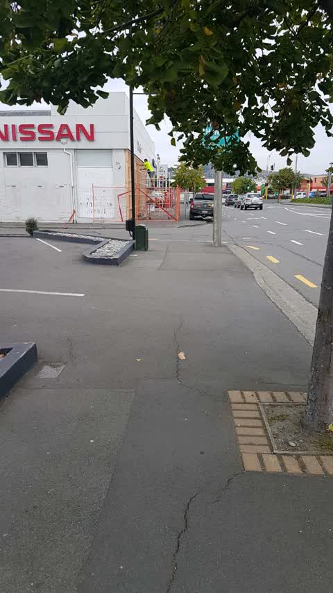
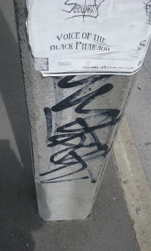
Photographed here 5 on record



What’s on record
 Graffiti on a road, footpath or bridge, 15 Dec 2025
On the main road.
 Graffiti on a sign, mural or public art, 24 Sept 2025
Graffiti on a wall
Roading/Streets, 27 Feb 2019
Forcing pedestrians on to the road , blocking access to disabled people
Roading/Streets, 10 Dec 2018
Parked on footpath
Graffiti, 14 Oct 2015
Elsewhere on Manchester Street
- 297-299 Manchester Street, 103 reports
- 293 Manchester Street, 72 reports
- 214 Manchester Street, 72 reports
- 153 Manchester Street, 52 reports
- 218 Manchester Street, 48 reports
- 76 Manchester Street, 45 reports
- 204 Manchester Street, 45 reports
- 192 Manchester Street, 40 reports
The street’s crash record
NZTA’s record names Manchester Street in 235 crashes that hurt somebody since 2006, 1 person killed, 38 seriously hurt.
The civic layer
This ground votes in Central ward, the Papanui-Innes-Central community board is its local layer. Ward lines don’t always follow suburb lines; this one is measured at the pin, not the suburb’s centre. The whole roll is at /wards.
Manchester Street, the whole record → · Everything about Christchurch Central City → · What stood on this ground → · On the map → · From the air, RetroLens holds the Crown’s aerials back to 1936; search the address there →
Questions, answered briefly
5 council reports on record since October 2015, most often roading/streets (2), graffiti on a sign, mural or public art (1), graffiti on a road, footpath or bridge (1).
Christchurch Central City, Christchurch, on Manchester Street.
Nothing on the heritage register at this exact spot, the record around this ground →
Science Alive Reserve, 206 m to its edge.