199 Armagh Street, Christchurch Central City
74 reports on record since January 2017 · 58 with photographs. The street’s heaviest record is 177 Armagh Street — 266 reports on file. Indicative rating valuation and school zones, hazards, bin day and what stood here before.
What gets reported here
- Graffiti — 21
- Graffiti somewhere else — 11
- Park - General Request — 6
- Graffiti on a fence, building or structure — 5
- Poles and Signage - General — 4
- Facility - General Request — 4
Photographed here 58 on record


Reported here
 Graffiti on a playground or in a park —
 parks team couldn't remove
 Graffiti on a fence, building or structure —
  Graffiti on a fence, building or structure —
  Damaged Street Sign —
 The P120 parking sign will probably fall over soon, it's no longer embedded in ground and is just resting there. With kids in the area swin
 Poles and Signage - General —
 p120 sign west side of carpark facing wrong way, pls correct
 Pavement - Damaged —
  Poles and Signage - General —
  Pavement - General —
 Edging board and road sign have been pulled out of carpark garden at margret mayhe playground, top car park
 Park - General Request —
 Mmp BBQs not working far left and far right
 Park - General Request —
 Food has been left on BBQ in Margaret Mahy
 Graffiti on a fence, building or structure —
  Park - General Request —
 4th BBQ on Avon side not working , not working with reset
 Poles and Signage - General —
 Pole would be better repositioned closer to kerb side, hazard to pedestrians with low vision
 Facility - General Request —
 Furthest north BBQ bot working, have tried reset button and turned power off and off several times
 General Request —
 Only one BBQ working again , breakfast being done down here 3 days a week and they are never all working
 Graffiti somewhere else —
 Near jetty in Margaret mahey park
 Graffiti on a fence, building or structure —
  Graffiti somewhere else —
  Graffiti somewhere else —
 Temp fencing
 Graffiti somewhere else —
  Vandalism - General —
 We don't have anything to get this off concrete currently
 Graffiti somewhere else —
  General Request —
 My son injured his knee quite badly slipping over on the entrance to this wee structure. The sand has eroded the non slip surface where it's
- Damaged Street Sign —
Another sign p120 left and arrow missing. Officer 98 ccc parking. Can't inforce
 Damaged Street Sign —
 Hi officer 98 ccc parking. The sign in the Margaret mahy car park. Has-been taken p120 lefthand arrow please fix so we can inforce
 Graffiti somewhere else —
 Seating near sand pit
 Graffiti somewhere else —
  Water Leak —
 Possible water leak flooding plants. That much water is not good for the plants.
 Graffiti somewhere else —
 Parks team couldn’t remove
- Hazard — vehicle —
Trying to park at here to go the park with my children and the car park is full of contractors and builders trucks. Would like to see better
 Poles and Signage - General —
 Margaret may p120 two signs have been swapped around. Probably tradies at local site.
 Hazard — vehicle —
 There are ALWAYS construction vehicles in the parking lot from workers across the road. You also often see working professionals (without ch
 Graffiti somewhere else —
 Graffiti on contractors site on fencing right along
 Graffiti somewhere else —
  Graffiti somewhere else —
 Graffiti on first disabled car Park at margret mahy playground main car park.
 Graffiti on a fence, building or structure —
 Graffiti on fence to construction site visible to margret mahey playground car park.
 Hazard — vehicle —
 The arrow on this p120 sign is pointing in the wrong direction. I can't really issue tickets to this sign with it the way it is. Can it ple
 Graffiti —
 On corner
 Graffiti —
 Temp fencing
 Park - General Request —
 Clean grill doesn’t work at all. Dirty grill turns on then turns off before fully heating
 Facility - General Request —
 3/4 BBQs at Margaret Mahy aren't working. 2 look like no gas (no button response) and 1 will flash red then turn off.
 Park - General Request —
 There is a pothole on the gravel path next to the parking lot at margerate mahy playground - on the playground side of the bbq area.
 Park - General Request —
 Three of the BBQs at Margaret Mahy don’t seem to be working.
 Dumped Rubbish —
 Please empty this bin Thanks
 Graffiti —
  Facility - General Request —
 Two bbqs not working
- General Request —
- Graffiti —
- Graffiti —
- Graffiti —
- Facility - General Request —
- Graffiti —
- Graffiti —
- Graffiti —
- Street Light Outage —
- Graffiti —
- Graffiti —
- Graffiti —
- Graffiti —
 Graffiti —
 Kids playground
 Graffiti —
 Black paint tag on CH D(B?) asset on the corner of Madras and Armagh Streets. It also needs a new number.
 Graffiti —
 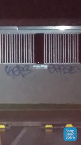 Graffiti —
 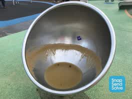 Parks —
 No drain in the circular seat. Full of stagnant water probable health hazard for children.
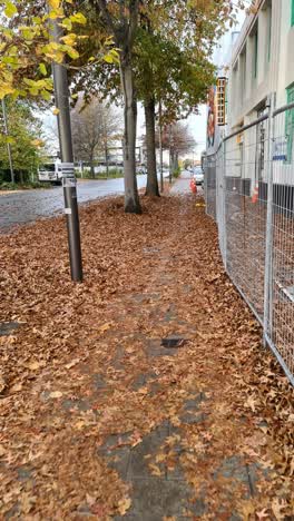 Roading/Streets —
 Stat is slippery as it can be. Any chances somebody can tidy it up ?
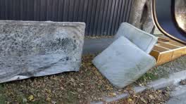 Rubbish/Recycling —
 - Graffiti —
on Friday we where using the disability toilets at the Margaret Mahy park and they were disgusting and covered inside with the words WHORE a
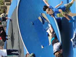 Parks —
 tiling is tearing away from equipment
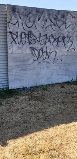 Graffiti —
 on perimeter fence east side of carpark
Graffiti —
Graffiti on two poles which support the access to the tunnel slide.
Parks —
Cars parked at Margret mahy playground, no one using playground and some cats have been here since early this morning well outside 120minute
Roading/Streets —
Is traffic meant to be parked in live lane, on left side of photo. Everyone driving past these cars crosses the centre line
Graffiti —
Top of spiral slide. Colour for removal = black
Roading/Streets —
Paver not replaced have temp fixed need properly installed. We're not put back after work on box
Also reported on Armagh Street
- 177 Armagh Street — 266 reports
- 90 Armagh Street — 234 reports
- 163 Armagh Street — 116 reports
- 167 Armagh Street — 109 reports
- 89 Armagh Street — 107 reports
- 88 Armagh Street — 89 reports
- 161 Armagh Street — 63 reports
- 4 Armagh Street — 61 reports
The street’s crash record
NZTA’s record names Armagh Street in 86 crashes that hurt somebody since 2006 — 13 seriously hurt, nobody killed.
The green nearby
- Poplars Reserve — 80 m to the edge · Botanic
- Cambridge Reserve — 133 m to the edge
- Fire Fighters Reserve — 161 m to the edge
- Latimer Square — 181 m to the edge · Botanic · 2 ha
- Edmonds Band Rotunda — 202 m to the edge · Botanic
Parks within half a kilometre, measured to the boundary — the council’s open data.
The civic shelf nearby
- Turanga Library — 434 m away · Library · Cathedral Square, Christchurch
Libraries, halls and the rest within half a kilometre — the council’s open data.
On the doorstep
- Christchurch Sea Kayaking — 58 m away · Attractions
- Kea Coffee Cafe Cart — 66 m away · Cafés
- Margaret Mahy Family Playground — 71 m away · Attractions
- Table at Monks — 76 m away · Restaurants
Businesses within four hundred metres, measured at the pin — OpenStreetMap and the council directories.
The bus nearby
- Gloucester St near Latimer Square — 167 m away · route 5, route 7
- Gloucester St near Latimer Square — 181 m away · route 5, route 7
The closest Metro stops, within four hundred and fifty metres.
The tracks through here
- Walk and bike track through Christchurch Central City — 50 m to the line · walk · bike
- Walk and bike track through Christchurch Central City — 74 m to the line · walk · bike
- Walk and bike track through Christchurch Central City — 86 m to the line · walk · bike
- Walk and bike track through Christchurch Central City — 93 m to the line · walk · bike
- Walk and bike track through Christchurch Central City — 189 m to the line · walk · bike
Tracks whose line passes within half a kilometre, measured to the line itself — the council’s open data.
The named ground
Named water within 500 m of this address, measured to the line or the edge; Named places within 1.5 km of this address; the council’s own structure register — bridges, boardwalks and steps standing nearby — the open map’s record.
The remembered names nearby
- ANZCO Foods — 54 m away ·
ANZCO FOODS / Donated for the people of Canterbury to enjoy, following fundraising by ANZC
· 2017 - Heritage Christchurch Edmonds’ Telephone Cabinet Presented — 86 m away ·
HERITAGE CHRISTCHURCH Edmonds’ Telephone Cabinet Presented 1929 Architect H. Francis Willi
· 2009 - H. Francis Willis — 97 m away ·
H. FRANCIS WILLIS. RENNELL BROS / ARCHITECT BUILDERS / W T TRETHEWEY / SCULPTOR
· 2009
Inscribed plaques within two hundred and fifty metres — the register’s pins, not surveyed spots. The whole roll is at /plaques.
Renting nearby
new bonds in Christchurch Central City ran about $508 a week — $42 below the city median of $550 — the suburb page keeps the rent record →.
What was here — Dwellings and Setting
84 m away · 86 Chester Street East · located to ±15 m · the place’s own record →
On the register. Nothing researched here yet.
What was here — Edmonds Clock Tower, Telephone Cabinet and Setting
93 m away · 295F Madras Street · located to ±15 m · the place’s own record →
On the register. Nothing researched here yet.
What was here — Poplars, Lamp Standards and Setting
on this spot · located to ±139 m · the place’s own record →
On the register. Nothing researched here yet.
What was here — Dwellings and Setting
127 m away · 100 Chester Street East · located to ±13 m · the place’s own record →
On the register. Nothing researched here yet.
What was here — Former MED Converter Station and Substation
127 m away · 102/210 Armagh Street · located to ±30 m · the place’s own record →
On the register. Nothing researched here yet.
The civic layer
This ground votes in Central ward — the Papanui-Innes-Central community board. Ward lines don’t always follow suburb lines; this one is measured at the pin, not the suburb’s centre.
What stood on this ground → · On the map → · From the air — the Crown’s aerials back to 1936; search the address on RetroLens →
Questions, answered briefly
74 council reports on record since January 2017 — most often graffiti (21), graffiti somewhere else (11), park - general request (6).
Christchurch Central City, Christchurch — on Armagh Street.
The heritage register names 5 places at or beside it — Dwellings and Setting, Edmonds Clock Tower, Telephone Cabinet and Setting.
Poplars Reserve — 80 m to its edge.