275 Manchester Street, Christchurch Central City
12 reports on record since August 2018 · 6 with photographs. The street’s heaviest record is 297-299 Manchester Street — 102 reports on file. Indicative rating valuation and school zones, hazards, bin day and what stood here before.
What gets reported here
Photographed here 6 on record


Reported here
 Roads - General —
one of many (Orion) inspection covers that require attention to stop the irritating/deafening banging when driven over by vehicles- particul
 Graffiti on a traffic light pole or cabinet, or wa —
 Poles and Signage - General —
This p10 has been damaged and needs to be replaced outside 277 thanks Julie
 Graffiti somewhere else —
Northside of urbanz accomodation
 Pavement - Damaged —
I tripped and rolled my ankle on these cobblestones this morning.
- Graffiti —
- Graffiti —
- Accessibility —
- Pavement - Damaged —
- Graffiti —
- Hazard — vehicle —
Roading/Streets —
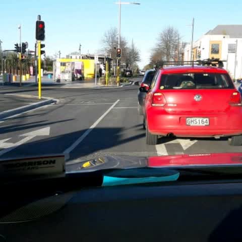
Hello Team Lane layout out this intersection is confusing as straight through traffic are using both lanes. Could we consider a right hand t
Also reported on Manchester Street
- 297-299 Manchester Street — 102 reports
- 293 Manchester Street — 72 reports
- 214 Manchester Street — 72 reports
- 153 Manchester Street — 52 reports
- 218 Manchester Street — 48 reports
- 76 Manchester Street — 45 reports
- 204 Manchester Street — 45 reports
- 192 Manchester Street — 40 reports
The street’s crash record
NZTA’s record names Manchester Street in 235 crashes that hurt somebody since 2006 — 1 person killed, 38 seriously hurt.
The green nearby
- Edmonds Band Rotunda — 141 m to the edge · Botanic
- Latimer Square — 218 m to the edge · Botanic · 2 ha
- Cathedral Square — 236 m to the edge · Botanic
- Poplars Reserve — 249 m to the edge · Botanic
- Victoria Square — 260 m to the edge · Botanic · 2 ha
Parks within half a kilometre, measured to the boundary — the council’s open data.
The civic shelf nearby
- Turanga Library — 218 m away · Library · Cathedral Square, Christchurch
- Triangle — 442 m away · Car park
Libraries, halls and the rest within half a kilometre — the council’s open data.
On the doorstep
- Child Sister — 13 m away · Cafés
- Urbanz Accommodation Christchurch — 33 m away · Hostels
- Odeon — 53 m away · Restaurants
- Crew Technology Recruitment — 55 m away · Recruitment
Businesses within four hundred metres, measured at the pin — OpenStreetMap and the council directories.
The bus nearby
- Gloucester St near Latimer Square — 159 m away · route 5, route 7
- Gloucester St near Latimer Square — 163 m away · route 5, route 7
The closest Metro stops, within four hundred and fifty metres.
The tracks through here
- Walk and bike track through Christchurch Central City — 3 m to the line · walk · bike
- Walk and bike track through Christchurch Central City — 54 m to the line · walk · bike
- Walk and bike track through Christchurch Central City — 125 m to the line · walk · bike
- Walk and bike track through Christchurch Central City — 189 m to the line · walk · bike
- Walk and bike track through Christchurch Central City — 252 m to the line · walk · bike
Tracks whose line passes within half a kilometre, measured to the line itself — the council’s open data.
The named ground
Named water within 500 m of this address, measured to the line or the edge; Named places within 1.5 km of this address; the council’s own structure register — bridges, boardwalks and steps standing nearby — the open map’s record.
The remembered names nearby
- Margaret Mahy Family Playground — 83 m away ·
MARGARET MAHY FAMILY PLAYGROUND / Officially opened on 22 December 2015 by / Elsie Mahy /
· 2017 - In Memory of / Jaime Robert McDowell Gilbert — 90 m away ·
IN MEMORY OF / JAIME ROBERT MCDOWELL GILBERT / WHO LOST HIS LIFE / AT THIS LOCATION IN THE
· 2018 - This Rotunda Shelter and Circular Seat Were Presented — 166 m away ·
THIS ROTUNDA SHELTER AND CIRCULAR SEAT WERE PRESENTED BY T.J. EDMONDS TO CELEBRATE FIFTY Y
· 2009
Inscribed plaques within two hundred and fifty metres — the register’s pins, not surveyed spots. The whole roll is at /plaques.
Renting nearby
new bonds in Christchurch Central City ran about $508 a week — $42 below the city median of $550 — the suburb page keeps the rent record →.
What was here — New Regent Street Shops and Setting
75 m away · 17 New Regent Street · located to ±48 m · the place’s own record →
On the register. Nothing researched here yet.
What was here — Former MED Converter Station and Substation
92 m away · 102/210 Armagh Street · located to ±30 m · the place’s own record →
On the register. Nothing researched here yet.
What was here — Theatre Royal Façade, Dome, Staircase and Setting
125 m away · 145 Gloucester Street · located to ±24 m · the place’s own record →
On the register. Nothing researched here yet.
What was here — Edmonds Band Rotunda Area including Rotunda, Shelter, Balustrades, Landing and Lamp Standards and Setting
164 m away · 230 Cambridge Terrace · located to ±57 m · the place’s own record →
On the register. Nothing researched here yet.
What was here — Commercial Building Façade and Setting, Former A W Smith and Son's Central Garage/Mayfair-Cinerama Theatre
194 m away · 115A Worcester Street · located to ±12 m · the place’s own record →
On the register. Nothing researched here yet.
The civic layer
This ground votes in Central ward — the Papanui-Innes-Central community board. Ward lines don’t always follow suburb lines; this one is measured at the pin, not the suburb’s centre.
What stood on this ground → · On the map → · From the air — the Crown’s aerials back to 1936; search the address on RetroLens →
Questions, answered briefly
12 council reports on record since August 2018 — most often graffiti (3), pavement - damaged (2), roads - general (1).
Christchurch Central City, Christchurch — on Manchester Street.
The heritage register names 5 places at or beside it — New Regent Street Shops and Setting, Former MED Converter Station and Substation.
Edmonds Band Rotunda — 141 m to its edge.