291 Oxford Terrace, Christchurch Central City
31 reports on record since March 2024 · 30 with photographs. The street’s heaviest record is 159 Oxford Terrace — 180 reports on file. Indicative rating valuation and school zones, hazards, bin day and what stood here before.
What gets reported here
Photographed here 30 on record




Reported here
 Graffiti on a playground or in a park —
all at firefighters reserve
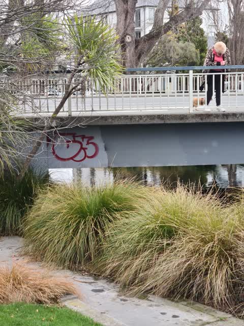
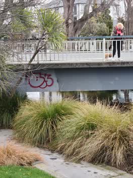
- Graffiti on a road, footpath or bridge —
graffiti on bridge at firefighters reserve
 Facility - General Request —
Graffiti on dark green utility cabinet, Fire Fighters Reserve, Kilmore Street CBD ChCh. ( Not Oxford Terrace as GPS suggests). Thanks. Graf
 Graffiti on a road, footpath or bridge —
thank you!
 Poles and Signage - General —
attempted theft of plaque, needs repair. thank you!
 Graffiti on a fence, building or structure —
graffiti on lamp post pole this corner
 Graffiti on a road, footpath or bridge —
See photo
 Graffiti on a road, footpath or bridge —
 Graffiti on a fence, building or structure —
Unclear who owns cabinet but likely Telco 2 x graffiti structures
 Graffiti on a road, footpath or bridge —
 Graffiti on a playground or in a park —
 Graffiti somewhere else —
Graffiti on vodaphone cabinet
 Graffiti somewhere else —
Graffiti y light post memorial park
 Graffiti somewhere else —
 Graffiti somewhere else —
Memorial park bollard near fire station
 Graffiti on a cabinet, pole or railway asset —
 Hazard — vehicle —
 Graffiti on a cabinet, pole or railway asset —
 Graffiti somewhere else —
 Graffiti on a cabinet, pole or railway asset —
One NZ mobile cabinet graffiti
 Graffiti on a sign, mural or public art —
Black paint tags (plus stickers) on reverse side of parking sign by 291 Oxford Terrace
 Vandalism - General —
 Graffiti on a fence, building or structure —
This may have been dealt to already. Looks slightly faded
 Pavement - Damaged —
This is my third time reporting this since March along with 2 nudges and nothing has happened. The fencing feet pose a trip hazard also and
 Graffiti on a fence, building or structure —
Silver paint tag on fence top rail on the south side of the Avon River bridge on Kilmore Street. (Check for others).
 Graffiti on a fence, building or structure —
Park benches
 Graffiti on a fence, building or structure —
 Pavement - Damaged —
Reported over a month ago and still not resolved
 Graffiti on a road, footpath or bridge —
Graffiti on both ends of bridge
 Graffiti —
 Pavement - Damaged —
Tile broken causing a large hole. The fencing around it was left for a few weeks following nearby works and may have been placed there as it
Also reported on Oxford Terrace
- 159 Oxford Terrace — 180 reports
- 153 Oxford Terrace — 174 reports
- 95 Oxford Terrace — 126 reports
- 211 Oxford Terrace — 125 reports
- 182 Oxford Terrace — 122 reports
- 184 Oxford Terrace — 109 reports
- 294 Oxford Terrace — 92 reports
- 152 Oxford Terrace — 87 reports
The street’s crash record
NZTA’s record names Oxford Terrace in 56 crashes that hurt somebody since 2006 — 1 person killed, 11 seriously hurt.
The green nearby
- Fire Fighters Reserve — you are in it
- Cambridge Reserve — 47 m to the edge
- Poplars Reserve — 55 m to the edge · Botanic
- Avon Riverbank Central City — 277 m to the edge · 6 ha
- Cambridge Green — 290 m to the edge
Parks within half a kilometre, measured to the boundary — the council’s open data.
On the doorstep
- Pillars Cafe — 47 m away · Cafés
- Foley Towers — 135 m away · Hostels
- Street Bowls Vegan & GF Food Truck — 166 m away · Fast food
- The Herb Centre Cafe — 174 m away · Cafés
Businesses within four hundred metres, measured at the pin — OpenStreetMap and the council directories.
The bus nearby
- Manchester St near Kilmore St — 282 m away · route 1, route 27, route 29, route 44, route 91, route 92, route 95
- Manchester St near Kilmore St — 285 m away · route 44, route 91, route 92
The closest Metro stops, within four hundred and fifty metres.
The tracks through here
- Walk and bike track through Christchurch Central City — 10 m to the line · walk · bike
- Walk and bike track through Christchurch Central City — 29 m to the line · walk · bike
- Walk and bike track through Christchurch Central City — 38 m to the line · walk · bike
- Walk and bike track through Christchurch Central City — 47 m to the line · walk · bike
- Walk and bike track through Christchurch Central City — 84 m to the line · walk · bike
Tracks whose line passes within half a kilometre, measured to the line itself — the council’s open data.
The named ground
Named water within 500 m of this address, measured to the line or the edge; Named places within 1.5 km of this address; the council’s own structure register — bridges, boardwalks and steps standing nearby — the open map’s record.
The remembered names nearby
- Scenic Circle Hotels New Zealand Wide 0800 NZ Owned — 6 m away ·
Scenic Circle Hotels New Zealand Wide 0800 NZ OWNED
· 2009 - Lion Foundation a Gaming Machine Charitable Trust Belfast — 9 m away ·
LION FOUNDATION A GAMING MACHINE CHARITABLE TRUST Belfast Tavern; Bush Inn Hotel; Halswell
· 2009 - A Tribute to Firefighters Sculpture by Graham Bennett Steel — 9 m away ·
A Tribute to Firefighters Sculpture by Graham Bennett Steel from the New York World Trade
· 2009
Inscribed plaques within two hundred and fifty metres — the register’s pins, not surveyed spots. The whole roll is at /plaques.
Renting nearby
new bonds in Christchurch Central City ran about $508 a week — $42 below the city median of $550 — the suburb page keeps the rent record →.
What was here — Edmonds Clock Tower, Telephone Cabinet and Setting
100 m away · 295F Madras Street · located to ±15 m · the place’s own record →
On the register. Nothing researched here yet.
What was here — Dwellings and Setting
125 m away · 86 Chester Street East · located to ±15 m · the place’s own record →
On the register. Nothing researched here yet.
What was here — Dwellings and Setting
125 m away · 100 Chester Street East · located to ±13 m · the place’s own record →
On the register. Nothing researched here yet.
What was here — Poplars, Lamp Standards and Setting
176 m away · located to ±139 m · the place’s own record →
On the register. Nothing researched here yet.
What was here — Former Vicarage of the Church of St Luke the Evangelist and Setting
210 m away · 185 Kilmore Street · located to ±12 m · the place’s own record →
On the register. Nothing researched here yet.
The civic layer
This ground votes in Central ward — the Papanui-Innes-Central community board. Ward lines don’t always follow suburb lines; this one is measured at the pin, not the suburb’s centre.
What stood on this ground → · On the map → · From the air — the Crown’s aerials back to 1936; search the address on RetroLens →
Questions, answered briefly
31 council reports on record since March 2024 — most often graffiti on a road, footpath or bridge (6), graffiti on a fence, building or structure (6), graffiti somewhere else (5).
Christchurch Central City, Christchurch — on Oxford Terrace.
The heritage register names 5 places at or beside it — Edmonds Clock Tower, Telephone Cabinet and Setting, Dwellings and Setting.
Fire Fighters Reserve — the address is inside it.