39 Manchester Street, Christchurch Central City
39 reports on record since December 2018 · 33 with photographs. The street’s heaviest record is 297-299 Manchester Street — 102 reports on file. Indicative rating valuation and school zones, hazards, bin day and what stood here before.
What gets reported here
Photographed here 33 on record


Reported here
 General Request —
 Tagging on street light
 Graffiti on a road, footpath or bridge —
 found graffiti at the park meter # CCC_4084
 Graffiti on a fence, building or structure —
 Graffiti
 Graffiti on a sign, mural or public art —
 Graffiti on sign board
 Graffiti on a fence, building or structure —
 graffiti on fixed structure
 Road Signage —
 A car hit a parking sign while backing out of our car park on Saturday.
 Graffiti on a sign, mural or public art —
 Graffiti on a sign
 Graffiti on a fence, building or structure —
 Graffiti on a wall
 Graffiti on a traffic light pole or cabinet, or wa —
 Graffiti on green cabinet
 Graffiti on a fence, building or structure —
 Graffiti across the side of the fence.
 Graffiti on a fence, building or structure —
 Graffiti across the side of the building.
 Graffiti on a cabinet, pole or railway asset —
  Graffiti somewhere else —
  Graffiti somewhere else —
 Over windows and building
 Graffiti somewhere else —
  Graffiti on a fence, building or structure —
 Graffiti on side of the building.
 Graffiti somewhere else —
  Graffiti somewhere else —
  Graffiti on a fence, building or structure —
 Graffiti across Wall of the building.
 Graffiti on a fence, building or structure —
 Graffiti across the wall.
 Graffiti on a fence, building or structure —
 Graffiti across signage.
 Graffiti on a fence, building or structure —
 Grafiti across the building and signage.
 Graffiti somewhere else —
  Graffiti on a fence, building or structure —
 Opp Allen street
 Pavement - General —
 Water meter left open. Trip hazard.
 Graffiti —
 Both sides of building on corner Allen st and Manchester st
 Graffiti —
  Graffiti —
 - Graffiti —
- Graffiti —
- Graffiti —
- Graffiti —
- Graffiti —
- Graffiti —
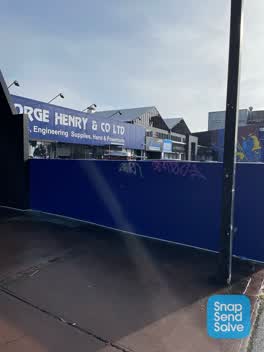 Graffiti —
 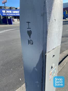 Graffiti —
 Black paint tag on concrete lamp pole on the corner of Allen and Manchester Streets.
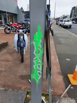 Graffiti —
 Private business
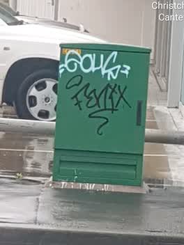 Graffiti —
 Graffiti —
Corner Allan and Manchester st
Also reported on Manchester Street
- 297-299 Manchester Street — 102 reports
- 293 Manchester Street — 72 reports
- 214 Manchester Street — 72 reports
- 153 Manchester Street — 52 reports
- 218 Manchester Street — 48 reports
- 76 Manchester Street — 45 reports
- 204 Manchester Street — 45 reports
- 192 Manchester Street — 40 reports
The street’s crash record
NZTA’s record names Manchester Street in 235 crashes that hurt somebody since 2006 — 1 person killed, 38 seriously hurt.
The green nearby
- Wilson Park — 285 m to the edge
- Gasson Reserve — 328 m to the edge
- Science Alive Reserve — 342 m to the edge
- Excelsior Hotel Reserve — 367 m to the edge · Botanic
- Carlyle Reserve — 405 m to the edge
Parks within half a kilometre, measured to the boundary — the council’s open data.
The civic shelf nearby
- St Asaph — 384 m away · Car park
- Re:start - Lichfield St — 442 m away · Car park
Libraries, halls and the rest within half a kilometre — the council’s open data.
On the doorstep
- BBQ & More — 16 m away · Bbq
- Vinnies — 36 m away · Op shops
- NZ Museum of Toys & Collectibles — 47 m away · Attractions
- Phoenix Restaurant — 57 m away · Restaurants
Businesses within four hundred metres, measured at the pin — OpenStreetMap and the council directories.
The bus nearby
- Manchester St near Allen St — 26 m away · route 27, route 84, route 85, route 95
- Manchester St near Welles St — 46 m away · route 27
The closest Metro stops, within four hundred and fifty metres.
The tracks through here
- Walk and bike track through Christchurch Central City — 5 m to the line · walk · bike
- Walk and bike track through Christchurch Central City — 222 m to the line · walk · bike
- Walk and bike track through Christchurch Central City — 222 m to the line · walk · bike
- Walk and bike track through Christchurch Central City — 294 m to the line · walk · bike
- Walk and bike track through Christchurch Central City — 298 m to the line · walk · bike
Tracks whose line passes within half a kilometre, measured to the line itself — the council’s open data.
The named ground
Named places within 1.5 km of this address; the council’s own structure register — bridges, boardwalks and steps standing nearby — the open map’s record.
Renting nearby
new bonds in Christchurch Central City ran about $508 a week — $42 below the city median of $550 — the suburb page keeps the rent record →.
What was here — Former R. Buchanan & Sons' City Foundry and Setting
180 m away · 2/210 St Asaph Street · located to ±14 m · the place’s own record →
On the register. Nothing researched here yet.
What was here — Former P & D Duncan Ltd Building and Setting
191 m away · 7/204 St Asaph Street · located to ±18 m · the place’s own record →
On the register. Nothing researched here yet.
The civic layer
This ground votes in Central ward — the Papanui-Innes-Central community board. Ward lines don’t always follow suburb lines; this one is measured at the pin, not the suburb’s centre.
What stood on this ground → · On the map → · From the air — the Crown’s aerials back to 1936; search the address on RetroLens →
Questions, answered briefly
39 council reports on record since December 2018 — most often graffiti (14), graffiti on a fence, building or structure (11), graffiti somewhere else (6).
Christchurch Central City, Christchurch — on Manchester Street.
The heritage register names 2 places at or beside it — Former R. Buchanan & Sons' City Foundry and Setting, Former P & D Duncan Ltd Building and Setting.
Wilson Park — 285 m to its edge.