50 Rolleston Avenue, Christchurch Central City
28 reports on record since June 2015 · 28 with photographs. The street’s heaviest record is 7 Rolleston Avenue, 125 reports on file. Indicative rating valuation and school zones, hazards, bin day and what stood here before.
What gets reported here
Photographed here 28 on record


Reported here
 Graffiti on a fence, building or structure,
 Graffiti on a fence, building or structure,
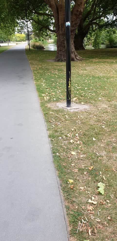
graffiti on light lamp post pole of Crossing
 Animal - General,
Animal manure on roadway
 Poles and Signage - General,
Street light bulb blown
 Graffiti on a fence, building or structure,
 Graffiti on a sign, mural or public art,
City council info sign opposite arts centre by entrance to botanical gardens
Parks,
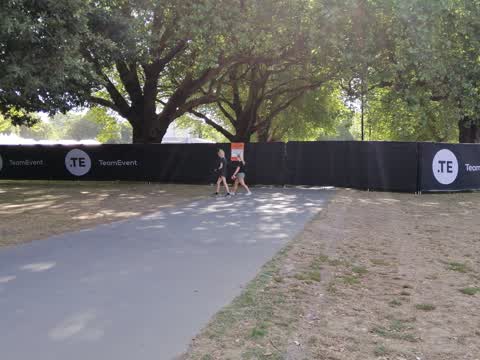
Totally uncalled for to close off a major cycle route due a stupid event. If not for the cyclists, traffic would be even more gridlocked tha
Graffiti,
on lamppost just east of lakes. on walkway
Parks,
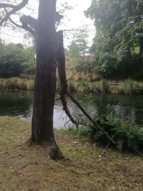
Trees are dead and dangerous re branches.
Parks,
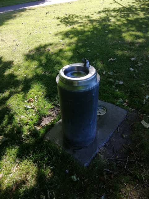
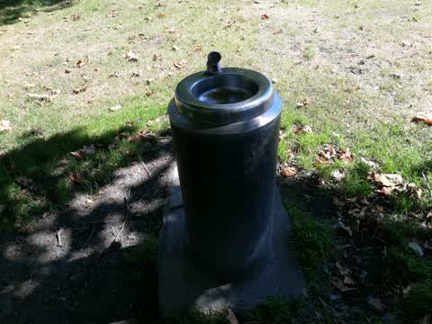
water fountain drain is clogged and the flow is so low you can't even drink out of it
Parks,
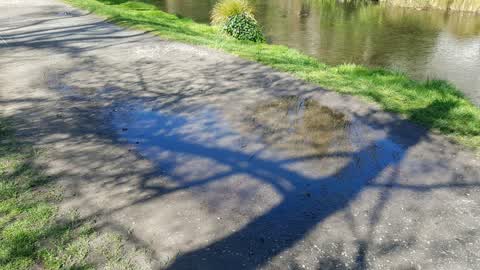
So many large potholes on the unsealed footpaths full of water. the staff who metal the paths always miss the real bad ones, God know what t
Parks,
Can't drink out of this fountain, the flow is so inadequate you need to inhale for 15 seconds just to get half a mouthful and I'm hot and t
Flooding,
This is the first drinking fountain on the unicycleway where it starts in North Hagley park. Someone has stuck something into the spout so t
Parks,
Totally blocked drain on drinking fountain, gross! And embarrassing for such a high tourist volume spot.
Parks,
Drinking fountain drain well and truly clogged, puddled water splashing into your face when drinking--gross!
Parks,
Walking behind a group of tourists who are talking about how untidy the rivers edge is. Have to say i agree.... it used to be beautiful alon
Roading/Streets,
Water is coming up under the sidewalk next to the botanical gardens
Graffiti,
Graffiti,
Graffiti,
Graffiti,
Poor tree
Graffiti,
Cycle walkway in Hagley Park
Graffiti,
Hagley Park on entrance to Armagh St carpark
Graffiti,
By tennis courts in Hagley Park
Parks,
Clogged drinking fountain. Gross because it splashes in face when drinking
Graffiti,
Parks,
Deep hole that is a huge hazard. Our dog nearly went down it and I nearly walked and fell in it another time, which would have most likely
Graffiti,
Also reported on Rolleston Avenue
- 7 Rolleston Avenue, 125 reports
- 57 Rolleston Avenue, 66 reports
- 52 Rolleston Avenue, 50 reports
- 64 Rolleston Avenue, 43 reports
- 26 Rolleston Avenue, 43 reports
- 5 Rolleston Avenue, 36 reports
- 11 Rolleston Avenue, 34 reports
- 9 Rolleston Avenue, 26 reports
From the air, then
Sourced from Canterbury Maps and partners. LINZ, CC BY 3.0 NZ. Each frame is cut from Environment Canterbury’s historic imagery MapServer for that decade, only where the Footprints layer names a CC BY survey (NZAM-covered spots stay out). RetroLens holds more Crown aerials →
The street’s crash record
NZTA’s record names Rolleston Avenue in 19 crashes that hurt somebody since 2006, 2 seriously hurt, nobody killed.
The green nearby
- Hagley Park North, you are in it · Sports ground · 91 ha
- Botanic Gardens, 110 m to the edge · Botanic · 21 ha
- Armagh Reserve, 151 m to the edge
- Cranmer Square, 323 m to the edge · Botanic · 2 ha
Parks within half a kilometre, measured to the boundary, the council’s open data.
The civic shelf nearby
- Rolleston Avenue, 211 m away · Car park
- Christchurch Hospital Grounds, 472 m away · Car park
Libraries, halls and the rest within half a kilometre, the council’s open data.
On the doorstep
- Christchurch Running Tours, 69 m away · Attractions
- Gym Block, 96 m away · Gyms & fitness
- Christ's College Guided Tours, 129 m away · Attractions
- Canterbury Museum, 194 m away · Attractions
Businesses within four hundred metres, measured at the pin: OpenStreetMap and the council directories.
The bus nearby
- Rolleston Ave near Gloucester St, 122 m away · route 8
- Rolleston Ave near Gloucester St, 168 m away · route 8
The closest Metro stops, within four hundred and fifty metres.
The tracks through here
- Walk and bike track through Christchurch Central City, 4 m to the line · walk · bike
- Walk and bike track through Christchurch Central City, 86 m to the line · walk · bike
- Walk and bike track through Christchurch Central City, 86 m to the line · walk · bike
- Walk and bike track through Christchurch Central City, 92 m to the line · walk · bike
- Walk and bike track through Christchurch Central City, 98 m to the line · walk · bike
Tracks whose line passes within half a kilometre, measured to the line itself, the council’s open data.
The named ground
Named water within 500 m of this address, measured to the line or the edge; Named places within 1.5 km of this address; the council’s own structure register, bridges, boardwalks and steps standing nearby, the open map’s record.
The remembered names nearby
- Mischa Kuball / Solidarity Grid, 2013 / Dáœsseldorf, 161 m away ·
Mischa Kuball / Solidarity Grid, 2013 / DÁœSSELDORF
· 2013 - Mischa Kuball / Solidarity Grid, 2014 / Graz, 176 m away ·
Mischa Kuball / Solidarity Grid, 2014 / GRAZ
· 2013 - Mischa Kuball / Solidarity Grid, 2015 / Boston, 195 m away ·
Mischa Kuball / Solidarity Grid, 2015 / BOSTON
· 2013
Inscribed plaques within two hundred and fifty metres, the register’s pins, not surveyed spots. The whole roll is at /plaques.
Renting nearby
new bonds in Christchurch Central City ran about $508 a week, $42 below the city median of $550, the suburb page keeps the rent record →.
What was here, Christ's College Jacobs House and Setting
57 m away · 33K Rolleston Avenue · located to ±23 m · the place’s own record →
On the register. Nothing researched here yet.
What was here, Christ's College School House and Setting
64 m away · 33A Rolleston Avenue · located to ±24 m · the place’s own record →
On the register. Nothing researched here yet.
What was here, Christ's College Former Hare Memorial Library and Classrooms and Setting
90 m away · 33H Rolleston Avenue · located to ±10 m · the place’s own record →
On the register. Nothing researched here yet.
What was here, Christ's College Main Quadrangle and Setting
107 m away · located to ±38 m · the place’s own record →
On the register. Nothing researched here yet.
What was here, Christ's College Former Big School and Setting
110 m away · 33R Rolleston Avenue · located to ±15 m · the place’s own record →
On the register. Nothing researched here yet.
The civic layer
This ground votes in Central ward, the Papanui-Innes-Central community board. Ward lines don’t always follow suburb lines; this one is measured at the pin, not the suburb’s centre.
What stood on this ground → · On the map → · From the air, the Crown’s aerials back to 1936; search the address on RetroLens →
Questions, answered briefly
28 council reports on record since June 2015, most often parks (10), graffiti (10), graffiti on a fence, building or structure (3).
Christchurch Central City, Christchurch, on Rolleston Avenue.
The heritage register names 5 places at or beside it, Christ's College Jacobs House and Setting, Christ's College School House and Setting.
Hagley Park North, the address is inside it, 91 ha.