57 Rolleston Avenue, Christchurch Central City
66 reports on record since September 2018 · 39 with photographs. The street’s heaviest record is 7 Rolleston Avenue — 124 reports on file. Indicative rating valuation and school zones, hazards, bin day and what stood here before.
What gets reported here
- Graffiti — 14
- Park - General Request — 10
- Damaged Road — 6
- Parks — 5
- Water Leak — 3
- Pothole — 3
Photographed here 39 on record


Reported here
 Graffiti on a road, footpath or bridge —
 Damaged Street Sign —
Filthy dirty sign for pedestrian crossing practically eligible plus it has Grafitti on it. Could consideration be given to Cleaning
 Graffiti on a road, footpath or bridge —
Graffiti on the bridge in a few spots
 Damaged Street Sign —
Graffiti and a pedestrian crossing sign that could do with a good clean
 Graffiti on a fence, building or structure —
Illegally placed posters and stickers on all electrical poles spanning the length of Rolleston Ave & Park Terrace. Require removal.
 Water Leak —
Water leak on footpath, recently repaired patch and leaking from joint line
 Graffiti on a bus stop or public toilet —
Graffiti on bus stop
- Damaged Road —
Broken bollards
 Poles and Signage - General —
Broken off and now missing Cycle lane safety poles out side a school
 Graffiti on a traffic light pole or cabinet, or wa —
Illegally placed sticker on new bus stop on Rolleston Ave .
 Water Leak —
Water leak in the outbound bike lane on rolleston Ave.
 Poles and Signage - General —
The centre line bollard has lost its reflective tape and is now a significant hazard to road traffic.
 Park - General Request —
Hagley Park - Missing Detour Signs Detour signs for peds and cyclists within Hagley Park have been removed so there is no guidance around t
 Roads - General —
Unsafe Temporary Traffic Management Shared path closure in Hagley Park (for Electric Avenue) directs all cyclists onto Botanical Gardens ac
 Pavement - General —
Re: Temporary Traffic Management Shared paths through Hagley Park closed, but no detour guidance provided for pedestrians (only detour sign
 Pavement - General —
Unauthorised Shared Path Closures The Armagh St shared path in Hagley Park has been closed without authorisation. MyWorksites show no works
 General Request —
This advance notice on dates is great, but it is 3/4 useless without some idea of where. Desperately needs a closed area map either on the s
 Trees - General —
Dead looking branch on Oak tree over grass area. Fungal growth on branch. Risk of falling off onto someone?
 Water Fountain —
The water fountain is loose and very wobbly. Seems to have come off its mounting
 Damaged Road —
Lots of potholes on the road leading into Hagley park
- Pothole —
- Pothole —
- Pavement - Damaged —
- Damaged Road —
- Damaged Road —
- Damaged Road —
- Water General —
- Pothole —
- Park - General Request —
- Damaged Road —
- Fallen Tree —
- Poles and Signage - General —
- Facility - General Request —
- Park - General Request —
- Park - General Request —
- Trees - General —
- Water Fountain —
- Park - General Request —
- Facility - General Request —
- Park - General Request —
- Park - General Request —
- Park - General Request —
- Park - General Request —
- General Request —
- Park - General Request —
- Water Leak —
 Graffiti —
Tag on metal street light on side of driveway to Hagley park parking off Park Terrace - opposite Christ college building that has the satell
 Graffiti —
3 tags on "no parking" sign on driveway to parking/lake of Hagley Park off Park Terrace Pink tag says "penis" but isn't super clear
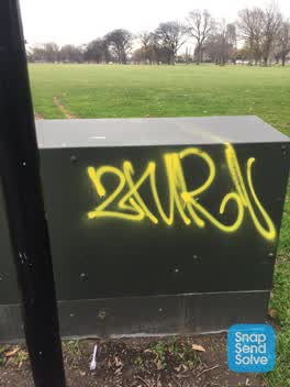
 Graffiti —
Utility box on walkway north Hagley Park by water fountain near Armagh St bridge
 Graffiti —
On walkway near Armagh St bridge
 Graffiti —
In Hayley south toilets
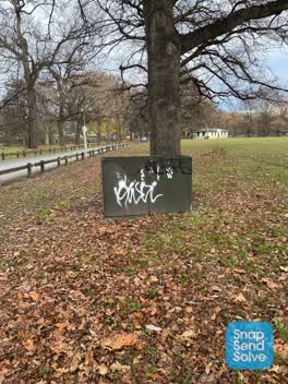 Graffiti —
Entrance to Armagh St car park in Hagley Park. Flood light kiosk.
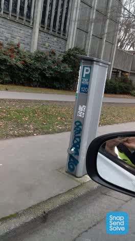 Graffiti —
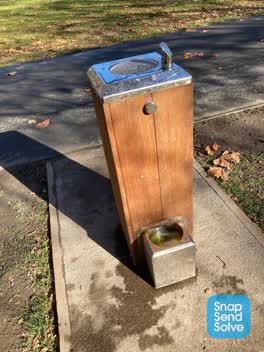 Parks —
Water fountain dog drink bit is blocked and backing up - blocked drain and getting a bit gross
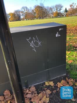 Graffiti —
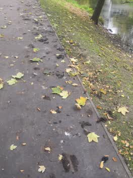 Parks —
Duck crap is making pedestrian traffic walk on the grass as duck droppings are like smelly tar when stuck to one's shoes
Graffiti —
very offensive graffitte on toilet block in botanic gardens carpark
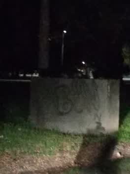 Graffiti —
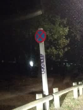 Graffiti —
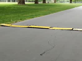 Parks —
Seems like someone has pulled these up off the ground making it major hazard for cyclists.
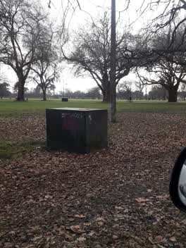 Graffiti —
Parks —
the flow is so low in this water fountain you can't even drink from it
Graffiti —
in North Hagley Park on shared pathway between sports field and the entertainment triangle
Parks —
Drinking fountain not working. A little water but not able to drink...
Flooding —
Water fountain is leaking and making a huge puddle and difficult access without getting wet and muddy!
Graffiti —
Armagh street bridge entrance
Also reported on Rolleston Avenue
- 7 Rolleston Avenue — 124 reports
- 52 Rolleston Avenue — 50 reports
- 64 Rolleston Avenue — 43 reports
- 26 Rolleston Avenue — 43 reports
- 5 Rolleston Avenue — 36 reports
- 11 Rolleston Avenue — 33 reports
- 50 Rolleston Avenue — 28 reports
- 9 Rolleston Avenue — 26 reports
The street’s crash record
NZTA’s record names Rolleston Avenue in 19 crashes that hurt somebody since 2006 — 2 seriously hurt, nobody killed.
The green nearby
- Hagley Park North — you are in it · Sports ground · 91 ha
- Botanic Gardens — 89 m to the edge · Botanic · 21 ha
- Armagh Reserve — 125 m to the edge
- Cranmer Square — 302 m to the edge · Botanic · 2 ha
Parks within half a kilometre, measured to the boundary — the council’s open data.
The civic shelf nearby
- Rolleston Avenue — 227 m away · Car park
Libraries, halls and the rest within half a kilometre — the council’s open data.
On the doorstep
- Christchurch Running Tours — 36 m away · Attractions
- Gym Block — 132 m away · Gyms & fitness
- Christ's College Guided Tours — 141 m away · Attractions
- Uniform Shop — 216 m away · Clothing
Businesses within four hundred metres, measured at the pin — OpenStreetMap and the council directories.
The bus nearby
- Rolleston Ave near Gloucester St — 121 m away · route 8
- Park Tce near Chester St W — 174 m away · route 8
The closest Metro stops, within four hundred and fifty metres.
The tracks through here
- Walk and bike track through Christchurch Central City — 27 m to the line · walk · bike
- Walk and bike track through Christchurch Central City — 48 m to the line · walk · bike
- Walk and bike track through Christchurch Central City — 55 m to the line · walk · bike
- Walk and bike track through Christchurch Central City — 69 m to the line · walk · bike
- Walk and bike track through Christchurch Central City — 81 m to the line · walk · bike
Tracks whose line passes within half a kilometre, measured to the line itself — the council’s open data.
The named ground
Named water within 500 m of this address, measured to the line or the edge; Named places within 1.5 km of this address; the council’s own structure register — bridges, boardwalks and steps standing nearby — the open map’s record.
The remembered names nearby
- Mischa Kuball / Solidarity Grid, 2013 / Dáœsseldorf — 129 m away ·
Mischa Kuball / Solidarity Grid, 2013 / DÁœSSELDORF
· 2013 - Mischa Kuball / Solidarity Grid, 2014 / Graz — 142 m away ·
Mischa Kuball / Solidarity Grid, 2014 / GRAZ
· 2013 - Mischa Kuball / Solidarity Grid, 2015 / Boston — 159 m away ·
Mischa Kuball / Solidarity Grid, 2015 / BOSTON
· 2013
Inscribed plaques within two hundred and fifty metres — the register’s pins, not surveyed spots. The whole roll is at /plaques.
Renting nearby
new bonds in Christchurch Central City ran about $508 a week — $42 below the city median of $550 — the suburb page keeps the rent record →.
What was here — Christ's College Jacobs House and Setting
85 m away · 33K Rolleston Avenue · located to ±23 m · the place’s own record →
On the register. Nothing researched here yet.
What was here — Hagley Park Bridge and Setting
89 m away · located to ±18 m · the place’s own record →
On the register. Nothing researched here yet.
What was here — Christ's College School House and Setting
101 m away · 33A Rolleston Avenue · located to ±24 m · the place’s own record →
On the register. Nothing researched here yet.
What was here — Christ's College Former Hare Memorial Library and Classrooms and Setting
126 m away · 33H Rolleston Avenue · located to ±10 m · the place’s own record →
On the register. Nothing researched here yet.
What was here — Dwelling and Setting
127 m away · located to ±12 m · the place’s own record →
On the register. Nothing researched here yet.
The civic layer
This ground votes in Central ward — the Papanui-Innes-Central community board. Ward lines don’t always follow suburb lines; this one is measured at the pin, not the suburb’s centre.
What stood on this ground → · On the map → · From the air — the Crown’s aerials back to 1936; search the address on RetroLens →
Questions, answered briefly
66 council reports on record since September 2018 — most often graffiti (14), park - general request (10), damaged road (6).
Christchurch Central City, Christchurch — on Rolleston Avenue.
The heritage register names 5 places at or beside it — Christ's College Jacobs House and Setting, Hagley Park Bridge and Setting.
Hagley Park North — the address is inside it, 91 ha.