65 Worcester Street, Christchurch Central City
32 reports on record since May 2021 · 26 with photographs. The street’s heaviest record is 142 Worcester Street, 103 reports on file. Indicative rating valuation and school zones, hazards, bin day and what stood here before.
What gets reported here
Photographed here 26 on record


Reported here
 Graffiti on a fence, building or structure,
There is graffiti on this building.
 Graffiti on a fence, building or structure,
graffiti on planter boxs
 Graffiti on a sign, mural or public art,
Black and green graffiti on parking signs of a Worcester Blvd carpark.
 Graffiti on a fence, building or structure,
Graffiti on bin
 Graffiti on a fence, building or structure,
See pics
 Graffiti on a fence, building or structure,
Graffiti on bin
 Poles and Signage - General,
Base of the pole is not stable and the sign keeps moving
 Graffiti somewhere else,
West side of building 69 Worcester st
 Graffiti somewhere else,
Orion cabinets in central carpark
 Graffiti somewhere else,
Central carpark
 Graffiti on a sign, mural or public art,
white graffiti on black sign, black graffiti on wooden box
 Damaged Road,
Broken cast iron Telecom lid on footpath across the road from Doubles coffee shop needs replaced urgently as it's a health and safety issue.
 Graffiti on a fence, building or structure,
69 Worcester Blvd
 Hazard, vehicle,
The p120 mobility at any time sign has been damaged and knocked over. The space in unenforceable. Also there is no back sign. Thanks Julie
 Poles and Signage - General,
Damaged pole and parking sign
 Hazard, vehicle,
P120 mobility signs knocked over by vehicle unable to enforce
 Graffiti on a sign, mural or public art,
Red and white paint tags on Colliers sign facing the footpath by 65 Worcester Street. If not in scope please ask Brynn Burrows 021 375 917 t
- Graffiti,
- Graffiti,
- Graffiti,
- Graffiti,
- Graffiti,
- Graffiti,
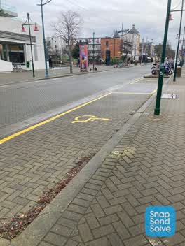 Damaged Street Sign,
Please replace missing Mobility & $P120 sign on new post at Mobility park outside private car park. Post has been cut down & is on ground in
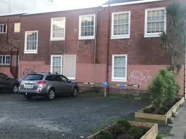 Graffiti,
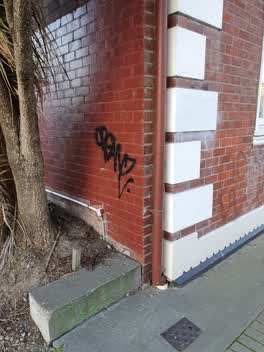 Graffiti,
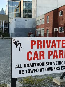 Graffiti,
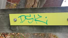 Graffiti,
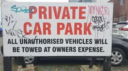 Graffiti,
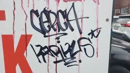 Graffiti,
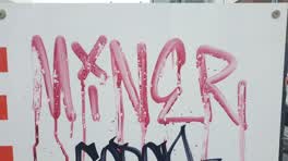 Graffiti,
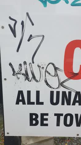 Graffiti,
Also reported on Worcester Street
- 142 Worcester Street, 103 reports
- 3 Worcester Street, 78 reports
- 78 Worcester Street, 69 reports
- 67 Worcester Street, 60 reports
- 138 Worcester Street, 60 reports
- 151 Worcester Street, 50 reports
- 40 Worcester Street, 40 reports
- 154 Worcester Street, 34 reports
From the air, then
Sourced from Canterbury Maps and partners. LINZ, CC BY 3.0 NZ. Each frame is cut from Environment Canterbury’s historic imagery MapServer for that decade, only where the Footprints layer names a CC BY survey (NZAM-covered spots stay out). RetroLens holds more Crown aerials →
The street’s crash record
NZTA’s record names Worcester Street in 64 crashes that hurt somebody since 2006, 9 seriously hurt, nobody killed.
The green nearby
- Scott Statue Reserve, 116 m to the edge · Botanic
- Canterbury Provincial Council Reserve, 184 m to the edge · Botanic
- Bridge Of Remembrance, 248 m to the edge · Botanic
- Cranmer Square, 256 m to the edge · Botanic · 2 ha
- Friendship Corner, 274 m to the edge · Botanic
Parks within half a kilometre, measured to the boundary, the council’s open data.
The civic shelf nearby
- Civic Offices, 104 m away · Council office
- Armagh Street, 276 m away · Car park
- Scales, 297 m away · Car park
- Rolleston Avenue, 332 m away · Car park
- Aldersgate, 334 m away · Car park
- Turanga Library, 423 m away · Library · Cathedral Square, Christchurch
- Triangle, 460 m away · Car park
Libraries, halls and the rest within half a kilometre, the council’s open data.
On the doorstep
- Doubles, 24 m away · Cafés
- Anthony Harper, 41 m away · Lawyers
- The Kitchen Cafe, 42 m away · Cafés
- Canterbury Club, 47 m away · Clubs
Businesses within four hundred metres, measured at the pin: OpenStreetMap and the council directories.
The bus nearby
- Hereford St near Montreal St, 148 m away · route 8
- Hereford St near Montreal St, 162 m away · route 8
The closest Metro stops, within four hundred and fifty metres.
The tracks through here
- Walk and bike track through Christchurch Central City, 8 m to the line · walk · bike
- Walk and bike track through Christchurch Central City, 88 m to the line · walk · bike
- Walk and bike track through Christchurch Central City, 147 m to the line · walk · bike
- Walk and bike track through Christchurch Central City, 158 m to the line · walk · bike
- Walk and bike track through Christchurch Central City, 172 m to the line · walk · bike
Tracks whose line passes within half a kilometre, measured to the line itself, the council’s open data.
The named ground
Named water within 500 m of this address, measured to the line or the edge; Named places within 1.5 km of this address; the council’s own structure register, bridges, boardwalks and steps standing nearby, the open map’s record.
The remembered names nearby
- Avon Riverbank Central City plaque, 76 m away ·
(illegible – inscription panel at memorial)
- Avon Riverbank Central City plaque, 86 m away ·
(no text found)
· 2000 - International Federation of University Women 22nd Triennial, 118 m away ·
INTERNATIONAL FEDERATION OF UNIVERSITY WOMEN 22ND TRIENNIAL CONFERENCE CHRISTCHURCH 1986 /
· 2000
Inscribed plaques within two hundred and fifty metres, the register’s pins, not surveyed spots. The whole roll is at /plaques.
Renting nearby
new bonds in Christchurch Central City ran about $508 a week, $42 below the city median of $550, the suburb page keeps the rent record →.
What was here, Digby's Commercial School/Worcester Chambers and Setting
28 m away · 69 Worcester Street · located to ±19 m · the place’s own record →
On the register. Nothing researched here yet.
What was here, Canterbury Club and Setting
43 m away · 129 Cambridge Terrace · located to ±28 m · the place’s own record →
On the register. Nothing researched here yet.
What was here, Canterbury Club Hitching Post and Setting
64 m away · the place’s own record →
On the register. Nothing researched here yet.
What was here, Canterbury Club Gas Lamp and Setting
65 m away · the place’s own record →
On the register. Nothing researched here yet.
What was here, Former CSA / CoCA Gallery and Setting
83 m away · 66 Gloucester Street · located to ±22 m · the place’s own record →
On the register. Nothing researched here yet.
The civic layer
This ground votes in Central ward, the Papanui-Innes-Central community board. Ward lines don’t always follow suburb lines; this one is measured at the pin, not the suburb’s centre.
What stood on this ground → · On the map → · From the air, the Crown’s aerials back to 1936; search the address on RetroLens →
Questions, answered briefly
32 council reports on record since May 2021, most often graffiti (14), graffiti on a fence, building or structure (6), graffiti somewhere else (3).
Christchurch Central City, Christchurch, on Worcester Street.
The heritage register names 5 places at or beside it, Digby's Commercial School/Worcester Chambers and Setting, Canterbury Club and Setting.
Scott Statue Reserve, 116 m to its edge.