4 Tidal View, Ferrymead
21 reports on record since December 2021 · 21 with photographs. The most-reported address on Tidal View. Indicative rating valuation and school zones, hazards, bin day and what stood here before.
What gets reported here
Photographed here 21 on record


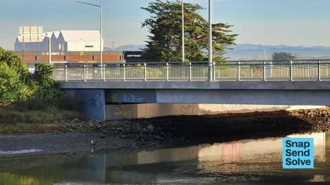


Reported here
 Graffiti on a road, footpath or bridge —
 Under the Ferrymead Bridge on the yacht club side by the pontoon
 Graffiti on a traffic light pole or cabinet, or wa —
 cnr Tidal View and Ferry Rd
 Graffiti on a fence, building or structure —
 Under the Ferrymead bridge
 Graffiti on a fence, building or structure —
 Under the Ferrymead Bridge on the town side of the bridge and on both the upstream and downstream sides. Thanks
 Graffiti on a road, footpath or bridge —
 On bridge
 Graffiti somewhere else —
 Centre island signage tagged no right turn arrow
 Graffiti somewhere else —
 Graffiti on north westside of bridge on end
 Graffiti on a fence, building or structure —
 Under the Ferrymead Bridge. City side / upstream side. Thanks
 Graffiti on a fence, building or structure —
 Ferrymead Bridge. Both ends on the Estuary side...
 Graffiti on a fence, building or structure —
  Graffiti somewhere else —
 Steel railings of ferry mead bridge has graffiti on them
 Graffiti somewhere else —
 Pole on Southside of bridge before you go over from city side see pics
 Graffiti on a road, footpath or bridge —
 On Ferrymead Bridge - left side heading towards town
 Graffiti on a road, footpath or bridge —
 Under bridge on city side
 Graffiti on a road, footpath or bridge —
 On top of handrail on river side of bridge
 Graffiti on a road, footpath or bridge —
 City and river side on bridge facing footpath
 Graffiti on a road, footpath or bridge —
 Under bridge south west side
 Graffiti on a road, footpath or bridge —
 Ferrymead bridge city and river side (southwest end)
 Overgrown Vegetation —
 This area just over the Ferrymead Bridge has become an eyesore again, the weeds are thigh high again
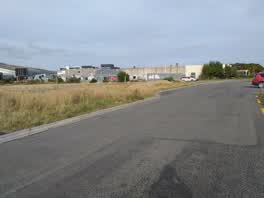 Graffiti —
 More graffiti added overnight
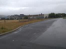 Graffiti —
 Fresh Graffiti on wall. Only just been painted over from last attack
Also reported on Tidal View
- 5 Tidal View — 15 reports
- 9 Tidal View — 9 reports
- 7 Tidal View — 4 reports
- 21E Tidal View — 4 reports
- 8 Tidal View — 2 reports
- 2 Tidal View — 2 reports
- 13 Tidal View — 2 reports
- 1 Tidal View — 2 reports
The street’s crash record
NZTA’s record names Tidal View in 4 crashes that hurt somebody since 2006 — 1 seriously hurt, nobody killed.
The green nearby
- Settlers Reserve — 40 m to the edge · 13 ha
- Scott Park Ferrymead — 94 m to the edge · 2 ha
- Te Awakura Reserve — 333 m to the edge
- Ferrymead Reserve — 358 m to the edge · Botanic · 1 ha
- The Brae — 454 m to the edge
Parks within half a kilometre, measured to the boundary — the council’s open data.
On the doorstep
- The Kebab King Ferrymead — 95 m away · Fast food
- Claddagh — 98 m away · Bars & pubs
- Best Turkish Food Co. — 100 m away · Restaurants
- Anytime Fitness — 101 m away · Gyms & fitness
Businesses within four hundred metres, measured at the pin — OpenStreetMap and the council directories.
The bus nearby
- Main Rd near St Andrews Hill Rd — 156 m away · route 3
- Main Rd near Te Awakura Tce — 257 m away · route 3
The closest Metro stops, within four hundred and fifty metres.
The tracks through here
- Walk and bike track through Ferrymead — 9 m to the line · walk · bike
- Walk and bike track through Ferrymead — 9 m to the line · walk · bike
- Walk and bike track through Ferrymead — 53 m to the line · walk · bike
- Walk and bike track through Ferrymead — 66 m to the line · walk · bike
- Walk and bike track through Ferrymead — 135 m to the line · walk · bike
Tracks whose line passes within half a kilometre, measured to the line itself — the council’s open data.
The named ground
Named water within 500 m of this address, measured to the line or the edge; the council’s own structure register — bridges, boardwalks and steps standing nearby — the open map’s record.
The remembered names nearby
- Christchurch / City Council / 1967 / H2o – S10 – T16 — 3 m away ·
CHRISTCHURCH / CITY COUNCIL / 1967 / H2O – S10 – T16
· 1998 - Donated by Friends and Family / in Memory of / Keith Murray — 240 m away ·
Donated by friends and family / in memory of / Keith Murray / (1966 – 2005) / who loved th
· 2005
Inscribed plaques within two hundred and fifty metres — the register’s pins, not surveyed spots. The whole roll is at /plaques.
What was here — Former Dwelling and Setting
151 m away · 2A Main Road · located to ±7 m · the place’s own record →
On the register. Nothing researched here yet.
The civic layer
This ground votes in Heathcote ward — the Spreydon-Cashmere-Heathcote community board. Ward lines don’t always follow suburb lines; this one is measured at the pin, not the suburb’s centre.
What stood on this ground → · On the map → · From the air — the Crown’s aerials back to 1936; search the address on RetroLens →
Questions, answered briefly
21 council reports on record since December 2021 — most often graffiti on a road, footpath or bridge (8), graffiti on a fence, building or structure (5), graffiti somewhere else (4).
Ferrymead, Christchurch — on Tidal View.
The heritage register names a place at or beside it — Former Dwelling and Setting.
Settlers Reserve — 40 m to its edge, 13 ha.