30 Butterfield Avenue, Linwood
23 reports on record since December 2018 · 21 with photographs. The street’s heaviest record is 82 Butterfield Avenue — 25 reports on file. Indicative rating valuation and school zones, hazards, bin day and what stood here before.
What gets reported here
Photographed here 21 on record



Reported here
 Dumped Rubbish —
 small pile of cutting ccc worker just emptied rubbish bin beside rubbish but didn't take away pile of rubbish, wouldn't you think someone wi
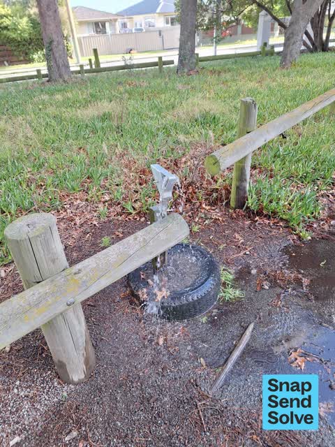
 Water Leak —
 whats wrong with these people!!!!! Stolen the tap even with a guard.
 Dumped Rubbish —
 this was not there yesterday
 Park - General Request —
 Both chains missing on gates of Linwood cemetery, that have been cut and taken
 Park - General Request —
 Need new padlock, old one doesn’t unlock with key
 Dumped Rubbish —
  Trees - General —
 Kids trike and metal scooter in trees. Worried about them falling in the wind onto someone. Very high up.
 Dumped Rubbish —
  Graffiti on a playground or in a park —
  Dumped Rubbish —
  Vandalism - General —
  Graffiti on a sign, mural or public art —
 Graffiti on interpretation board
 Graffiti somewhere else —
 Linwood cemetery
 Trees - General —
 A broken branch hanging loose in tree above pathway
 Trees - General —
 Large dead tree
 Dumped Rubbish —
 - Trees - General —
- Dumped Rubbish —
 Graffiti —
 Chain gates to access the cemetery have been cut
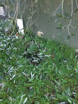 Water Leak —
 Leak from meter box
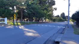 Roading/Streets —
 hi, I bike along here and the 20km/he speed calming seems to allow car to travel over it still at high speeds, some dont even need to slow
Rubbish and Bins - General —
Parks —
Wandering dog followed us for 30.mins around Linwood Cemetary. Thurs 20/12. No owner in sight.
Also reported on Butterfield Avenue
- 82 Butterfield Avenue — 25 reports
- 25 Butterfield Avenue — 17 reports
- 78 Butterfield Avenue — 15 reports
- 46 Butterfield Avenue — 12 reports
- 31 Butterfield Avenue — 9 reports
- 30A Butterfield Avenue — 9 reports
- 76 Butterfield Avenue — 8 reports
- 6 Butterfield Avenue — 8 reports
The street’s crash record
NZTA’s record names Butterfield Avenue in 4 crashes that hurt somebody since 2006 — 1 seriously hurt, nobody killed.
The green nearby
- Bromley Park — 74 m to the edge · Sports ground · 4 ha
- Merrilees Reserve — 380 m to the edge
- Worcester Reserve — 494 m to the edge · 1 ha
Parks within half a kilometre, measured to the boundary — the council’s open data.
The civic shelf nearby
- Linwood Cemetery — you are in it · Cemetery
Libraries, halls and the rest within half a kilometre — the council’s open data.
On the doorstep
- VetCall — 226 m away · Vets
Businesses within four hundred metres, measured at the pin — OpenStreetMap and the council directories.
The bus nearby
- Buckleys Rd and Dacre St — 194 m away · route 5, route 80, route 155, the Orbiter (clockwise)
- Buckleys Rd near Butterfield Ave — 218 m away · route 5, route 80, route 155, the Orbiter (anticlockwise)
The closest Metro stops, within four hundred and fifty metres.
The tracks through here
- Walk and bike track through Linwood — 200 m to the line · walk · bike
- Walk and bike track through Linwood — 313 m to the line · walk · bike
Tracks whose line passes within half a kilometre, measured to the line itself — the council’s open data.
The named ground
the council’s own structure register — bridges, boardwalks and steps standing nearby — the open map’s record.
Renting nearby
new bonds in Linwood ran about $478 a week — $72 below the city median of $550 — the suburb page keeps the rent record →.
What was here — Linwood Cemetery
on this spot · located to ±322 m · the place’s own record →
On the register. Nothing researched here yet.
The civic layer
This ground votes in Linwood ward — the Coastal-Burwood-Linwood community board. Ward lines don’t always follow suburb lines; this one is measured at the pin, not the suburb’s centre.
What stood on this ground → · On the map → · From the air — the Crown’s aerials back to 1936; search the address on RetroLens →
Questions, answered briefly
23 council reports on record since December 2018 — most often dumped rubbish (7), trees - general (4), water leak (2).
Linwood, Christchurch — on Butterfield Avenue.
The heritage register names a place at or beside it — Linwood Cemetery.
Bromley Park — 74 m to its edge, 4 ha.