54 Oxford Street, Lyttelton
73 reports on record since November 2020 · 64 with photographs. The street’s heaviest record is 26 Oxford Street, 83 reports on file. Indicative rating valuation and school zones, hazards, bin day and what stood here before.
What gets reported here
Photographed here 64 on record


Reported here
 Playground Equipment,
 Can we please have the shade sails put up now we are in Term 4 to support sun safety.
- Playground Equipment,
Swings in playground need oiling as they make an awful squeaking noise. Thanks v much.
 Graffiti on a playground or in a park,
 Graffiti needs removal in skatepark
 Graffiti on a playground or in a park,
 Graffiti removal required on steps area to rose garden
 Graffiti on a playground or in a park,
 Graffiti in children’s playground
 Graffiti on a fence, building or structure,
 Graffiti on council pool frontage.
 Graffiti on a fence, building or structure,
 graffiti still there
 Graffiti on a playground or in a park,
 Playground and skatepark have been hit hard again with graffiti everywhere - needs urgent attention
 Graffiti on a fence, building or structure,
 second snap and send, why do you not take it seriously??
 Graffiti on a playground or in a park,
 Tagging in skatepark also historic walls - please remove
 Graffiti on a playground or in a park,
 New graffiti in skatepark that needs removing
 Graffiti on a fence, building or structure,
 Graffiti
 Graffiti on a playground or in a park,
 New graffiti in skatepark - needs removal Can we please get some signage put up about respected the shared space as our tamariki are getti
 Water Leak,
 Water leak in corner of playground - increasing in size - needs urgent attention
 Graffiti on a playground or in a park,
 New graffiti in skatepark that needs urgent removal please and thank you
 Graffiti on a playground or in a park,
 Graffiti
 Playground Equipment,
 Flooding in corner of playground above Lyttelton school
 Playground Equipment,
 A tripping and slip hazard has been created by the spraying or removing of grass exposing a concrete edge leaving the concrete steps higher
 Graffiti on a playground or in a park,
 Graffiti in skatepark - needs removing
 Facility - General Request,
 This important historical clock and significant feature of the Lyttelton community has not had the correct time for many many months. Can it
 Graffiti on a sign, mural or public art,
 Graffiti on sign board
 Graffiti on a fence, building or structure,
 Graffiti on fence
 Graffiti on a fence, building or structure,
 Graffiti on building
 Park - General Request,
 No sunshade on children’s play area
 Graffiti on a playground or in a park,
 Graffiti all over walls to playground
 Graffiti on a fence, building or structure,
  Graffiti on a road, footpath or bridge,
 Please arrange removal of this tag. Many thanks!
 Graffiti on a fence, building or structure,
 Graffiti on wall of Lyttelton primary school
 Graffiti on a fence, building or structure,
 Graffiti on wall
 Graffiti on a playground or in a park,
 Fresh graffiti in skatepark
 Graffiti on a fence, building or structure,
 It’s near to other graffiti but not the same
 Graffiti on a fence, building or structure,
  Playground Equipment,
 Now that summer is here shade sails need to be reinstalled in playground space
 Graffiti on a playground or in a park,
 Fresh graffiti in skatepark area that needs removing please and thank you
 Playground Equipment,
 Signage ripped from fence - need reattaching
- Rubbish and Bins - General,
Public bin is missing
 Graffiti on a playground or in a park,
 Fresh graffiti in skatepark - needs repainting over
 Graffiti on a playground or in a park,
 Skatepark has been targeted with lots of graffiti again over the weekend - inappropriate language and images - urgent action required
 Graffiti on a playground or in a park,
 New graffiti in skatepark, the skate bowl and on the mural walls, signage and surrounding concrete walls
 Graffiti on a playground or in a park,
 New graffiti on both sides of concrete walls near grassy / skatepark
 Graffiti on a playground or in a park,
 New graffiti all over skatepark - needs urgent attention. School students are very disappointed to see their park treated so poorly over the
 Graffiti on a playground or in a park,
 More graffiti added to wall over weekend - needs urgent attention
 Graffiti on a playground or in a park,
 New graffiti on concrete wall - needs removing
 Graffiti on a playground or in a park,
 New graffiti in Skatepark
 Playground Equipment,
 Shade sail has two holes in it - needs patching or replacing
 Graffiti on a fence, building or structure,
 Graffiti on wall at Oxford rose gardens
 Overgrown Vegetation,
 Overgrown garden bed outside Norman Kirk Memorial Pool
 Graffiti on a fence, building or structure,
  Graffiti on a fence, building or structure,
 Historical location and wall
 Hazard, vehicle,
 Car parked in disabled spot on council land
 Abandoned Vehicle,
 Abandoned van been here for weeks
 Hazard, vehicle,
 Ute parked in disabled car park on council property
 Facility - General Request,
 Clock set at wrong time
 Hazard, vehicle,
 parked for last seek. no mobility sticker
 Abandoned Vehicle,
 Abandoned van and campervan - have been parked in the lyttelton community pool parking spot (including disabled spot) for over a week
 Park - General Request,
 Lyttelton Rose Garden, Clock Tower, Goal area has a missing drain cover. Could really hurt someone if they don't see the hole!
 Graffiti,
 Someone has made a swastika in the skateboard park in Lyttelton. It’s in the bowl at the far end of the skatepark on Oxford street. I don’t
- Hazard, vehicle,
- Overgrown Vegetation,
- Graffiti,
- Fallen Tree,
- Water Leak,
- Graffiti,
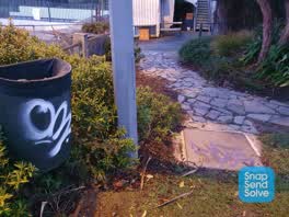 Graffiti,
 Daily occurrence - new ones this morning plus the usual broken bottles in the rose gardens, condoms, empty meth point bags and homemade pipe
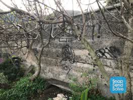 Graffiti,
 Found more- in community gardens. Thanks
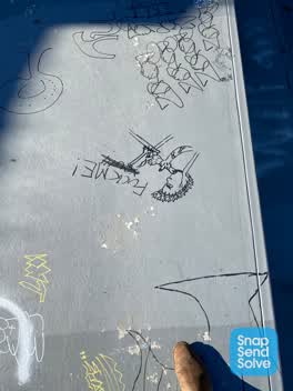 Graffiti,
 Quite a bit of new graffiti in the skatepark we need to get removed asap so our kids can use it please Lyttelton primary school
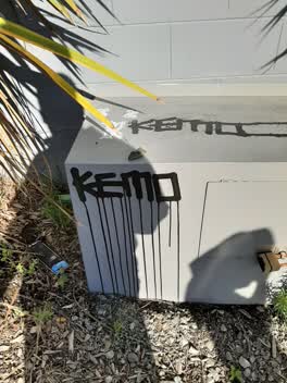 Graffiti,
 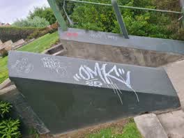 Graffiti,
 In the rose garden/goal area
 Graffiti,
 Someone has graffiti over artwork in the skate park/basketball area in Lyttelton park
 Graffiti,
 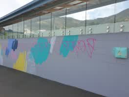 Graffiti,
 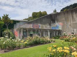 Graffiti,
 - Parks,
a older man each morning is leaving pool gate open for anyone to come in free of charge. he is intentional putting something against the gat
Also reported on Oxford Street
- 26 Oxford Street, 83 reports
- 6 Oxford Street, 35 reports
- 24 Oxford Street, 28 reports
- 20 Oxford Street, 27 reports
- 26A Oxford Street, 21 reports
- 18 Oxford Street, 12 reports
- 25 Oxford Street, 10 reports
- 54A Oxford Street, 9 reports
From the air, then
Sourced from Canterbury Maps and partners. RNZAF, CC BY 3.0 NZ. Each frame is cut from Environment Canterbury’s historic imagery MapServer for that decade, only where the Footprints layer names a CC BY survey (NZAM-covered spots stay out). RetroLens holds more Crown aerials →
The street’s crash record
NZTA’s record names Oxford Street in 3 crashes that hurt somebody since 2006, 1 seriously hurt, nobody killed.
The green nearby
- Oxford Street Reserve, you are in it · Botanic
- Sumner Road Gardens, 155 m to the edge
- Baden Norris Reserve, 177 m to the edge
- Urumau Reserve, 216 m to the edge · Regional · 26 ha
- Albion Square, 245 m to the edge · Botanic
Parks within half a kilometre, measured to the boundary, the council’s open data.
The civic shelf nearby
- Lyttelton Cemetery, 134 m away · Cemetery
- Lyttelton Service Centre, 240 m away · Service centre
- Lyttelton Library, 259 m away · Library · 29 Winchester St, Lyttelton 8082
- Lyttelton Anglican Cemetery, 282 m away · Cemetery
Libraries, halls and the rest within half a kilometre, the council’s open data.
On the doorstep
- The Garage Sale, 31 m away · Op shops
- Everest Indian Restaurant & Takeaway, 144 m away · Restaurants
- Snoclothes & Milly May, 145 m away · Clothing
- Everest, 146 m away · Restaurants
Businesses within four hundred metres, measured at the pin: OpenStreetMap and the council directories.
The bus nearby
- Oxford Street near Winchester Street, 80 m away · route 8, route 155
- Norwich Quay near Canterbury St, 305 m away · route 8, route 155
The closest Metro stops, within four hundred and fifty metres.
The named ground
Named places within 1.5 km of this address; the council’s own structure register, bridges, boardwalks and steps standing nearby, the open map’s record.
The remembered names nearby
- Lyttelton Gaol on This Site Stood the Infamous Lyttelton, 35 m away ·
LYTTELTON GAOL ON THIS SITE STOOD THE INFAMOUS LYTTELTON GAOL BUILT IN 1851 AS A WOODEN LO
· 2008 - Opened 1928 F. E. Sutton Mayor, 39 m away ·
OPENED 1928 F. E. SUTTON MAYOR
· 2008 - Erected in Grateful Memory of Charles Hazlitt Upham Mrcs, 49 m away ·
ERECTED IN GRATEFUL MEMORY OF CHARLES HAZLITT UPHAM MRCS LRCP (THE LITTLE DOCTOR) 1863 - 1
· 2008
Inscribed plaques within two hundred and fifty metres, the register’s pins, not surveyed spots. The whole roll is at /plaques.
Renting nearby
new bonds in Lyttelton ran about $600 a week, $50 above the city median of $550, the suburb page keeps the rent record →.
What was here, Former Lyttelton Gaol Site
on this spot · 26D Oxford Street · located to ±55 m · the place’s own record →
On the register. Nothing researched here yet.
What was here, Cobblestone Gutters and Setting
on this spot · located to ±116 m · the place’s own record →
On the register. Nothing researched here yet.
What was here, Former Warder's House and Setting
68 m away · 39 Oxford Street · located to ±11 m · the place’s own record →
On the register. Nothing researched here yet.
What was here, Dwelling and Setting
72 m away · 47 Oxford Street · located to ±11 m · the place’s own record →
On the register. Nothing researched here yet.
What was here, Dwelling and Setting
80 m away · 34 St Davids Street · located to ±10 m · the place’s own record →
On the register. Nothing researched here yet.
The civic layer
This ground votes in Banks Peninsula ward, the Banks Peninsula community board. Ward lines don’t always follow suburb lines; this one is measured at the pin, not the suburb’s centre.
What stood on this ground → · On the map → · From the air, the Crown’s aerials back to 1936; search the address on RetroLens →
Questions, answered briefly
73 council reports on record since November 2020, most often graffiti on a playground or in a park (21), graffiti on a fence, building or structure (14), graffiti (12).
Lyttelton, Christchurch, on Oxford Street.
The heritage register names 5 places at or beside it, Former Lyttelton Gaol Site, Cobblestone Gutters and Setting.
Oxford Street Reserve, the address is inside it.