107 Estuary Road
6 council reports since September 2016, 6 carrying a photograph. The street’s heaviest record is 222 Estuary Road, 33 reports on file.
From the air, then
Sourced from Canterbury Maps and partners. RNZAF, CC BY 3.0 NZ. Each frame is cut from Environment Canterbury’s historic imagery MapServer for that decade, only where the Footprints layer names a CC BY survey (NZAM-covered spots stay out). RetroLens holds more Crown aerials →
The green nearby
- South New Brighton Beach, 295 m to the edge · Regional · 37 ha
- Te Karoro Karoro Reserve, 298 m to the edge · 2 ha · playground, 12 pieces
- Bridge Reserve, 334 m to the edge · 7 ha
- Blighs Garden, 467 m to the edge · 6 ha
Parks within half a kilometre, measured to the boundary, the council’s open data. The whole roll is at /parks.
On the doorstep
- Common Ground - South Brighton, 28 m away · Fast food
- Dune Cafe, 29 m away · Cafés
- Challenge, 83 m away · Petrol stations
- Green Bear Coffee, 93 m away · Coffee roasters
Businesses within four hundred metres, measured at the pin, OpenStreetMap and the council directories.
The bus nearby
- Estuary Rd, 4 m away · route 60
- Estuary Rd, 116 m away · route 60
The closest Metro stops, within four hundred and fifty metres.
The tracks through here
- Walk and bike track through South New Brighton, 410 m to the line · walk · bike
- Walk and bike track through South New Brighton, 491 m to the line · walk · bike
- Walk and bike track through South New Brighton, 491 m to the line · walk · bike
Tracks whose line passes within half a kilometre, the council’s open data.
The named ground
Named places within 1.5 km of this address; the council’s own structure register, bridges, boardwalks and steps standing nearby, the open map’s record.
Renting nearby
new bonds in South New Brighton ran about $640 a week, $90 above the city median of $550, the suburb page keeps the rent record →.
What gets reported here
Photographed here 6 on record


What’s on record
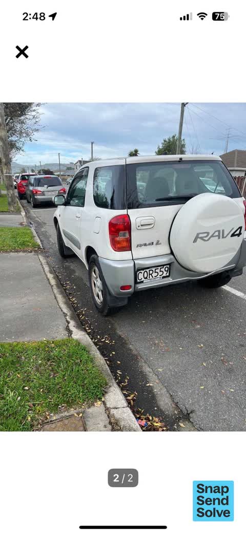
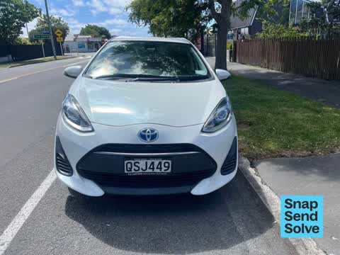
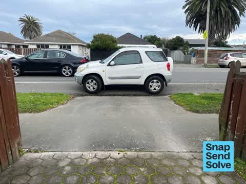
 Hazard, vehicle, 18 Nov 2025
Cars constantly parking over our driveway. They park here to visit the busy cafe next door. We have no issue with the cafe we love it but ha
 Hazard, vehicle, 16 Nov 2025
Once again a car park over driveway for the second time in a day we need a yellow line here near drive as this happens daily
 Hazard, vehicle, 16 Nov 2025
Parked particularly over driveway can’t get our truck out without driving over kerb
 Hazard, vehicle, 13 Jul 2025
This car parked over our driveway today while she was visiting the cafe next door was there for 45 mins and we couldn’t go out due to being
 Trees - General, 20 Apr 2025
Tree has grown into power lines and sways a lot in the wind. Afraid tree will bring down the power lines
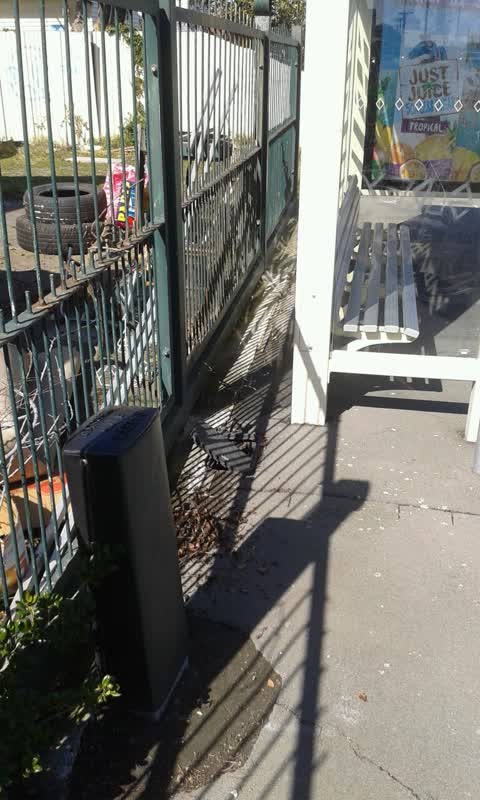
Water Supply, 10 Sept 2016
Bus stop round about estuary rd/bridge str: watermeter cover does not close
Elsewhere on Estuary Road
- 222 Estuary Road, 33 reports
- 204B Estuary Road, 27 reports
- 404 Estuary Road, 20 reports
- 392A Estuary Road, 19 reports
- 190 Estuary Road, 19 reports
- 386A Estuary Road, 18 reports
- 236 Estuary Road, 15 reports
- 402 Estuary Road, 13 reports
The street’s crash record
NZTA’s record names Estuary Road in 17 crashes that hurt somebody since 2006, 3 people killed, 5 seriously hurt.
The civic layer
This ground votes in Coastal ward, the Coastal-Burwood-Linwood community board is its local layer. Ward lines don’t always follow suburb lines; this one is measured at the pin, not the suburb’s centre. The whole roll is at /wards.
Estuary Road, the whole record → · Everything about South New Brighton → · What stood on this ground → · On the map → · From the air, RetroLens holds the Crown’s aerials back to 1936; search the address there →
Questions, answered briefly
6 council reports on record since September 2016, most often hazard, vehicle (4), water supply (1), trees - general (1).
South New Brighton, Christchurch, on Estuary Road.
Nothing on the heritage register at this exact spot, the record around this ground →
South New Brighton Beach, 295 m to its edge, 37 ha.