215 Rocking Horse Road, Southshore
12 reports on record since February 2021 · 11 with photographs. The street’s heaviest record is 220 Rocking Horse Road — 45 reports on file. Indicative rating valuation and school zones, hazards, bin day and what stood here before.
What gets reported here
Photographed here 11 on record


Reported here
 General Request —
 large parties of people (photos show about 20 people), but multiple groups going and coming so presence almost continuous, collecting large
 Graffiti on a sign, mural or public art —
 Offensive tagging CCC sign
 Graffiti on a fence, building or structure —
 Signage tagged
 Graffiti on a sign, mural or public art —
 Tagging on back of Southshore spit reserve sign at beach entrance, southern end of Rockinghorse Road
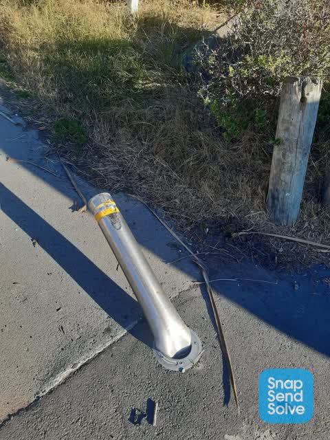
 Pavement - Damaged —
 Photo 1 with cone there was drinking fountain there but drunk driver smashed through bollard (photo 2) and took it out - this happened in Ma
 Graffiti —
 Graffiti on sign
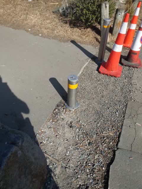
 Accessibility —
 Bollards left down again - this time on 14t15th December allowing public access to spit where all public/private vehicles are prohibited. T
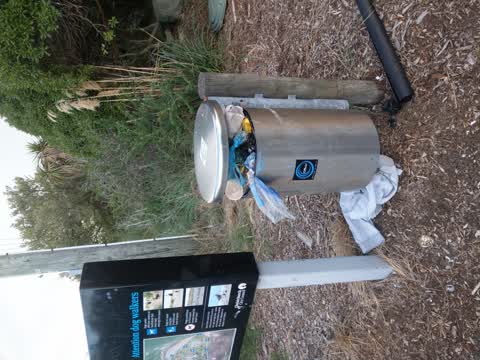
- Dumped Rubbish —
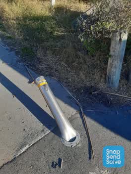 Parks —
 Bollard damaged by vehicle
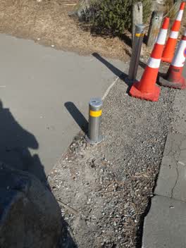 Parks —
 Pole has been lowered not by ranger or ccc
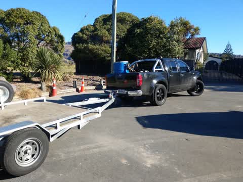
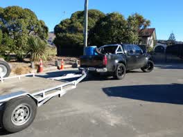 Roading/Streets —
 truck and trailer parked across reserve and 215 driveway. this keeps happenning with different vehicles across driveways of 213,215, 214 and
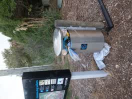 Rubbish/Recycling —
Also reported on Rocking Horse Road
- 220 Rocking Horse Road — 45 reports
- 213 Rocking Horse Road — 16 reports
- 216 Rocking Horse Road — 10 reports
- 154 Rocking Horse Road — 9 reports
- 34 Rocking Horse Road — 8 reports
- 66A Rocking Horse Road — 7 reports
- 42 Rocking Horse Road — 7 reports
- 78 Rocking Horse Road — 6 reports
The street’s crash record
NZTA’s record names Rocking Horse Road in 8 crashes that hurt somebody since 2006 — 2 seriously hurt, nobody killed.
The green nearby
- Spit Reserve — you are in it · Regional · 27 ha
- Wimbrels Way Reserve — 344 m to the edge
Parks within half a kilometre, measured to the boundary — the council’s open data.
The bus nearby
The closest Metro stops, within four hundred and fifty metres.
The named ground
Named places within 1.5 km of this address — the open map’s record.
The remembered names nearby
- Tachibana Girls High School / 1997 - 2000 — 77 m away ·
Tachibana Girls High School / 1997 - 2000
· 1998
Inscribed plaques within two hundred and fifty metres — the register’s pins, not surveyed spots. The whole roll is at /plaques.
Renting nearby
new bonds in Southshore ran about $640 a week — $90 above the city median of $550 — the suburb page keeps the rent record →.
The civic layer
This ground votes in Coastal ward — the Coastal-Burwood-Linwood community board. Ward lines don’t always follow suburb lines; this one is measured at the pin, not the suburb’s centre.
What stood on this ground → · On the map → · From the air — the Crown’s aerials back to 1936; search the address on RetroLens →
Questions, answered briefly
12 council reports on record since February 2021 — most often parks (2), graffiti on a sign, mural or public art (2), rubbish/recycling (1).
Southshore, Christchurch — on Rocking Horse Road.
Nothing on the heritage register at this exact spot — the record around this ground →
Spit Reserve — the address is inside it, 27 ha.