
Southshore, Christchurch
940 council reports since June 2015, the 78th busiest suburb in the city. 735 photographs on record.
The record also holds about $640 a week to rent· 2023 Census snapshot· 735 photographs· 5 old photographs· 4 parks· 36.1% of the outline mapped liquefied· 13.0% of the outline in the red zone· graded mostly TC3 in 2011· the record drew water over 33% of the outline· the mapped tsunami reach covers 96% of the outline· the Ngāi Tahu schedule covers 100% of the outline· ecological sites over 46% of the outline· landscape schedules over 48% of the outline· high flood hazard over 38% of the outline· 475 SCIRT photographs filed on this ground· 4 remembered names on this ground· 5 drawn rules bind this ground· 119 parcels of made ground· the 2019 model grades this ground mostly medium· 5 council structures on the register· 276 trees on the register· the plan’s word on this ground· 10 epicentres inside the outline· 10 injury crashes· 104 recorded victimisations· 16 bus stops· 1 business· the council’s fix times· 21 documents· 5 mentions on the wire
Live source links
Link-outs to the source’s own live pages, chch.live does not copy their live values or source text.
Living here rent · the ground · the day-to-day
$640/week
middle half $520–$650
New bonds here ran at about $640 a week in the April–June 2026 quarter, the middle half of them between $520 and $650, across 15 bonds lodged, up 9% on a year ago. That’s about $90 a week above the city’s own quarter median of $550. Tenancy Services counts these under the South New Brighton area, which takes in this coast with its neighbours.
By dwelling type and bedrooms, April–June 2026 quarter
- 1-bedroom house, $650 a week · 9 new bonds
Median and quartiles of weekly rents on new private bonds, by quarter. New bonds are fresh lodgements, not the whole rental stock; under five bonds the rent is withheld, and counts are randomly rounded. Source: Tenancy Services rental bond data: provisional while the bond system migrates.
The ground: 13% of the outline went into the residential red zone; the February 2011 survey drew liquefaction over 36% of it, the rest of the watch is drawn further down.
Day to day it holds 4 parks and 16 bus stops, each is counted further down.
Lately the record’s mostly trees & parks, 111 reports in the year to 13 October 2026, the newest 11 October 2026.
One for the quiz, Its busiest day on record was 23 May 2018, 9 reports in a single day.
2023 Census snapshot SA1 areas grouped here
About 3,321 people and 1,296 occupied private households in the “South New Brighton” statistical area, grouped from 23 SA1 areas. Nearby statistical areas stand in for this place, so this is a proxy rather than a count for the suburb boundary.
More of the 2023 Census
- Born overseas20% of stated birthplace
- European ethnicity92% of ethnicity responses
- Māori ethnicity15% of ethnicity responses
- Pacific Peoples ethnicity4% of ethnicity responses
- Asian ethnicity3% of ethnicity responses
- Households with internet87% of stated households
- Households with two or more vehicles58% of stated households
Ethnicity is a multiple-response measure, so those percentages are not meant to add to 100%.
Stats NZ’s 2023 Census uses fixed random rounding to base 3. Unavailable or confidential cells are left out, not treated as zero. individuals · households · geography · CC BY 4.0.
About the suburb
Southshore is an eastern coastal suburb within Christchurch, New Zealand. It is located on a narrow 2.5 km (1.6 mi) long sandspit that runs along the eastern side of the Avon Heathcote Estuary and west of the Pacific Ocean. The suburb is 8 km (5.0 mi) east of the city centre and 5 km (3.1 mi) south of New Brighton's main retail area.
As reported 735 on record
The suburb, back then 5 in the archive
Placed by the record’s locality join or the name in its own title, a lead, not a claim each frame stood here.
The shape of it outline © OpenStreetMap · recent reports, pinned
The record on Southshore
- Southshore enters the written record on 1 January 1926, “Aerial photomosaic of Southshore Spit and Moncks Bay”, Canterbury Stories.
- “Southshore” appears somewhere in 21 of the archive’s records, title, description or body.
- The first report the feed ever carried here: roading/streets, 9 June 2015, at 88–122.
- Its busiest day on record was 23 May 2018, 9 reports in a single day.
- The street that keeps coming up is Rocking Horse Road, reported on 339 separate days.
- For elections the suburb’s centre falls inside Coastal ward, the Coastal-Burwood-Linwood community board is its local layer. The whole roll is at /wards.
Lately the newest reports
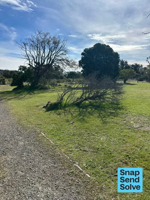
Trees - General7 Stilt Ln
There are a few dead trees which should be removed. They’re starting to be unsightly on the reserve. Another tree truck about 50m along the walking track to…

Trees - General7 Stilt Ln
These two palm trees have dropped lots of fronds and they’re making quite a mess on the reserve. It would be great if the fronds could be removed and the trees…

Animal - Domestic6 Plover St
Hiya I believe this is the dog I made a complaint about recently due to owner having no control of it. I was with my wee cocker spaniel. I have just seen this…
Animal - General2A Penguin Street
this gentleman was not very aware of our estuary edge dog rules today and did not take kindly to being asked to put his two terrier dogs on a lead.

Street Gutters / Storm Water104 Rocking Horse Road
drains by road have been blocked for weeks causing surface flooding on road and path. both sides of the rd. overflowing onto berms now


Facility - General Request21A Caspian Street
Under the sand is wooden steps on a chain. it has got buried under the sand. can you please uncover the steps before summer.

Dumped Rubbish3A Penguin St
Dumped rubbish. It has been here for weeks. Fully blocking path Children and people in wheelchairs have to use the Road. It’s collecting more rubbish

Abandoned Vehicle191 Rocking Horse Road
no registration and no warrant fitness since 2025 Red Vitz car parked on road outside 189 Rockinghorse Rd South Shore Chch p

Animal - Domestic135A Rocking Horse Road
Owner had no recall over his dog. I was up by sand dunes with my little dog on long line. His dog ran to us from low tide at distance. I asked him to call…
Reports per year down 3% 2024→2025
15
29
16
35
17
42
18
56
19
37
20
69
21
110
22
149
23
126
24
102
25
99
What gets reported
Exactly what people say
How fast the council fixes things here 1,436 finished jobs on record
The median council work order pinned in Southshore took 5 days to resolve, the city-wide median is 3 days, so this ground runs slower than the city as a whole. The slowest tenth waited 4 months or longer. 62 tickets are open here now, the oldest was filed 13 October 2021.
Work orders, not the resident reports above, the council’s MyCouncilTicket stream, and one job can appear in both. A median counts only finished jobs; open ones are named as open, never averaged in. The ticket roll · the whole city’s fix times.
The suburb today
Schools here
Zoned for Avonside Girls' High School · Christchurch Adventist School · Haeata Community Campus · Hillview Christian School · Marian College · Middleton Grange School · and 4 more zones, the drawn zone is indicative; the Ministry’s written scheme is the legal boundary.
The green here 4
- Southshore Beach ParkRegional · 28 ha
- Spit ReserveRegional · 27 ha
- Wimbrels Way Reserve
- Plover Reserveplayground, 23 pieces
Parks and reserves in the council’s open data, a park lands in the suburb its centre falls inside. The whole roll is at /parks.
The ground that moved
The February 2011 survey drew mapped ground failure over 36.1% of this outline, about 40 hectares. A patch is a footprint, not a finding about an address; the count for the whole city is at /liquefaction.
The Crown’s 2011 classification drew 13.0% of this outline, about 14 hectares inside the residential red zone. A mapped area files under the suburb its middle sits in, and a classification is the record of a decision, not a finding about an address; the whole line is drawn at /redzone.
The 2011 grading filed 34.6% of this outline, about 38 hectares, mostly TC3. A graded area files under the suburb its middle sits in, and a category is a verdict for a patch of ground, not a finding about an address; the grades are drawn at /technical-categories.
The flood record drew water over 33.2% of this outline, about 37 hectares, across 1 named event. A patch is one event’s observation, not a live hazard finding; the whole record is drawn at /floods.
The mapped tsunami extent covers 96% of this outline, about 105 hectares. The sea’s modelled reach, not a prediction, the plan’s inundation line, not the evacuation zones; the share is read from a sampled join. The whole extent is drawn at /tsunami.
The files record 119 parcels of made or characterised ground inside this outline, about 19 hectares, mostly sand, silt, topsoil, 2 carry fill the file can’t vouch for. A record is the file’s word on what was laid, not a fresh survey; the whole layer is drawn at /fill.
The 2019 liquefaction study put 33% of this outline in the medium class, 90% of the outline fell inside an assessed area, and 1 assessed area here carry the free-face flag for possible lateral spreading. A class is the model’s verdict on a patch of ground, not a finding about an address; the whole study is drawn at /vulnerability.
The council’s structure register stands 5 assets on this ground, 5 boardwalks, sited at Spit Reserve, Southshore Beach Park. The register’s site names are its own labels for the ground an asset stands in; the layer is drawn at the map.
The register counts 276 living trees inside this outline, 2 veterans among them, mostly Cabbage tree, Ngaio, Pohutukawa. The file remembers 87 trees felled here. A tree record is the register’s word on what stands or stood; the whole canopy is drawn at /trees.
The plan files 46% of this outline under Open Space Coastal, 38% residential, the rest mostly Residential Suburban 38%, Specific Purpose (Flat Land Recovery) 11%. A zone is a permission, not a description, the mix is read from a sampled join of the plan’s polygons; the whole district is drawn at /zones.
The plan’s schedule of sites significant to Ngāi Tahu covers 100% of this outline, about 110 hectares, ngā tūranga tūpuna, ngā wai. Shares read from a sampled join; a recognition overlay, not a catalogue. The whole schedule is drawn at /cultural.
The plan’s ecological schedules cover 46% of this outline, about 50 hectares across 2 scheduled sites, all protected under Schedule A. Shares read from a sampled join; a recognition overlay, not a survey. The whole ledger is drawn at /ecology.
The plan’s landscape schedules cover 48% of this outline, about 52 hectares across 4 scheduled areas, 48% of it outstanding, the plan’s strongest landscape standing, and 100% of it sits inside the coastal environment. Shares read from a sampled join; a protection overlay, not a ranking of views. The kept view is drawn at /landscape.
The plan’s flood map draws 38% of this outline inside high flood hazard ground, about 42 hectares across 17 mapped areas. The broader flood-management watch covers 66% of it, Southshore. Shares read from a sampled join; a model’s map, not a promise. The waiting water is drawn at /flood-hazard.
The plan’s water-margin layers cross this outline, and an esplanade line holds a public edge here. The margin is the plan’s drawing, not a survey of the bank; the reaches, strips and held edges are mapped at /water-margin.
The rebuild’s cameras filed 475 photographs on this ground, 2010–2016, stormwater work mostly. Each frame is a receipt the dig left behind, a work log, not a survey of what stands now; the whole record is drawn at /rebuild.
The remembered names stand on this ground, 4 inscribed plaques, Spit Reserve, Southshore Beach Park among the grounds. The plaque is the register’s pin, not a surveyed spot; the whole roll is kept at /plaques.
The rulebook binds this ground, 5 drawn instruments, 3 of them dog rules, 2 camping zones, a certified self-contained van can stay the night at City Coastal Restricted Zone; the other zone bans it outright; the outline sits inside the takiwā of Te Ngai Tuahuriri Runanga. The bylaw is the instrument, this the map of it, the whole rulebook is drawn at /rules.
GeoNet’s catalogue puts 10 magnitude-3+ epicentres inside this outline since the sequence opened, the biggest a M3.9 in 2011. An epicentre is where the instruments placed the break, not a measure of the shaking here; the whole catalogue is counted at /sequence, the live record is /quakes, and the story in plain language is the earthquakes explainer.
The crash record 10 injury crashes
10 crashes that hurt somebody on record inside Southshore's outline, 3 seriously hurt, nobody killed.
The corner that keeps appearing: Rocking Horse Road at Heron Street, 2 injury crashes.
The crime record 104 recorded victimisations
104 victimisations on the Police record inside Southshore’s outline, September 2022–August 2026, mostly theft, about 8 a year per 1,000 residents. Up 30% on the year before. Reported is not all, how much never reaches the record depends on the offence.
The buses through it 16 stops
16 Metro stops inside Southshore's outline, in ECan’s stop record, served by route 60.
- Caspian St near Rocking Horse Rd near Caspian St
- Caspian St near Rocking Horse Rd near Caspian St
- Rocking Horse Rd near Godwit St near Rocking Horse Rd
- Rocking Horse Rd near Godwit St near Rocking Horse Rd
- Rocking Horse Rd near Heron St near Rocking Horse Rd
- Rocking Horse Rd near Heron St near Rocking Horse Rd
- Rocking Horse Rd near Penguin St near Rocking Horse Rd
- Rocking Horse Rd near Penguin St near Rocking Horse Rd
- Rocking Horse Rd near Petrel Ln
- Rocking Horse Rd near Plover St near Rocking Horse Rd
- Rocking Horse Rd near Plover St near Rocking Horse Rd
- Rocking Horse Rd near Tern St near Rocking Horse Rd
- Rocking Horse Rd near Tern St near Rocking Horse Rd
- Rocking Horse Rd near Torea Ln
- Rocking Horse Rd near Whimbrels Wy
- Southshore
Businesses here 1 in the directory
1 premises in Southshore across 1 kind, from OpenStreetMap, the council’s licensed-premises register and its 2024 Find Christchurch directory. Each kind below opens at this suburb’s shelf.
Before any of that
Documents 21
What the archive’s sources say about Southshore, titled for it, turned up by a search for one of its places, or carrying its name in the text. These are leads and citations: the originals live at the provider, linked from each row.
41920s
1950s
1970s
52000s
92010s
2020s
Aerial photomosaic of Southshore Spit and Moncks Bay
Aerial photomosaic of Southshore Spit, Moncks Bay, Clifton and Redcliffs. Christchurch 1926 aerial photomosaics…Canterbury Stories · Christchurch City Libraries ·
Aerial photomosaic of Southshore
Aerial photomosaic of Southshore southward from Jellicoe Street. Christchurch 1926 aerial photomosaics…Christchurch 1926 aerial photomosaics · Canterbury Stories · Christchurch City Libraries ·
Aerial photomosaic of Southshore Spit
Aerial photomosaic of Southshore Spit. Christchurch 1926 aerial photomosaics…Christchurch 1926 aerial photomosaics · Canterbury Stories · Christchurch City Libraries ·
Aerial photomosaic of Moncks Bay and Southshore Spit
Aerial photomosaic of Southshore Spit and Moncks Bay. Christchurch 1926 aerial photomosaics…Christchurch 1926 aerial photomosaics · Canterbury Stories · Christchurch City Libraries ·
View of Sumner Beach and Southshore
View of Sumner Beach and Southshore through the trees in Scarborough. Redcliffs, Christchurch and the Southern Alps are visible in the…Wildey collection · Canterbury Stories · Christchurch City Libraries ·
LIST OF CIVIL UNION
…Rutherglen Avenue, Ilam, ChristchurchChirnside, Marie Anne Elizabeth, 1-2 Mermaid Place, Southshore, ChristchurchChristie, Toni Constance, 45 Helston Road, Johnsonville, WellingtonClark, Beverley Ali…New Zealand Gazette · Department of Internal Affairs · · text held
LIST OF CIVIL UNION CELEBRANTS
…Pennygale Close, Dannemora, Auckland.Chirnside, Marie Anne Elizabeth, 1-2 Mermaid Place, Southshore, Christchurch.Christie, Toni Constance, 45 Helston Road, Johnsonville, Wellington.Clark, Beverley A…New Zealand Gazette · Department of Internal Affairs · · text held
Notice of Intention to Remove Companies From the Register
…ONSULTING OTAGO LIMITED.SOUTHERN SWAN MILLENNIUM TOUR LIMITED.SOUTHEY INVESTMENTS LIMITED.SOUTHSHORE PROPERTIES LIMITED.SOUTHSIDE CHOPPERS LIMITED.SOUTHWARK PROPERTIES LIMITED.SOVEREIGN BRICKLAYERS LI…New Zealand Gazette · Department of Internal Affairs · · text held
LIST OF CIVIL UNION
…Pennygale Close, Dannemora, Auckland.Chirnside, Marie Anne Elizabeth, 1-2 Mermaid Place, Southshore, Christchurch.Christie, Beverley Joyce, 16B Aubrey Crescent, Rainbow Point, Taupo.Christie, Toni Co…New Zealand Gazette · Department of Internal Affairs · · text held
The rest are a search away, the whole shelf, for the name →
The wire on Southshore 5 lately
Knobbled Orbweaver seen — Rocking Horse Rd near Plover St, Southshore, Christchurch 8062, New ZealandiNaturalist · max_mutant ·
Something seen — Southshore Spit Reserve, Christchurch, Canterbury, NZiNaturalist · katrina_muir ·
Karaka seen — Rocking Horse Rd near Torea Ln, Southshore, Christchurch 8062, New ZealandiNaturalist · otago ·
Something seen — Southshore, Southshore, Christchurch 8062, New ZealandiNaturalist · dmc838 ·
Tunneling Mud Crab seen — Southshore, Christchurch 8062, New ZealandiNaturalist · mac_durning ·
Next door
Compare Southshore with Redcliffs · Moncks Bay · Clifton · South New Brighton · Richmond Hill · Mount Pleasant, same record, side by side.
Questions, answered briefly
What is Southshore?
Southshore is an eastern coastal suburb within Christchurch, New Zealand. The public record holds 940 council reports for it, the first filed in June 2015.
How many people does the 2023 Census count for Southshore?
About 3,321 people and 1,296 occupied private households (nearby SA1s): grouped from Stats NZ SA1 areas through this site’s suburb join. Indicative, not a LIM.
What gets reported in Southshore?
940 reports on record, most often trees & parks (243), roads & footpaths (237), rubbish & dumping (190). 111 of them in the year to 13 October 2026.
How many crashes has Southshore had?
10 injury crashes on the police record inside the suburb’s outline, 3 seriously hurt, nobody killed. The suburb’s crashes, mapped →
Did earthquakes strike under Southshore?
GeoNet’s catalogue puts 10 magnitude-3+ epicentres inside the suburb’s mapped outline since the September 2010 mainshock, the biggest a M3.9 in 2011. An epicentre is where the instruments placed the break, not a measure of the shaking felt here. The whole sequence, counted → · The story, in plain language →
What did the earthquakes grade Southshore?
The 2011 technical categories filed 34.6% of the suburb’s outline, about 38 hectares, mostly TC3. TC1 meant standard foundations sufficed, TC2 enhanced, TC3 site-specific engineering, a verdict for the patch of ground, not a finding about any one address. The grades, drawn →
Every suburb in Christchurch → · Its decade, charted → · the whole A–Z →