Wooldridge Road
204 reports at 36 addresses in Harewood, the first in 2016, the latest 2026. 172 separate days somebody filed something about it.
Where it runs
Each report dot is the average of the spots reports were filed from, where reporters stood on Wooldridge Road, not the street’s surveyed line. The strong outline is Harewood.
From the air, then
Sourced from Canterbury Maps and partners. LINZ, CC BY 3.0 NZ. Each frame is cut from Environment Canterbury’s historic imagery MapServer for that decade, only where the Footprints layer names a CC BY survey (NZAM-covered spots stay out). RetroLens holds more Crown aerials →
The addresses on it
- 313-315 Wooldridge Road, 39 reports
- 253 Wooldridge Road, 32 reports
- 240 Wooldridge Road, 21 reports
- 290 Wooldridge Road, 20 reports
- 278 Wooldridge Road, 13 reports
- 276 Wooldridge Road, 12 reports
- 202 Wooldridge Road, 11 reports
- 204 Wooldridge Road, 8 reports
- 295 Wooldridge Road, 7 reports
- 307 Wooldridge Road, 5 reports
- 311 Wooldridge Road, 3 reports
- 245 Wooldridge Road, 3 reports
- 215 Wooldridge Road, 3 reports
- 315 Wooldridge Road, 2 reports
- 313 Wooldridge Road, 2 reports
- 261 Wooldridge Road, 2 reports
- 206 Wooldridge Road, 2 reports
- 317 Wooldridge Road, 1 report
- 305 Wooldridge Road, 1 report
- 3/202 Wooldridge Road, 1 report
- 280 Wooldridge Road, 1 report
- 272 Wooldridge Road, 1 report
- 270 Wooldridge Road, 1 report
- 268 Wooldridge Road, 1 report
- 266 Wooldridge Road, 1 report
- 263 Wooldridge Road, 1 report
- 260 Wooldridge Road, 1 report
- 257-311 Wooldridge Road, 1 report
- 252 Wooldridge Road, 1 report
- 244 Wooldridge Road, 1 report
- 241 Wooldridge Road, 1 report
- 223 Wooldridge Road, 1 report
- 219 Wooldridge Road, 1 report
- 214 Wooldridge Road, 1 report
- 212 Wooldridge Road, 1 report
- 2/202 Wooldridge Road, 1 report
What got reported
- Rubbish & dumping, 74 reports
- Trees & parks, 66 reports
- Graffiti & vandalism, 20 reports
- Roads & footpaths, 18 reports
- Water & drains, 14 reports
- Everything else, 7 reports
- Vehicles & parking, 4 reports
- Animals & pests, 1 report
Year by year
- 2016, 1 report
- 2018, 10 reports
- 2019, 4 reports
- 2020, 17 reports
- 2021, 9 reports
- 2022, 33 reports
- 2023, 46 reports
- 2024, 38 reports
- 2025, 43 reports
The businesses on it, 2
Premises whose address in the directory is Wooldridge Road, the commercial record alongside the civic one.
The named ground
the council’s own structure register, bridges, boardwalks and steps standing nearby, the open map’s record.
The crash record on it
NZTA’s record names Wooldridge Road in 21 crashes that hurt somebody since 2006, 3 seriously hurt, nobody killed.
The corner the record returns to: Harewood Road & Wooldridge Road, 46 crashes pinned to the pairing.
Its file in the papers
Papers Past records that surfaced when the archive searched for the street’s name, they answered the search; whether they are about this street is a reader’s call, at the link.
As it was reported

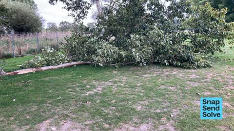


The latest on it
- Dumped Rubbish, 253 Wooldridge Road,
- Trees - General, 290 Wooldridge Road,
- Park - General Request, 253 Wooldridge Road,
- Roads - General, 2/202 Wooldridge Road,
- Dumped Rubbish, 290 Wooldridge Road,
- Water Leak, 290 Wooldridge Road,
- Water Leak, 290 Wooldridge Road,
- Graffiti on a bus stop or public toilet, 313-315 Wooldridge Road,
- Animal - General, 245 Wooldridge Rd,
- Damaged Asset – CCC contractor, 245 Wooldridge Rd,
- Graffiti on a bus stop or public toilet, 313-315 Wooldridge Road,
- Graffiti on a bus stop or public toilet, 313-315 Wooldridge Road,
- Flooding, 240 Wooldridge Road,
- Flooding, 204 Wooldridge Road,
- Dumped Rubbish, 240 Wooldridge Road,
Questions, answered briefly
In Harewood, Christchurch, New Zealand.
204 reports at 36 addresses, most often rubbish & dumping (74), trees & parks (66), graffiti & vandalism (20).
2016, the record covers 172 separate days somebody filed something about it, through 2026.
Harewood Road and Wooldridge Road, 46 police-reported crashes at the pairing.
Every street the archive knows → · Harewood → · This street as a feed →