240 Wooldridge Road, Harewood
21 reports on record since March 2020 · 13 with photographs. The street’s heaviest record is 313-315 Wooldridge Road — 39 reports on file. Indicative rating valuation and school zones, hazards, bin day and what stood here before.
What gets reported here
Photographed here 13 on record




Reported here
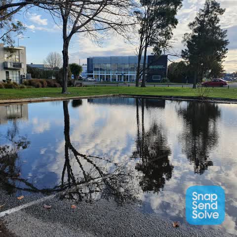
 Flooding —
 Blocked drain
 Dumped Rubbish —
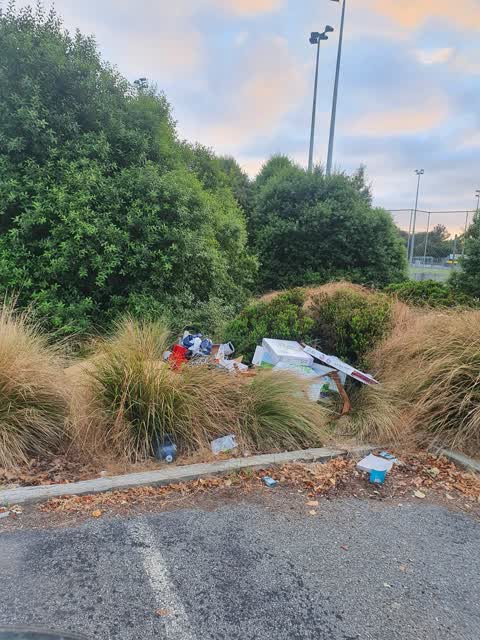
 Various bags of rubbish dumped near bin on the footpath at Nunweek Hockey Turf 3.
 Hazard — vehicle —
 Hello. That state of the carpark at Nunweek park is terrible. There are significant potholes, multiple flooding issues when it rains and the
 Overgrown Vegetation —
 Old man's beard infestation
 Dumped Rubbish —
 Nah has been here 3 weeks
 Facility - General Request —
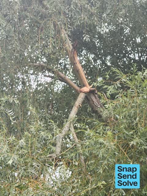
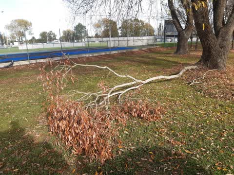
 Large branch broken in tree between bays 3 and 4. Get alot of dog walkers so it needs to come down
 Overgrown Vegetation —
 All the gardens are over grown and even the path has overgrown
 Rubbish and Bins - General —
 Crate missing inside big belly. Nunweek carpark.
- Dumped Rubbish —
- Pothole —
- Road Signage —
- Park - General Request —
- Dumped Rubbish —
- Fallen Tree —
- Dumped Rubbish —
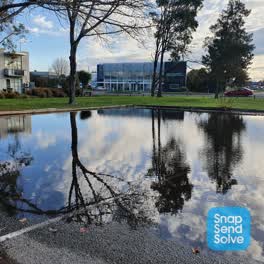 Sewer - Leak / Blockage —
 Have been trying for the past 5 years to get this drain emptied. Every single time it rains it floods
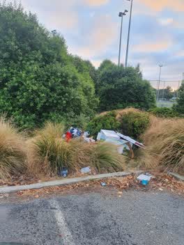 Rubbish/Recycling —
 Some dirty bugger has dumped house hold items in the bush
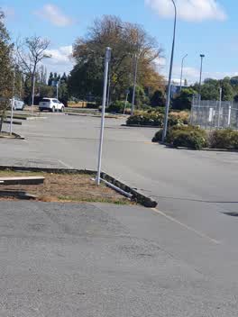 Roading/Streets —
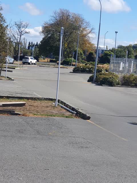
 parking sign has been push over as well as the barrier been broken
- Parks —
had a car burnt out in the carpark at nunweek park. 2nd bay
Parks —
snapped branch
Parks —
Also reported on Wooldridge Road
- 313-315 Wooldridge Road — 39 reports
- 253 Wooldridge Road — 32 reports
- 290 Wooldridge Road — 20 reports
- 278 Wooldridge Road — 13 reports
- 276 Wooldridge Road — 12 reports
- 202 Wooldridge Road — 11 reports
- 204 Wooldridge Road — 8 reports
- 295 Wooldridge Road — 7 reports
The street’s crash record
NZTA’s record names Wooldridge Road in 21 crashes that hurt somebody since 2006 — 3 seriously hurt, nobody killed.
The green nearby
- Nunweek Park — you are in it · Sports ground · 20 ha
- Wairakei Reserve — 179 m to the edge · 1 ha
- Becmead Walkway — 312 m to the edge
- Benmore Gardens Reserve — 368 m to the edge
- Roydvale Reserve — 376 m to the edge
Parks within half a kilometre, measured to the boundary — the council’s open data.
On the doorstep
- Pure Cafe Co - Woolridge Road — 104 m away · Cafés
- Bin Inn — 128 m away · Supermarkets
- Maxwells Drycleaning — 133 m away · Dry cleaners
- Repco — 133 m away · Car parts
Businesses within four hundred metres, measured at the pin — OpenStreetMap and the council directories.
The bus nearby
The closest Metro stops, within four hundred and fifty metres.
The tracks through here
- Walk and bike track through Harewood — 143 m to the line · walk · bike
- Walk and bike track through Harewood — 185 m to the line · walk · bike
- Walk and bike track through Harewood — 396 m to the line · walk · bike
Tracks whose line passes within half a kilometre, measured to the line itself — the council’s open data.
The civic layer
This ground votes in Harewood ward — the Fendalton-Waimairi-Harewood community board. Ward lines don’t always follow suburb lines; this one is measured at the pin, not the suburb’s centre.
What stood on this ground → · On the map → · From the air — the Crown’s aerials back to 1936; search the address on RetroLens →
Questions, answered briefly
21 council reports on record since March 2020 — most often dumped rubbish (5), parks (3), overgrown vegetation (2).
Harewood, Christchurch — on Wooldridge Road.
Nothing on the heritage register at this exact spot — the record around this ground →
Nunweek Park — the address is inside it, 20 ha.