The port’s own town
The harbour walk covers the waterfront; this one is the town behind it, the vicarages and named houses of the west end, the lodges and shops of the main streets, the cells, the stables and the cobblestone gutters the borough left on the roll. It ends at the battery that watched the harbour mouth. Long, with a climb at the finish.
The walk, as a line
Straight between pins, the streets run longer. Every numbered pin opens that place’s own record.
The stops, in order
- Magazine and Setting · Heritage NZ list 7234 · 23 unread leads
The magazine, where the port kept its powder.
- Erskine Point Gun Emplacement and Setting
The Erskine Point gun emplacement, the harbour’s western gun.
- Dwelling and Setting, Omarama, 53 Cressy Terrace · 11 unread leads
Omarama, the west end’s named dwelling.
- Dwelling and Setting/ Former St Saviour's Vicarage, 2 Brittan Terrace · 20 unread leads
The former St Saviour’s vicarage.
- Dwelling and Setting, Dalcroy House, 16 Godley Quay · Heritage NZ list 7379 · 20 unread leads
Dalcroy House.
- Dwelling and Setting, Lochranza, 14 Godley Quay · Heritage NZ list 3087 · 20 unread leads
Lochranza.
- Former Boarding House and Setting, 28 Dublin Street · 40 unread leads
The former boarding house, the town’s travellers had a listed roof.
- Former Kilwinning Lodge and Setting, 26 Canterbury Street · 39 unread leads
The Kilwinning Lodge, one of two lodge halls on the walk.
- Commercial Building and Setting, Former Maher's Drapery, 31 London Street · 21 unread leads
Maher’s Drapery, the main street’s commercial entry.
- St Saviours Church at Holy Trinity, 17 Winchester Street · 39 unread leads
St Saviour’s at Holy Trinity, the church the vicarage belonged to.
- 2 Norwich Quay, 2 Norwich Quay · 22 unread leads
2 Norwich Quay, back down to the water’s edge.
- Former Warder's House and Setting, 39 Oxford Street · Heritage NZ list 7533 · 41 unread leads
The former warder’s house, the gaol’s keeper had a listed home.
- Former Lyttelton Borough Council Stables and Setting, 4 Donald Street · 40 unread leads
The borough council’s stables, local government kept horses here.
- Cobblestone Gutters and Setting · 2 unread leads
The cobblestone gutters, the street itself is a listing.
- Former Lyttelton Police Station Cells and Setting, 5 Sumner Road · Heritage NZ list 7355 · 41 unread leads
The police station’s cells, the town kept its lock-up too.
- Former Masonic Lodge Hall, Lodge of Unanimity, and Setting, 6 St Davids Street · Heritage NZ list 7382 · 40 unread leads
The Masonic hall, the second lodge on the roll.
- Former Court Queen of the Isles Foresters' Lodge Hall and Setting, 26 St Davids Street · 25 unread leads
The Foresters' hall, the third; the town was built on lodges.
- Battery Point Battery · Heritage NZ list 7553 · 20 unread leads
Battery Point, the battery at the harbour’s far point, the walk’s last climb.
What the register built on the way
Council structures within about 30 m of the stop-to-stop line, the bridges, steps and shelters the route passes. Site names are the register’s own.
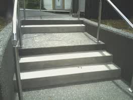 A set of steps at Albion Square, 5 steps · built 2014
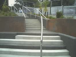 A set of steps at Albion Square, 21 steps · built 2014
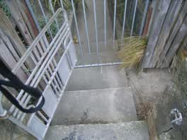 A set of steps at Sumner Road Gardens, 2 m long · built 2008 4 m off the line
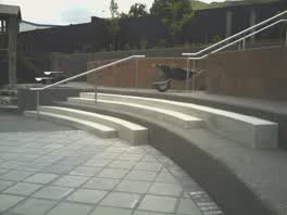 A set of steps at Albion Square, 6 steps · built 2014 4 m off the line
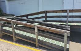 A ramp at Lyttelton Recreation Centre, 2.62 m long · built 1899 5 m off the line
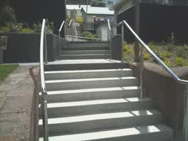 A set of steps at Albion Square, 6 steps · built 2014 5 m off the line
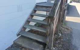 A set of steps at Lyttelton Recreation Centre, 6 steps · built 1899 5 m off the line
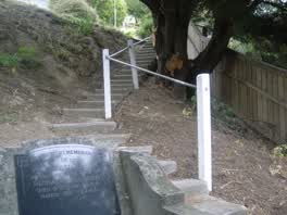 A set of steps at Lyttelton Cemetery, 14 m long · built 2008 6 m off the line
The reports along it
3,458 council reports pinned within 150 m of the line, most often Graffiti & vandalism and Roads & footpaths, 2,889 with a photograph. A pin is where a reporter stood, not a claim about the place itself.
 Graffiti on a road, footpath or bridge
 Graffiti on a road, footpath or bridge
 Trees - General
 Facility - General Request
 Graffiti on a fence, building or structure
 Public Toilet
 Dumped Rubbish
 Overgrown Vegetation
 Graffiti on a fence, building or structure
 Road Signage
Questions, answered briefly
The harbour walk covers the waterfront; this one is the town behind it, the vicarages and named houses of the west end, the lodges and shops of the main streets, the cells, the stables and the cobblestone gutters the borough left on the roll. 18 listed places, 4.6 km as the line runs, Lyttelton.
Magazine and Setting to Battery Point Battery, the order is a suggestion, not the only way round.
Every one, each pin is a row in the district plan’s heritage schedule, and each opens the place’s own sourced record here.
4.6 km measured straight between the pins, the streets run longer, and the stops deserve a pause each.
The record behind this
Every stop is a row in the district plan’s heritage schedule, held here as the register’s own layer. The order and the notes are ours, the listings are the council’s and Heritage New Zealand’s. "Setting" is the register’s word for the ground a listing covers.
The rest of the register here: Lyttelton
The same ground today: Lyttelton
More walks over this ground: The port’s first streets
This page as markdown: /walks/lyttelton-town.md · the route as data: /walks/lyttelton-town.geojson · on the live map: the walks layer.