256 Armagh Street, Christchurch Central City
16 reports on record since March 2021 · 12 with photographs. The street’s heaviest record is 177 Armagh Street — 266 reports on file. Indicative rating valuation and school zones, hazards, bin day and what stood here before.
What gets reported here
Photographed here 12 on record




Reported here
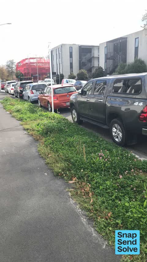
 Overgrown Vegetation —
 There appears to be no person in the Mike Greer development between 250 and 256 Armagh St responsible for keeping the berm mowed. The person
 Street Gutters / Storm Water —
 Blocked drain limiting drainage
 Water Leak —
 Toby connection leaking
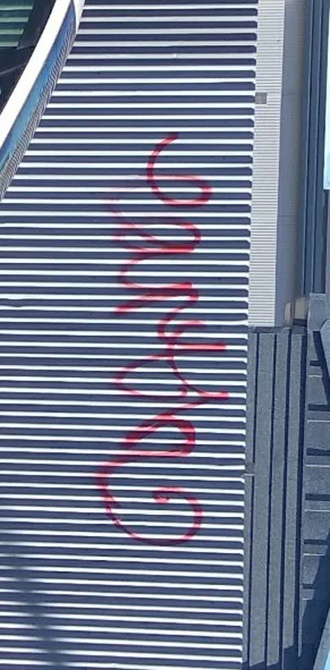
 Graffiti on a fence, building or structure —
 graffiti on fence
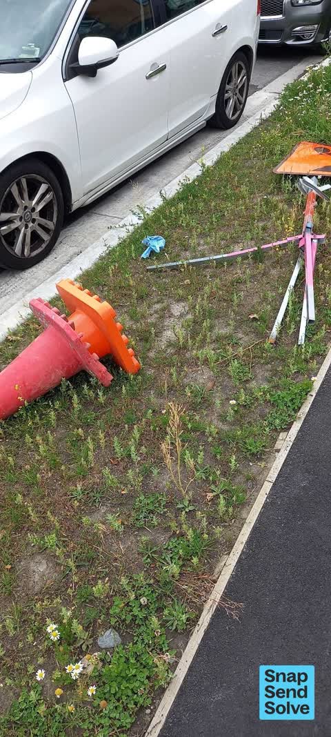
 Pavement - General —
 256 Armagh St: two road cones and metal stand dumped on the berm
 Graffiti on a fence, building or structure —
  Abandoned Vehicle —
 This car has been here for more than a week and also broken. No one came to move it.
 Graffiti somewhere else —
  Graffiti somewhere else —
  Vandalism - General —
  Graffiti on a fence, building or structure —
 Black and white paint tags on CN861 asset by 256 Armagh Street.
- Graffiti —
- Graffiti —
- Graffiti —
- Graffiti —
 Graffiti —
Also reported on Armagh Street
- 177 Armagh Street — 266 reports
- 90 Armagh Street — 234 reports
- 163 Armagh Street — 116 reports
- 167 Armagh Street — 109 reports
- 89 Armagh Street — 107 reports
- 88 Armagh Street — 89 reports
- 199 Armagh Street — 74 reports
- 161 Armagh Street — 63 reports
The street’s crash record
NZTA’s record names Armagh Street in 86 crashes that hurt somebody since 2006 — 13 seriously hurt, nobody killed.
The green nearby
- Latimer Square — 132 m to the edge · Botanic · 2 ha
- Poplars Reserve — 169 m to the edge · Botanic
- Fire Fighters Reserve — 219 m to the edge
- Cambridge Reserve — 239 m to the edge
- Chester Street East Reserve — 293 m to the edge
Parks within half a kilometre, measured to the boundary — the council’s open data.
On the doorstep
- Table at Monks — 78 m away · Restaurants
- City Putt and Cruise — 109 m away · Attractions
- Armagh Automotive — 137 m away · Car repair
- Beat Street — 169 m away · Cafés
Businesses within four hundred metres, measured at the pin — OpenStreetMap and the council directories.
The bus nearby
- Gloucester St near Barbadoes St — 133 m away · route 5, route 7
- Gloucester St near Barbadoes St — 133 m away · route 5, route 7
The closest Metro stops, within four hundred and fifty metres.
The tracks through here
- Walk and bike track through Christchurch Central City — 7 m to the line · walk · bike
- Walk and bike track through Christchurch Central City — 89 m to the line · walk · bike
- Walk and bike track through Christchurch Central City — 160 m to the line · walk · bike
- Walk and bike track through Christchurch Central City — 207 m to the line · walk · bike
- Walk and bike track through Christchurch Central City — 252 m to the line · walk · bike
Tracks whose line passes within half a kilometre, measured to the line itself — the council’s open data.
The named ground
Named water within 500 m of this address, measured to the line or the edge; Named places within 1.5 km of this address; the council’s own structure register — bridges, boardwalks and steps standing nearby — the open map’s record.
The remembered names nearby
- Afac — 137 m away ·
afac / (dedication text illegible – backlit)
· 2013 - H. Francis Willis — 181 m away ·
H. FRANCIS WILLIS. RENNELL BROS / ARCHITECT BUILDERS / W T TRETHEWEY / SCULPTOR
· 2009 - This Clock Tower, Telephone Cabinet and All Standard Lights — 184 m away ·
THIS CLOCK TOWER, TELEPHONE CABINET AND ALL STANDARD LIGHTS IN POPLAR CRESCENT WERE PRESEN
· 2009
Inscribed plaques within two hundred and fifty metres — the register’s pins, not surveyed spots. The whole roll is at /plaques.
Renting nearby
new bonds in Christchurch Central City ran about $508 a week — $42 below the city median of $550 — the suburb page keeps the rent record →.
What was here — Dwellings and Setting
103 m away · 100 Chester Street East · located to ±13 m · the place’s own record →
On the register. Nothing researched here yet.
What was here — Dwellings and Setting
121 m away · 86 Chester Street East · located to ±15 m · the place’s own record →
On the register. Nothing researched here yet.
What was here — Edmonds Clock Tower, Telephone Cabinet and Setting
187 m away · 295F Madras Street · located to ±15 m · the place’s own record →
On the register. Nothing researched here yet.
What was here — Former MED Converter Station and Substation
248 m away · 102/210 Armagh Street · located to ±30 m · the place’s own record →
On the register. Nothing researched here yet.
The civic layer
This ground votes in Central ward — the Papanui-Innes-Central community board. Ward lines don’t always follow suburb lines; this one is measured at the pin, not the suburb’s centre.
What stood on this ground → · On the map → · From the air — the Crown’s aerials back to 1936; search the address on RetroLens →
Questions, answered briefly
16 council reports on record since March 2021 — most often graffiti (5), graffiti on a fence, building or structure (3), graffiti somewhere else (2).
Christchurch Central City, Christchurch — on Armagh Street.
The heritage register names 4 places at or beside it — Dwellings and Setting, Dwellings and Setting.
Latimer Square — 132 m to its edge, 2 ha.