329 Manchester Street, Christchurch Central City
13 reports on record since July 2022 · 9 with photographs. The street’s heaviest record is 297-299 Manchester Street — 102 reports on file. Indicative rating valuation and school zones, hazards, bin day and what stood here before.
What gets reported here
Photographed here 9 on record





Reported here
 Water Leak —
burst pipe
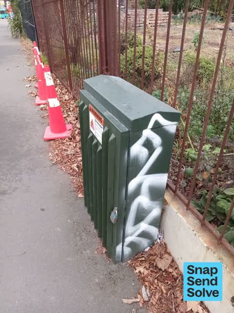
 Graffiti on a fence, building or structure —
graffiti on light lamp post pole
 Graffiti on a fence, building or structure —
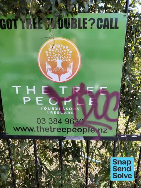
The tree people advertising poster
 Graffiti on a sign, mural or public art —
Purple paint tag on Tree People sign facing the footpath at 329 Manchester Street.
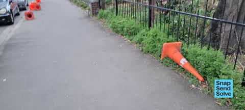
 Pavement - General —
These cones have been laying on footpath all week & becoming tripping hazard
 Hazard — vehicle —
Is this an official TMP? I think tradies from nearby site are reserving soace for private vehicles
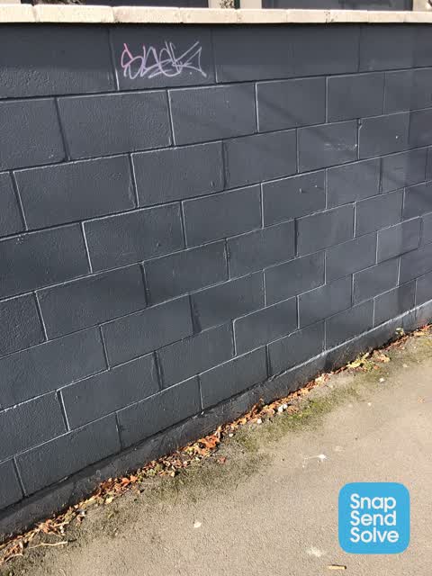
 Graffiti on a fence, building or structure —
We will sort it buy just wanted to let you know the tagger
 Vandalism - General —
- Pavement - Damaged —
- Graffiti —
- Graffiti —
- General Request —
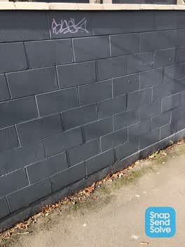 Graffiti —
Also reported on Manchester Street
- 297-299 Manchester Street — 102 reports
- 293 Manchester Street — 72 reports
- 214 Manchester Street — 72 reports
- 153 Manchester Street — 52 reports
- 218 Manchester Street — 48 reports
- 76 Manchester Street — 45 reports
- 204 Manchester Street — 45 reports
- 192 Manchester Street — 40 reports
The street’s crash record
NZTA’s record names Manchester Street in 235 crashes that hurt somebody since 2006 — 1 person killed, 38 seriously hurt.
The green nearby
- Cambridge Reserve — 200 m to the edge
- Edmonds Band Rotunda — 225 m to the edge · Botanic
- Poplars Reserve — 265 m to the edge · Botanic
- Fire Fighters Reserve — 287 m to the edge
- Victoria Square — 305 m to the edge · Botanic · 2 ha
Parks within half a kilometre, measured to the boundary — the council’s open data.
On the doorstep
- Forte 2 — 120 m away · Doctors & clinics
- Knit World — 158 m away · Wool
- Forte Health — 159 m away · Hospital
- Urology Associates — 165 m away · Doctors & clinics
Businesses within four hundred metres, measured at the pin — OpenStreetMap and the council directories.
The bus nearby
- Manchester St near Kilmore St — 56 m away · route 1, route 27, route 29, route 44, route 91, route 92, route 95
- Manchester St near Kilmore St — 89 m away · route 44, route 91, route 92
The closest Metro stops, within four hundred and fifty metres.
The tracks through here
- Walk and bike track through Christchurch Central City — 1 m to the line · walk · bike
- Walk and bike track through Christchurch Central City — 259 m to the line · walk · bike
- Walk and bike track through Christchurch Central City — 262 m to the line · walk · bike
- Walk and bike track through Christchurch Central City — 269 m to the line · walk · bike
- Walk and bike track through Christchurch Central City — 291 m to the line · walk · bike
Tracks whose line passes within half a kilometre, measured to the line itself — the council’s open data.
The named ground
Named water within 500 m of this address, measured to the line or the edge; Named places within 1.5 km of this address; the council’s own structure register — bridges, boardwalks and steps standing nearby — the open map’s record.
The remembered names nearby
- Planted by the / Canterbury Provincial [] / to Commemorate — 237 m away ·
PLANTED BY THE / CANTERBURY PROVINCIAL [illegible] / TO COMMEMORATE / THE GOLDEN JUBILEE /
· 2009 - These Trees Were Planted by / Past Presidents — 237 m away ·
THESE TREES WERE PLANTED BY / PAST PRESIDENTS OF / NATIONAL COUNCIL OF WOMEN / CHRISTCHURC
· 2009 - 25th May 1991 / 25 Years in New Zealand Working — 240 m away ·
25th May 1991 / 25 years in New Zealand working / for prisoners of conscience and / politi
· 2009
Inscribed plaques within two hundred and fifty metres — the register’s pins, not surveyed spots. The whole roll is at /plaques.
Renting nearby
new bonds in Christchurch Central City ran about $508 a week — $42 below the city median of $550 — the suburb page keeps the rent record →.
What was here — Former Church of St Luke the Evangelist Bell Tower and Setting
53 m away · 258 Manchester Street · located to ±4 m · the place’s own record →
On the register. Nothing researched here yet.
What was here — Former Vicarage of the Church of St Luke the Evangelist and Setting
102 m away · 185 Kilmore Street · located to ±12 m · the place’s own record →
On the register. Nothing researched here yet.
What was here — Poplars, Lamp Standards and Setting
234 m away · located to ±139 m · the place’s own record →
On the register. Nothing researched here yet.
What was here — Edmonds Band Rotunda Area including Rotunda, Shelter, Balustrades, Landing and Lamp Standards and Setting
249 m away · 230 Cambridge Terrace · located to ±57 m · the place’s own record →
On the register. Nothing researched here yet.
The civic layer
This ground votes in Central ward — the Papanui-Innes-Central community board. Ward lines don’t always follow suburb lines; this one is measured at the pin, not the suburb’s centre.
What stood on this ground → · On the map → · From the air — the Crown’s aerials back to 1936; search the address on RetroLens →
Questions, answered briefly
13 council reports on record since July 2022 — most often graffiti on a fence, building or structure (3), graffiti (3), water leak (1).
Christchurch Central City, Christchurch — on Manchester Street.
The heritage register names 4 places at or beside it — Former Church of St Luke the Evangelist Bell Tower and Setting, Former Vicarage of the Church of St Luke the Evangelist and Setting.
Cambridge Reserve — 200 m to its edge.