33 Rolleston Avenue, Christchurch Central City
21 reports on record since February 2020 · 9 with photographs. The street’s heaviest record is 7 Rolleston Avenue — 124 reports on file. Indicative rating valuation and school zones, hazards, bin day and what stood here before.
What gets reported here
Photographed here 9 on record


Reported here
 Graffiti on a traffic light pole or cabinet, or wa —
Tag in lamp post
 Graffiti somewhere else —
Graffiti on Orion cabinet
 Vandalism - General —
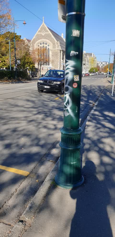
Unsightly damage to tram poles all the way down Rolleston Ave.
 Graffiti —
Illegally placed posters. Requiring removal.
 Graffiti —
- Graffiti —
- Roads - General —
- Overgrown Vegetation —
- General Request —
- Street Light Outage —
- Damaged Road —
- Street Light Outage —
- Damaged Street Light —
- Hazard — vehicle —
- Pavement - General —
- Street Gutters / Storm Water —
- Fallen Tree —
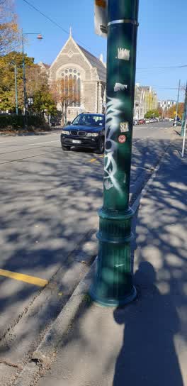 Graffiti —
tram line post by museum lecture theatre opposite ravenscar house
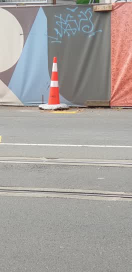 Graffiti —
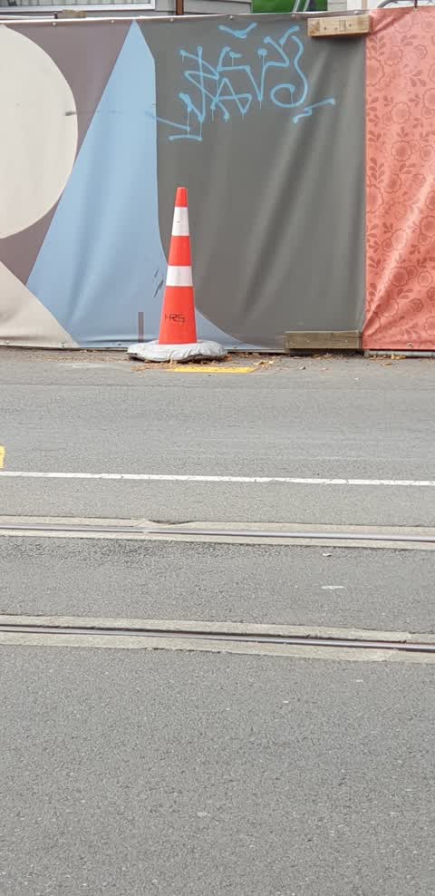
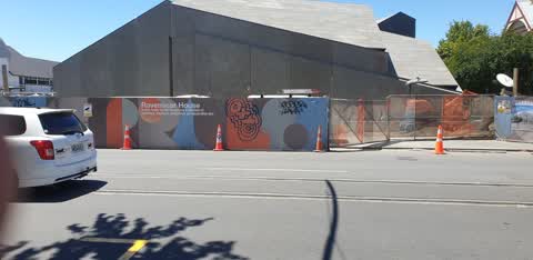
also on security fence ravenscar house opposite Christ's college
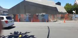 Graffiti —
ravens at house development fence opposite museum. lots of unsightly graffiti on this prime tourist area
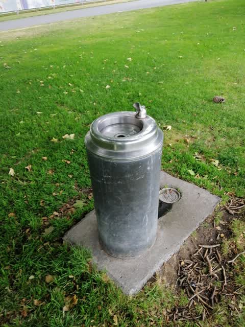
Parks —
Fountain drain is clogged, GROSS! Unusable anyway as flow is so weak you can't even get a drink. I'M THIRSTY TOO!!!!
Also reported on Rolleston Avenue
- 7 Rolleston Avenue — 124 reports
- 57 Rolleston Avenue — 65 reports
- 52 Rolleston Avenue — 50 reports
- 64 Rolleston Avenue — 43 reports
- 26 Rolleston Avenue — 43 reports
- 5 Rolleston Avenue — 36 reports
- 11 Rolleston Avenue — 33 reports
- 50 Rolleston Avenue — 28 reports
The street’s crash record
NZTA’s record names Rolleston Avenue in 19 crashes that hurt somebody since 2006 — 2 seriously hurt, nobody killed.
The green nearby
- Botanic Gardens — 19 m to the edge · Botanic · 21 ha
- Hagley Park North — 146 m to the edge · Sports ground · 91 ha
- Armagh Reserve — 193 m to the edge
- Cranmer Square — 289 m to the edge · Botanic · 2 ha
- Nurses Memorial Chapel — 478 m to the edge · Botanic
Parks within half a kilometre, measured to the boundary — the council’s open data.
The civic shelf nearby
- Rolleston Avenue — 54 m away · Car park
- Civic Offices — 385 m away · Council office
- Christchurch Hospital Grounds — 399 m away · Car park
- Scales — 444 m away · Car park
- Armagh St — 494 m away · Car park
Libraries, halls and the rest within half a kilometre — the council’s open data.
On the doorstep
- Christchurch Grand Tour — 44 m away · Attractions
- Canterbury Museum — 48 m away · Attractions
- Christ's College Guided Tours — 56 m away · Attractions
- Museum Cafe — 62 m away · Cafés
Businesses within four hundred metres, measured at the pin — OpenStreetMap and the council directories.
The bus nearby
- Rolleston Ave near Gloucester St — 35 m away · route 8
- Rolleston Ave near Gloucester St — 100 m away · route 8
The closest Metro stops, within four hundred and fifty metres.
The tracks through here
- Walk and bike track through Christchurch Central City — 20 m to the line · walk · bike
- Walk and bike track through Christchurch Central City — 84 m to the line · walk · bike
- Walk and bike track through Christchurch Central City — 158 m to the line · walk · bike
- Walk and bike track through Christchurch Central City — 180 m to the line · walk · bike
- Walk and bike track through Christchurch Central City — 180 m to the line · walk · bike
Tracks whose line passes within half a kilometre, measured to the line itself — the council’s open data.
The named ground
Named water within 500 m of this address, measured to the line or the edge; Named places within 1.5 km of this address; the council’s own structure register — bridges, boardwalks and steps standing nearby — the open map’s record.
The remembered names nearby
- Botanic Gardens — 94 m away ·
BOTANIC GARDENS / THIS FENCE, ERECTED TO COMMEMORATE THE CENTENARY OF THE BOTANIC GARDENS
· 2004 - Botanic Gardens — 102 m away ·
BOTANIC GARDENS / ADMINISTERED BY THE CHRISTCHURCH DOMAINS BOARD UNTIL 1946 AND SINCE BY T
· 2004 - Christchurch Botanic Gardens - Donated by Llewellyn — 106 m away ·
CHRISTCHURCH BOTANIC GARDENS - DONATED BY LLEWELLYN J MITCHELL
· 1998
Inscribed plaques within two hundred and fifty metres — the register’s pins, not surveyed spots. The whole roll is at /plaques.
Renting nearby
new bonds in Christchurch Central City ran about $508 a week — $42 below the city median of $550 — the suburb page keeps the rent record →.
What was here — Christ's College Dining Hall Tower and Hospital and Setting
on this spot · 33 Rolleston Avenue · located to ±16 m · the place’s own record →
On the register. Nothing researched here yet.
What was here — Christ's College Memorial Dining Hall and Setting
23 m away · 33J Rolleston Avenue · located to ±20 m · the place’s own record →
On the register. Nothing researched here yet.
What was here — Christ's College Former New Classrooms and Setting
31 m away · 33 Rolleston Avenue · located to ±21 m · the place’s own record →
On the register. Nothing researched here yet.
What was here — Canterbury Museum Centennial Wing Facade
33 m away · located to ±11 m · the place’s own record →
On the register. Nothing researched here yet.
What was here — Christ's College Administration Building and Setting
44 m away · 33Q Rolleston Avenue · located to ±11 m · the place’s own record →
On the register. Nothing researched here yet.
The civic layer
This ground votes in Central ward — the Papanui-Innes-Central community board. Ward lines don’t always follow suburb lines; this one is measured at the pin, not the suburb’s centre.
What stood on this ground → · On the map → · From the air — the Crown’s aerials back to 1936; search the address on RetroLens →
Questions, answered briefly
21 council reports on record since February 2020 — most often graffiti (6), street light outage (2), vandalism - general (1).
Christchurch Central City, Christchurch — on Rolleston Avenue.
The heritage register names 5 places at or beside it — Christ's College Dining Hall Tower and Hospital and Setting, Christ's College Memorial Dining Hall and Setting.
Botanic Gardens — 19 m to its edge, 21 ha.