60 Lichfield Street, Christchurch Central City
19 reports on record since February 2016 · 15 with photographs. The street’s heaviest record is 160 Lichfield Street — 37 reports on file. Indicative rating valuation and school zones, hazards, bin day and what stood here before.
What gets reported here
Photographed here 15 on record




Reported here
 Graffiti on a fence, building or structure —
 graffiti on concrete wall
 Graffiti on a traffic light pole or cabinet, or wa —
 graffiti on traffic control cabinet
 Graffiti on a traffic light pole or cabinet, or wa —
 stickers on traffic signal controller
 Graffiti on a cabinet, pole or railway asset —
 Paint tags on traffic controller at the corner of Lichfield and Colombo Street
 Graffiti on a cabinet, pole or railway asset —
  Damaged Street Sign —
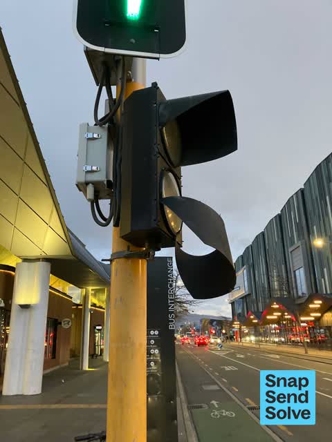
 Pole 3 - ped crossing lights faulty. Green man works fine. Red man flickers off and on, and countdown does not run.
 Damaged Street Sign —
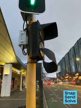
 Cowl loose on pedestrian crossing light south east corner of Colombo and Litchfield Street
 Graffiti somewhere else —
 Seats oppsite 51 Lichfield street
 Graffiti —
 Black paint tag facing Colombo Street on a traffic controller asset at the corner of Lichfield Street.
 Graffiti —
 There is a Graffiti near the Muffin Break shop, bus interchange
- Graffiti —
- Graffiti —
- Graffiti —
- Road Blockage —
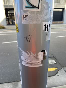 Graffiti —
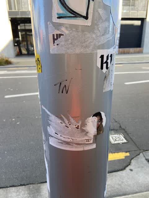
 TN black paint tag plus an anti vax sticky tag (plus sticky tags galore) on steel lamppost on Lichfield Street near Number 51
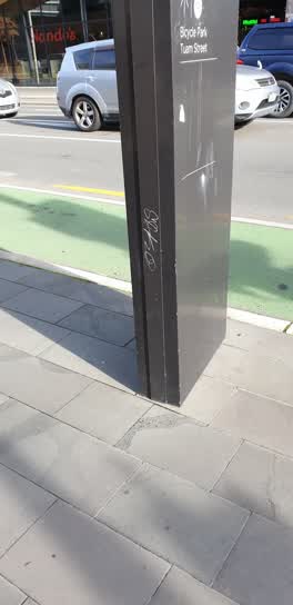 Graffiti —
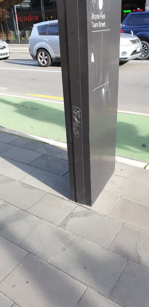
 Black bus exchange sign out side bus exchange Colombo St
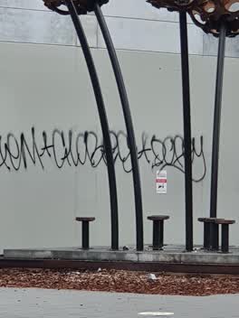 Graffiti —
 Roading/Streets —
Rubbish in rain garden / road landscape
Graffiti —
Also reported on Lichfield Street
- 160 Lichfield Street — 37 reports
- 84 Lichfield Street — 27 reports
- 90 Lichfield Street — 25 reports
- 71 Lichfield Street — 25 reports
- 116 Lichfield Street — 22 reports
- 140 Lichfield Street — 19 reports
- 81 Lichfield Street — 18 reports
- 75 Lichfield Street — 18 reports
The street’s crash record
NZTA’s record names Lichfield Street in 71 crashes that hurt somebody since 2006 — 14 seriously hurt, nobody killed.
The green nearby
- City Mall — 125 m to the edge
- High Street Triangles — 168 m to the edge
- The Stewart Plaza — 207 m to the edge
- Friendship Corner — 239 m to the edge · Botanic
- Bridge Of Remembrance — 263 m to the edge · Botanic
Parks within half a kilometre, measured to the boundary — the council’s open data.
The civic shelf nearby
- Re:start - Lichfield St — 65 m away · Car park
- Triangle — 179 m away · Car park
- Scales — 454 m away · Car park
- Turanga Library — 469 m away · Library · Cathedral Square, Christchurch
- Civic Offices — 473 m away · Council office
Libraries, halls and the rest within half a kilometre — the council’s open data.
On the doorstep
- Joe's Garage — 6 m away · Restaurants
- One Shot Esports Bar — 7 m away · Bars & pubs
- Shanghai Street Dumplings - Central City — 9 m away · Restaurants
- Joes Garage - EntX — 17 m away · Cafés
Businesses within four hundred metres, measured at the pin — OpenStreetMap and the council directories.
The bus nearby
- Bus Interchange (Intercity stop) — 53 m away · route 3, route 8, route 80
- Bus Interchange (Platform B) — 72 m away · route 1, route 7, route 8, route 27, route 44, route 91, route 92, route 95
The closest Metro stops, within four hundred and fifty metres.
The tracks through here
- Walk and bike track through Christchurch Central City — 111 m to the line · walk · bike
- Walk and bike track through Christchurch Central City — 230 m to the line · walk · bike
- Walk and bike track through Christchurch Central City — 235 m to the line · walk · bike
- Walk and bike track through Christchurch Central City — 247 m to the line · walk · bike
- Walk and bike track through Christchurch Central City — 261 m to the line · walk · bike
Tracks whose line passes within half a kilometre, measured to the line itself — the council’s open data.
The named ground
Named water within 500 m of this address, measured to the line or the edge; Named places within 1.5 km of this address; the council’s own structure register — bridges, boardwalks and steps standing nearby — the open map’s record.
The remembered names nearby
- Te Kiheru Wai o Tahu / the Canoe Bailer of Tahu / 2015 — 206 m away ·
Te Kiheru Wai o Tahu / The Canoe Bailer of Tahu / 2015 / (MÄori text and English translat
· 2015
Inscribed plaques within two hundred and fifty metres — the register’s pins, not surveyed spots. The whole roll is at /plaques.
Renting nearby
new bonds in Christchurch Central City ran about $508 a week — $42 below the city median of $550 — the suburb page keeps the rent record →.
What was here — Former Beaths Department Store (components)
113 m away · 201/690 Colombo Street · located to ±21 m · the place’s own record →
On the register. Nothing researched here yet.
What was here — Commercial Building and Setting, Former Sargood Son and Ewen
182 m away · 92 Lichfield Street · located to ±28 m · the place’s own record →
On the register. Nothing researched here yet.
What was here — Triangle Reserve and Setting
185 m away · 261F High Street · located to ±18 m · the place’s own record →
On the register. Nothing researched here yet.
What was here — Commercial Building and Setting, Former Wellington Woollen Mills Manufacturing Company
202 m away · 96 Lichfield Street · located to ±28 m · the place’s own record →
On the register. Nothing researched here yet.
What was here — Commercial Building and Setting
204 m away · 225 High Street · located to ±19 m · the place’s own record →
On the register. Nothing researched here yet.
The civic layer
This ground votes in Central ward — the Papanui-Innes-Central community board. Ward lines don’t always follow suburb lines; this one is measured at the pin, not the suburb’s centre.
What stood on this ground → · On the map → · From the air — the Crown’s aerials back to 1936; search the address on RetroLens →
Questions, answered briefly
19 council reports on record since February 2016 — most often graffiti (9), graffiti on a traffic light pole or cabinet, or wa (2), graffiti on a cabinet, pole or railway asset (2).
Christchurch Central City, Christchurch — on Lichfield Street.
The heritage register names 5 places at or beside it — Former Beaths Department Store (components), Commercial Building and Setting, Former Sargood Son and Ewen.
City Mall — 125 m to its edge.