84 Lichfield Street, Christchurch Central City
27 reports on record since February 2021 · 22 with photographs. The street’s heaviest record is 160 Lichfield Street — 37 reports on file. Indicative rating valuation and school zones, hazards, bin day and what stood here before.
What gets reported here
Photographed here 22 on record



Reported here
 Hazard — vehicle —
Illegally parked for 30 minutes
 Graffiti on a fence, building or structure —
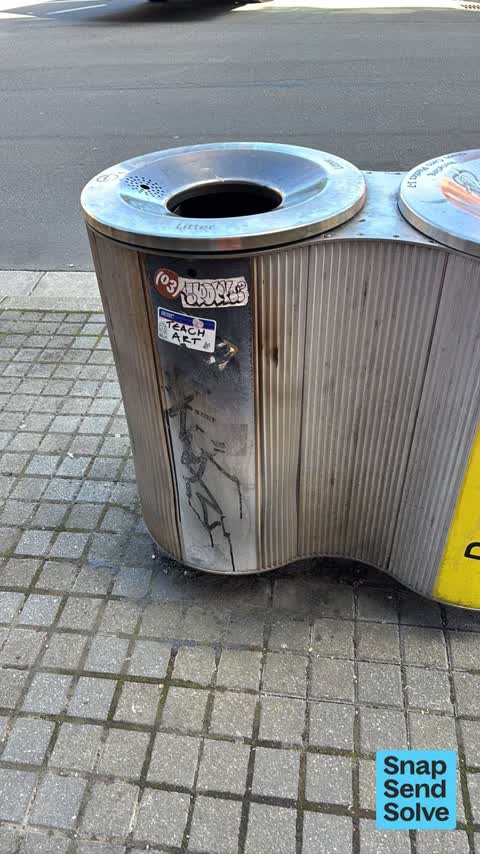
Black paint and sticky tags on litter bin near 84 Lichfield Street.
 Graffiti on a fence, building or structure —
Graffiti on bus exchange all in a row
 General Request —
Grocery Clearance Store abandoned trolley
 Graffiti on a bus stop or public toilet —
Graffiti outside Bus interchange on Litchfield Street
 Graffiti on a bus stop or public toilet —
Graffiti outside Bus Interchange on Lichfield street
 Graffiti on a traffic light pole or cabinet, or wa —
Black and brown paint tags on ATSC4 traffic controller by 84 Lichfield Street
 Graffiti on a fence, building or structure —
 Graffiti on a fence, building or structure —
 Graffiti on a bus stop or public toilet —
 Graffiti on a bus stop or public toilet —
 Graffiti somewhere else —
 Graffiti on a cabinet, pole or railway asset —
 Graffiti on a fence, building or structure —
old brickbuilding next tobus exchange
 Graffiti on a bus stop or public toilet —
Rampant graffiti in bus interchange toilets
 Graffiti somewhere else —
Bus terminal public toilets have graffiti on sink and back of the door, hard to see in photo
 Graffiti —
White paint tag on top of litter bin near 84 Lichfield Street.
 Graffiti —
Mauve, black and white paint tags on 2 bin tops at 84 Lichfield Street.
 Graffiti —
End stall at bus interchange
- Graffiti —
- Graffiti —
- Graffiti —
- Graffiti —
 Accessibility —
Disabled toilet Bus exchange Damaged wall tiles
- Graffiti —
Graffiti noted on the underpass on main North Rd heading from Belfast to chanyes cnr
 Graffiti —
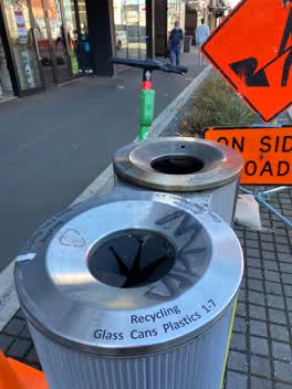
Black paint tag on steel lid of rubbish bin by Boardertown on Lichfield Street.
 Graffiti —
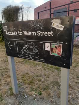
you have to think about putting the sign up much higher it's been graffiti many times or not have it at all
Also reported on Lichfield Street
- 160 Lichfield Street — 37 reports
- 90 Lichfield Street — 25 reports
- 71 Lichfield Street — 25 reports
- 116 Lichfield Street — 22 reports
- 60 Lichfield Street — 19 reports
- 140 Lichfield Street — 19 reports
- 81 Lichfield Street — 18 reports
- 75 Lichfield Street — 18 reports
The street’s crash record
NZTA’s record names Lichfield Street in 71 crashes that hurt somebody since 2006 — 14 seriously hurt, nobody killed.
The green nearby
- City Mall — 117 m to the edge
- Excelsior Hotel Reserve — 132 m to the edge · Botanic
- High Street Triangles — 139 m to the edge
- The Stewart Plaza — 218 m to the edge
- Cathedral Square — 338 m to the edge · Botanic
Parks within half a kilometre, measured to the boundary — the council’s open data.
The civic shelf nearby
- Re:start - Lichfield St — 175 m away · Car park
- Triangle — 184 m away · Car park
- Turanga Library — 466 m away · Library · Cathedral Square, Christchurch
- St Asaph — 490 m away · Car park
Libraries, halls and the rest within half a kilometre — the council’s open data.
On the doorstep
- TimeZoneOne Advertising Agency — 22 m away · Business
- ElectrifyNZ — 24 m away · Business
- Boardertown — 28 m away · Business
- Pilgrim — 29 m away · Cafés
Businesses within four hundred metres, measured at the pin — OpenStreetMap and the council directories.
The bus nearby
- Bus Interchange (Platform D) — 24 m away · route 1, route 7, route 8, route 27, route 44, route 91, route 92, route 95
- Bus Interchange (Platform C) — 42 m away · route 3, route 5, route 29, route 60, route 80, route 81, route 84, route 85, route 86
The closest Metro stops, within four hundred and fifty metres.
The tracks through here
- Walk and bike track through Christchurch Central City — 117 m to the line · walk · bike
- Walk and bike track through Christchurch Central City — 121 m to the line · walk · bike
- Walk and bike track through Christchurch Central City — 268 m to the line · walk · bike
- Walk and bike track through Christchurch Central City — 367 m to the line · walk · bike
- Walk and bike track through Christchurch Central City — 370 m to the line · walk · bike
Tracks whose line passes within half a kilometre, measured to the line itself — the council’s open data.
The named ground
Named water within 500 m of this address, measured to the line or the edge; Named places within 1.5 km of this address; the council’s own structure register — bridges, boardwalks and steps standing nearby — the open map’s record.
The remembered names nearby
- Te Kiheru Wai o Tahu / the Canoe Bailer of Tahu / 2015 — 117 m away ·
Te Kiheru Wai o Tahu / The Canoe Bailer of Tahu / 2015 / (MÄori text and English translat
· 2015 - The First Public Water Supply Well Was Drilled Near This — 230 m away ·
THE FIRST PUBLIC WATER SUPPLY WELL was drilled near this site on 10 February 1864 by the C
· 2009 - ‘corgis on High’ — Christchurch City Public Artwork — 236 m away ·
‘Corgis on High’ — Christchurch City public artwork, 6 December 2003
· 2009
Inscribed plaques within two hundred and fifty metres — the register’s pins, not surveyed spots. The whole roll is at /plaques.
Renting nearby
new bonds in Christchurch Central City ran about $508 a week — $42 below the city median of $550 — the suburb page keeps the rent record →.
What was here — Commercial Building and Setting, Former Sargood Son and Ewen
50 m away · 92 Lichfield Street · located to ±28 m · the place’s own record →
On the register. Nothing researched here yet.
What was here — Commercial Building and Setting, Former Wellington Woollen Mills Manufacturing Company
68 m away · 96 Lichfield Street · located to ±28 m · the place’s own record →
On the register. Nothing researched here yet.
What was here — Commercial Building and Setting
71 m away · 225 High Street · located to ±19 m · the place’s own record →
On the register. Nothing researched here yet.
What was here — Triangle Reserve and Setting
107 m away · 192F High Street · located to ±17 m · the place’s own record →
On the register. Nothing researched here yet.
What was here — Triangle Reserve and Setting
111 m away · 220F High Street · located to ±17 m · the place’s own record →
On the register. Nothing researched here yet.
The civic layer
This ground votes in Central ward — the Papanui-Innes-Central community board. Ward lines don’t always follow suburb lines; this one is measured at the pin, not the suburb’s centre.
What stood on this ground → · On the map → · From the air — the Crown’s aerials back to 1936; search the address on RetroLens →
Questions, answered briefly
27 council reports on record since February 2021 — most often graffiti (10), graffiti on a fence, building or structure (5), graffiti on a bus stop or public toilet (5).
Christchurch Central City, Christchurch — on Lichfield Street.
The heritage register names 5 places at or beside it — Commercial Building and Setting, Former Sargood Son and Ewen, Commercial Building and Setting, Former Wellington Woollen Mills Manufacturing Company.
City Mall — 117 m to its edge.