85 Armagh Street, Christchurch Central City
25 reports on record since December 2020 · 20 with photographs. The street’s heaviest record is 177 Armagh Street — 266 reports on file. Indicative rating valuation and school zones, hazards, bin day and what stood here before.
What gets reported here
Photographed here 20 on record




Reported here
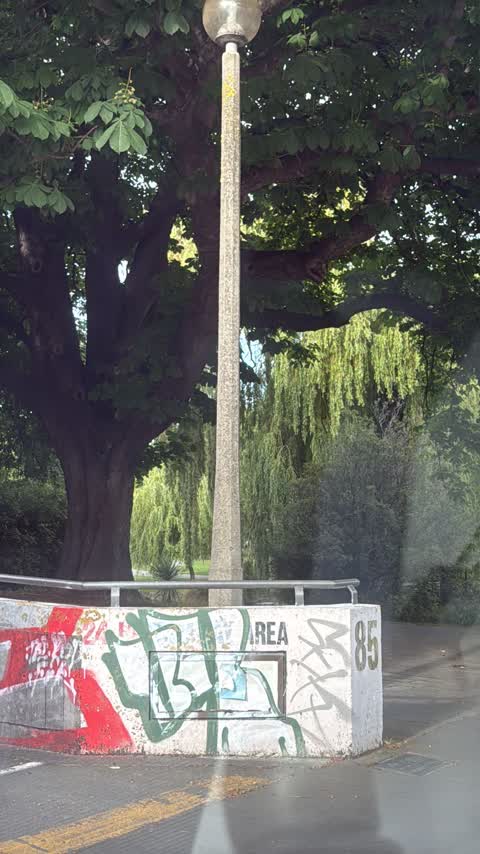
 Graffiti on a fence, building or structure —
 Tramway General —
White paint tag on tramlines pole 93 by 85 Armagh Street.
 Pest / Vermin —
Waasp nest spotted in hedging between Millies House Preschool and The Avon River. Nest opposite information board, at bottom of hedge - you
 Graffiti on a sign, mural or public art —
Graffiti on sign board
 Graffiti on a fence, building or structure —
Graffiti on wall
 Graffiti on a fence, building or structure —
Graffiti Across the side of the building.
 Graffiti on a fence, building or structure —
Graffiti Across side of the fence
 Graffiti on a fence, building or structure —
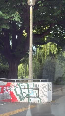
Graffiti on fence
- Graffiti on a fence, building or structure —
Graffiti on fence
- Pavement - General —
blocked road drain
 Graffiti on a fence, building or structure —
Graffiti across the side of the building.
 Graffiti on a fence, building or structure —
Silver paint tag on anonymous asset on a concrete wall facing the footpath at 85 Armagh Street.
 Graffiti on a fence, building or structure —
Graffiti on ccc managed lamp post pole
 Graffiti on a fence, building or structure —
 Graffiti on a fence, building or structure —
 Graffiti somewhere else —
 Graffiti somewhere else —
Fence
 Graffiti somewhere else —
 Park - General Request —
Commemorative park has been pulled up and removed from in front of the horse watering ramp in Victoria Square close to Armagh St Bridge
 Graffiti —
- Trees - General —
- Fallen Tree —
- Fallen Tree —
 Graffiti —
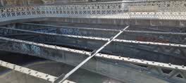
Victoria Square Hamish Hay Bridge
 Roading/Streets —
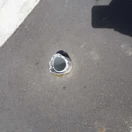
old pole base sticking up in pavement. very dangerous, sharp and sticking out 10 cm
Also reported on Armagh Street
- 177 Armagh Street — 266 reports
- 90 Armagh Street — 234 reports
- 163 Armagh Street — 116 reports
- 167 Armagh Street — 109 reports
- 89 Armagh Street — 107 reports
- 88 Armagh Street — 89 reports
- 199 Armagh Street — 74 reports
- 161 Armagh Street — 63 reports
The street’s crash record
NZTA’s record names Armagh Street in 86 crashes that hurt somebody since 2006 — 13 seriously hurt, nobody killed.
The green nearby
- Victoria Square — 32 m to the edge · Botanic · 2 ha
- Canterbury Provincial Council Reserve — 37 m to the edge · Botanic
- Cranmer Square — 272 m to the edge · Botanic · 2 ha
- Godley Statue Reserve — 275 m to the edge · Botanic
- Cathedral Square — 276 m to the edge · Botanic
Parks within half a kilometre, measured to the boundary — the council’s open data.
The civic shelf nearby
- Aldersgate — 119 m away · Car park
- Armagh St — 134 m away · Car park
- Turanga Library — 281 m away · Library · Cathedral Square, Christchurch
- Civic Offices — 430 m away · Council office
Libraries, halls and the rest within half a kilometre — the council’s open data.
On the doorstep
- Millie's House — 24 m away · Childcare
- Prison Escape — 42 m away · Attractions
- Ice Cream Charlie — 74 m away · Fast food
- Quake City — 89 m away · Museums
Businesses within four hundred metres, measured at the pin — OpenStreetMap and the council directories.
The bus nearby
- Kilmore Street Town Hall — 213 m away · route 1, route 29, route 95
- Kilmore St near Manchester St — 354 m away · route 1, route 27, route 29, route 95
The closest Metro stops, within four hundred and fifty metres.
The tracks through here
- Walk and bike track through Christchurch Central City — 30 m to the line · walk · bike
- Walk and bike track through Christchurch Central City — 51 m to the line · walk · bike
- Walk and bike track through Christchurch Central City — 172 m to the line · walk · bike
- Walk and bike track through Christchurch Central City — 225 m to the line · walk · bike
- Walk and bike track through Christchurch Central City — 272 m to the line · walk · bike
Tracks whose line passes within half a kilometre, measured to the line itself — the council’s open data.
The named ground
Named water within 500 m of this address, measured to the line or the edge; Named places within 1.5 km of this address; the council’s own structure register — bridges, boardwalks and steps standing nearby — the open map’s record.
The remembered names nearby
- Ettie Rout 1877–1936 Guardian Angel of the ANZAC — 44 m away ·
ETTIE ROUT 1877–1936 GUARDIAN ANGEL OF THE ANZAC
· 2009 - This Ramp, to Facilitate the Watering of Horses, Was Built — 50 m away ·
THIS RAMP, TO FACILITATE THE WATERING OF HORSES, WAS BUILT IN DECEMBER 1874. / CHRISTCHURC
· 2026 - The Weeping Willows of Christchurch to Commemorate — 56 m away ·
THE WEEPING WILLOWS OF CHRISTCHURCH TO COMMEMORATE / FRANCOIS LE LIEVRE / WHO FIRST CAME T
· 2026
Inscribed plaques within two hundred and fifty metres — the register’s pins, not surveyed spots. The whole roll is at /plaques.
Renting nearby
new bonds in Christchurch Central City ran about $508 a week — $42 below the city median of $550 — the suburb page keeps the rent record →.
What was here — Former Magistrates Court and Setting
25 m away · 85 Armagh Street · located to ±21 m · the place’s own record →
On the register. Nothing researched here yet.
What was here — Armagh Street Bridge and Setting
33 m away · located to ±18 m · the place’s own record →
On the register. Nothing researched here yet.
What was here — Horse Watering Ramp and Setting
45 m away · located to ±7 m · the place’s own record →
On the register. Nothing researched here yet.
What was here — Armagh Street Kerbstones and Setting
50 m away · 280A Durham Street North · located to ±26 m · the place’s own record →
On the register. Nothing researched here yet.
What was here — Canterbury Provincial Council Buildings Former Land Transfer Office
54 m away · 86 Armagh Street · located to ±15 m · the place’s own record →
On the register. Nothing researched here yet.
The civic layer
This ground votes in Central ward — the Papanui-Innes-Central community board. Ward lines don’t always follow suburb lines; this one is measured at the pin, not the suburb’s centre.
What stood on this ground → · On the map → · From the air — the Crown’s aerials back to 1936; search the address on RetroLens →
Questions, answered briefly
25 council reports on record since December 2020 — most often graffiti on a fence, building or structure (11), graffiti somewhere else (3), graffiti (2).
Christchurch Central City, Christchurch — on Armagh Street.
The heritage register names 5 places at or beside it — Former Magistrates Court and Setting, Armagh Street Bridge and Setting.
Victoria Square — 32 m to its edge, 2 ha.