86 Armagh Street, Christchurch Central City
33 reports on record since September 2020 · 28 with photographs. The street’s heaviest record is 177 Armagh Street — 266 reports on file. Indicative rating valuation and school zones, hazards, bin day and what stood here before.
What gets reported here
Photographed here 28 on record



Reported here
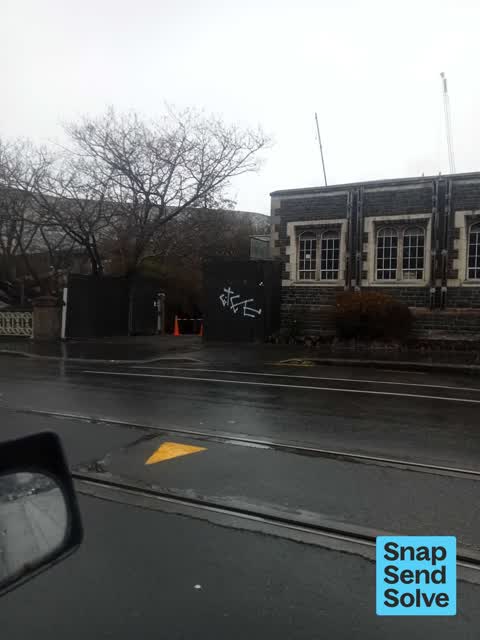
 Graffiti on a fence, building or structure —
 graffiti on green tin fence
 Graffiti on a fence, building or structure —
 graffiti on green tin fence
 Graffiti on a fence, building or structure —
 graffiti on green fence
 Graffiti on a fence, building or structure —
 EKOE white paint tag on concrete bridge post by 86 Armagh Street.
 Graffiti on a fence, building or structure —
 graffiti on green fence
 Pavement - General —
 Missing cycle hoop but bolts still in pavement causing trip hazard. (I tripped).
 Flooding —
 Flooding on road, happens every time it rains. Multiple snaps sent!
 Graffiti on a fence, building or structure —
 Graffiti on a wall
 Graffiti on a road, footpath or bridge —
 Tagging on bridge support. Some on other side of bridge too.
 Facility - General Request —
 Anti skateboarding divots on top edge of stone seat have been “filled” to enable skateboard tricks! Second occurrence in this location.
 Flooding —
 Continual flooding in this area after rain.
 Street Gutters / Storm Water —
 Flooding on the road blocking asses to a gas valve so is a large H&S risk also causes issues on a bad storm as it blocks the lane fully
 Graffiti on a fence, building or structure —
 Silver paint tag on top rail of Gloucester Street bridge over the River Avon by Cambridge Terrace.
 Graffiti on a fence, building or structure —
 Red paint tag on River Avon bridge a tad east of Gloucester and Cambridge Terrace.
 Flooding —
 Drained a bit now but always fills up when it rains , grate under water isn't blocked at road level
 Street Gutters / Storm Water —
 Blocked drain here, creates surface flooding whenever it rains
 Park - General Request —
 Lime scooter in the river - reported last week to lime - still there
 Graffiti somewhere else —
  Graffiti somewhere else —
  Graffiti somewhere else —
  Graffiti somewhere else —
  Graffiti somewhere else —
  Graffiti somewhere else —
 Parks team couldn’t remove
 Graffiti somewhere else —
  Graffiti on a sign, mural or public art —
 Silver paint tag on security sign (!) facing the footpath by 86 Armagh Street.
 Graffiti on a fence, building or structure —
  Animal - Deceased —
 There are at least 7 dead pigeons on the gravel & grass in the Te Pae Convention Centre reserve, between Te Pae & Cathedral Sq that is being
- Graffiti —
- Graffiti —
- Graffiti —
- Graffiti —
- Graffiti —
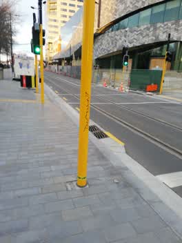 Graffiti —
 On the traffic light pole
Also reported on Armagh Street
- 177 Armagh Street — 266 reports
- 90 Armagh Street — 234 reports
- 163 Armagh Street — 116 reports
- 167 Armagh Street — 109 reports
- 89 Armagh Street — 107 reports
- 88 Armagh Street — 89 reports
- 199 Armagh Street — 74 reports
- 161 Armagh Street — 63 reports
The street’s crash record
NZTA’s record names Armagh Street in 86 crashes that hurt somebody since 2006 — 13 seriously hurt, nobody killed.
The green nearby
- Canterbury Provincial Council Reserve — you are in it · Botanic
- Victoria Square — 57 m to the edge · Botanic · 2 ha
- Godley Statue Reserve — 227 m to the edge · Botanic
- Scott Statue Reserve — 227 m to the edge · Botanic
- Cathedral Square — 237 m to the edge · Botanic
Parks within half a kilometre, measured to the boundary — the council’s open data.
The civic shelf nearby
- Armagh St — 139 m away · Car park
- Aldersgate — 150 m away · Car park
- Turanga Library — 257 m away · Library · Cathedral Square, Christchurch
- Civic Offices — 373 m away · Council office
- Triangle — 471 m away · Car park
Libraries, halls and the rest within half a kilometre — the council’s open data.
On the doorstep
- Millie's House — 52 m away · Childcare
- Prison Escape — 55 m away · Attractions
- Te Pae Convention Centre — 71 m away · Business
- Curious Palate Cafe & Bistro — 74 m away · Cafés
Businesses within four hundred metres, measured at the pin — OpenStreetMap and the council directories.
The bus nearby
- Kilmore Street Town Hall — 274 m away · route 1, route 29, route 95
- Kilmore St near Manchester St — 401 m away · route 1, route 27, route 29, route 95
The closest Metro stops, within four hundred and fifty metres.
The tracks through here
- Walk and bike track through Christchurch Central City — 30 m to the line · walk · bike
- Walk and bike track through Christchurch Central City — 46 m to the line · walk · bike
- Walk and bike track through Christchurch Central City — 111 m to the line · walk · bike
- Walk and bike track through Christchurch Central City — 212 m to the line · walk · bike
- Walk and bike track through Christchurch Central City — 223 m to the line · walk · bike
Tracks whose line passes within half a kilometre, measured to the line itself — the council’s open data.
The named ground
Named water within 500 m of this address, measured to the line or the edge; Named places within 1.5 km of this address; the council’s own structure register — bridges, boardwalks and steps standing nearby — the open map’s record.
The remembered names nearby
- Ettie Rout 1877–1936 Guardian Angel of the ANZAC — 73 m away ·
ETTIE ROUT 1877–1936 GUARDIAN ANGEL OF THE ANZAC
· 2009 - Provincial Council Building 1865 — Canterbury Centenary — 74 m away ·
PROVINCIAL COUNCIL BUILDING 1865 — Canterbury Centenary plaque
· 2009 - Gifted to the City by the Descendants — 89 m away ·
GIFTED TO THE CITY BY THE DESCENDANTS OF / STEPHEN AND REBECCA BROOKER / OCTOBER 1991 / BR
· 2018
Inscribed plaques within two hundred and fifty metres — the register’s pins, not surveyed spots. The whole roll is at /plaques.
Renting nearby
new bonds in Christchurch Central City ran about $508 a week — $42 below the city median of $550 — the suburb page keeps the rent record →.
What was here — Canterbury Provincial Council Buildings Former Land Transfer Office
on this spot · 86 Armagh Street · located to ±15 m · the place’s own record →
On the register. Nothing researched here yet.
What was here — Armagh Street Kerbstones and Setting
33 m away · 280A Durham Street North · located to ±26 m · the place’s own record →
On the register. Nothing researched here yet.
What was here — Canterbury Provincial Council Buildings Courtyard/Grounds
on this spot · 280 Durham Street North · located to ±64 m · the place’s own record →
On the register. Nothing researched here yet.
What was here — Canterbury Provincial Council Buildings
on this spot · 280 Durham Street North · located to ±51 m · the place’s own record →
On the register. Nothing researched here yet.
What was here — Armagh Street Bridge and Setting
42 m away · located to ±18 m · the place’s own record →
On the register. Nothing researched here yet.
The civic layer
This ground votes in Central ward — the Papanui-Innes-Central community board. Ward lines don’t always follow suburb lines; this one is measured at the pin, not the suburb’s centre.
What stood on this ground → · On the map → · From the air — the Crown’s aerials back to 1936; search the address on RetroLens →
Questions, answered briefly
33 council reports on record since September 2020 — most often graffiti on a fence, building or structure (9), graffiti somewhere else (7), graffiti (6).
Christchurch Central City, Christchurch — on Armagh Street.
The heritage register names 5 places at or beside it — Canterbury Provincial Council Buildings Former Land Transfer Office, Armagh Street Kerbstones and Setting.
Canterbury Provincial Council Reserve — the address is inside it.