1010B Ferry Road
10 council reports since June 2017, 8 carrying a photograph. The street’s heaviest record is 982 Ferry Road, 63 reports on file.
From the air, then
Sourced from Canterbury Maps and partners. RNZAF, CC BY 3.0 NZ. Each frame is cut from Environment Canterbury’s historic imagery MapServer for that decade, only where the Footprints layer names a CC BY survey (NZAM-covered spots stay out). RetroLens holds more Crown aerials →
The green nearby
- Settlers Reserve, 120 m to the edge · 13 ha
- Charlesworth Reserve, 215 m to the edge · Regional · 24 ha
- Ferry Esplanade Reserve, 232 m to the edge · 1 ha
- Ferrymead Park, 331 m to the edge · Regional · 77 ha
Parks within half a kilometre, measured to the boundary, the council’s open data. The whole roll is at /parks.
On the doorstep
- Food Factory Seconds Shop Ferrymead, 19 m away · Delis
- Visions & Vino Arts and Entertainment Studio, 25 m away · Attractions
- Cafe Elly, 40 m away · Cafés
- de Spa Chocolatier Factory Shop Showroom, 41 m away · Delis
Businesses within four hundred metres, measured at the pin, OpenStreetMap and the council directories.
The bus nearby
- Ferrymead Shops, 37 m away · route 3, route 140, route 155
- Ferrymead Shops, 82 m away · route 3, route 140, route 155
The closest Metro stops, within four hundred and fifty metres.
The tracks through here
- Walk and bike track through Ferrymead, 3 m to the line · walk · bike
- Walk and bike track through Ferrymead, 60 m to the line · walk · bike
- Walk and bike track through Ferrymead, 109 m to the line · walk · bike
- Walk and bike track through Ferrymead, 170 m to the line · walk · bike
- Walk and bike track through Ferrymead, 219 m to the line · walk · bike
Tracks whose line passes within half a kilometre, the council’s open data.
The named ground
Named water within 500 m of this address, measured to the line or the edge; the council’s own structure register, bridges, boardwalks and steps standing nearby, the open map’s record.
What gets reported here
Photographed here 8 on record



What’s on record
 Roads - General, 22 Mar 2026
 The yellow lines have been painted over . Right outside Soulful coffee caravan. Need to put back as it is the start of the cycle lane . Had
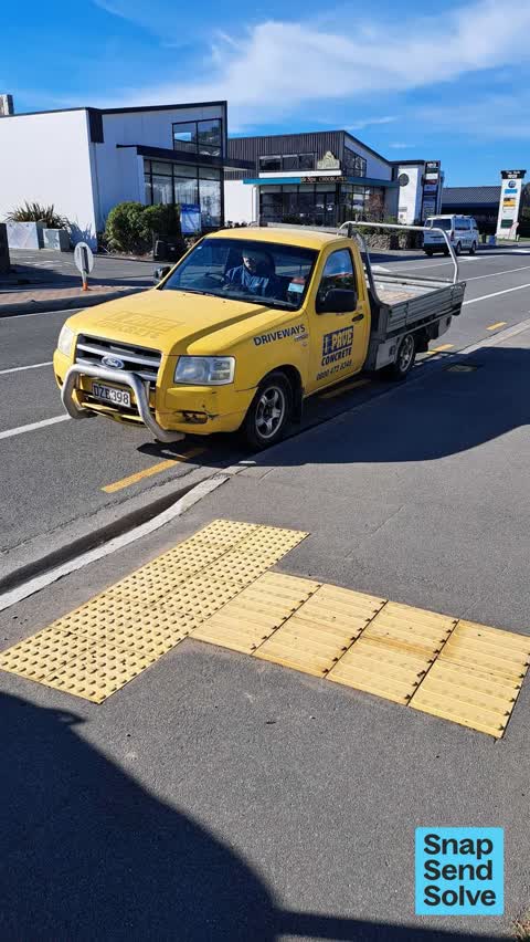
 Hazard, vehicle, 21 Jul 2025
 Car parked over yellow lines making access to road crossing difficult.
 Poles and Signage - General, 15 May 2025
 Is it possible to get the p30 extended to where the coffee shop is? And put in another series of byls at 1014? There is a traffic flow probl
 Roads - General, 5 Jan 2025
 Ped refuge hand rail bent
 Hazard, vehicle, 5 Sept 2024
 Van parked over access to crossing by Cpuntdown supermarket. Pkease prevent this by yellow barriers either side of lower kerbed area off foo
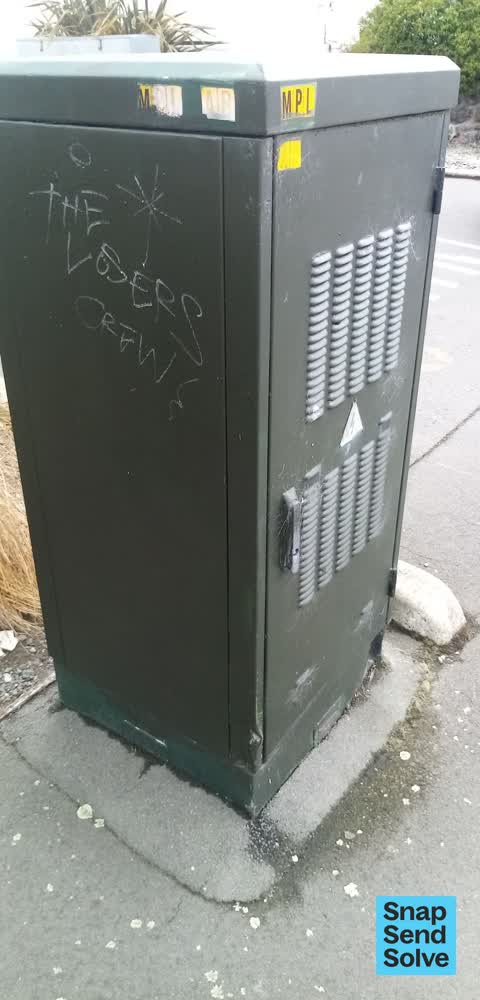
 Graffiti, 18 Mar 2024
 Graffiti, 18 Mar 2024
- Graffiti, 22 Mar 2023
- Water Leak, 10 Feb 2023
Roading/Streets, 15 Jun 2017
Possibly illegal road crossing at Cares Appliances
Elsewhere on Ferry Road
- 982 Ferry Road, 63 reports
- 992 Ferry Road, 40 reports
- 1070 Ferry Road, 31 reports
- 1005 Ferry Road, 25 reports
- 988 Ferry Road, 21 reports
- 1016 Ferry Road, 16 reports
- 960 Ferry Road, 14 reports
- 1105 Ferry Road, 14 reports
The street’s crash record
NZTA’s record names Ferry Road in 41 crashes that hurt somebody since 2006, 1 person killed, 11 seriously hurt.
The civic layer
This ground votes in Heathcote ward, the Spreydon-Cashmere-Heathcote community board is its local layer. Ward lines don’t always follow suburb lines; this one is measured at the pin, not the suburb’s centre. The whole roll is at /wards.
Ferry Road, the whole record → · Everything about Ferrymead → · What stood on this ground → · On the map → · From the air, RetroLens holds the Crown’s aerials back to 1936; search the address there →
Questions, answered briefly
10 council reports on record since June 2017, most often graffiti (3), roads - general (2), hazard, vehicle (2).
Ferrymead, Christchurch, on Ferry Road.
Nothing on the heritage register at this exact spot, the record around this ground →
Settlers Reserve, 120 m to its edge, 13 ha.