269 Bridle Path Road, Ferrymead
27 reports on record since January 2016 · 27 with photographs. The street’s heaviest record is 225 Bridle Path Road — 97 reports on file. Indicative rating valuation and school zones, hazards, bin day and what stood here before.
What gets reported here
- Graffiti — 5
- Dumped Rubbish — 4
- Water Leak — 2
- Rubbish/Recycling — 2
- Hazard — vehicle — 2
- Water General — 1
Photographed here 27 on record


Reported here
 Rubbish and Bins - General —
 The rubbish bin at the Ferrymead Bays Football ground is full and rubbish is being placed around it
 Dumped Rubbish —
 Rubbish
 Water General —
 Broken sprinkler
 Overgrown Vegetation —
 old man's beard seeding.
 Abandoned Vehicle —
 Abandoned and/or stolen car. Parked across footpath. Been here at least 24 hours. Rego/WoF from April 2025.
 Dumped Rubbish —
 Household rubbish dumped on side of the road. What a shame.
 Dumped Rubbish —
 dumped rubbish
 Public Toilet —
 Toilet at ferrymead park is overflowing
 Water Leak —
 Severe leak
 Water Leak —
 This may have already been reported? On Bridle Path Road there is a water leak. Thanks.
 Dumped Rubbish —
  Hazard — vehicle —
 Cars parked across the footpath
 Hazard — vehicle —
 Cars parked over footpath. Can we have signs it a fence to stop this
 Graffiti on a fence, building or structure —
 On an old toilet block?
 General Request —
 Ferrymead Park is getting a hybrid field with no upgrade to intercept plastic that will break down from the fibres. I then looked into this
 Graffiti somewhere else —
 On sign near bus stop on Bridle Path Road. New graffiti along with the others right nearby.
 Graffiti —
 Graffiti on toilet block
Parks —
car been here for several weeks.Wheels and other car parts slowly being stolen.
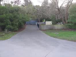 Graffiti —
 Graffiti on closed toilet block by ferrymead tramway yard
 Graffiti —
 graffiti in Male toilet
Flooding —
L Water running from drain cover on walkway beside sports park and sheds. Smells putrid, sewerage?
Roading/Streets —
almost broke my front wheel when driving over these potholes in the dark. very deep.
Pothole —
Holes forming at entrances, on bends and in intersections all along Ferrymead Park Drive.
Rubbish/Recycling —
Rubbish/Recycling —
Graffiti —
Graffiti —
Also reported on Bridle Path Road
- 225 Bridle Path Road — 97 reports
- 256 Bridle Path Road — 40 reports
- 289 Bridle Path Road — 31 reports
- 275 Bridle Path Road — 22 reports
- 279 Bridle Path Road — 20 reports
- 271 Bridle Path Road — 20 reports
- 281 Bridle Path Road — 12 reports
- 270 Bridle Path Road — 11 reports
The street’s crash record
NZTA’s record names Bridle Path Road in 12 crashes that hurt somebody since 2006 — 1 person killed, 4 seriously hurt.
The green nearby
- Cannon Hill Reserve — 84 m to the edge · 3 ha
- Ferrymead Reserve — 246 m to the edge · Botanic · 1 ha
- Settlers Reserve — 388 m to the edge · 13 ha
- Ferrymead Park — 411 m to the edge · Regional · 77 ha
- Old School Reserve — 456 m to the edge · 3 ha
Parks within half a kilometre, measured to the boundary — the council’s open data.
On the doorstep
- Ferrymead Night Market — 75 m away · Markets
Businesses within four hundred metres, measured at the pin — OpenStreetMap and the council directories.
The bus nearby
- Bridle Path Rd near Ferrymead Park Dr — 140 m away · route 155
- Bridle Path Rd near Ferrymead Park Dr — 242 m away · route 155
The closest Metro stops, within four hundred and fifty metres.
The named ground
Named water within 500 m of this address, measured to the line or the edge; the council’s own structure register — bridges, boardwalks and steps standing nearby — the open map’s record.
The remembered names nearby
- Ferrymead / Christchurch — 103 m away ·
FERRYMEAD / CHRISTCHURCH
· 2013 - Christchurch / City Council Your People Your City — 119 m away ·
CHRISTCHURCH / CITY COUNCIL YOUR PEOPLE YOUR CITY
· 2013
Inscribed plaques within two hundred and fifty metres — the register’s pins, not surveyed spots. The whole roll is at /plaques.
The civic layer
This ground votes in Heathcote ward — the Spreydon-Cashmere-Heathcote community board. Ward lines don’t always follow suburb lines; this one is measured at the pin, not the suburb’s centre.
What stood on this ground → · On the map → · From the air — the Crown’s aerials back to 1936; search the address on RetroLens →
Questions, answered briefly
27 council reports on record since January 2016 — most often graffiti (5), dumped rubbish (4), water leak (2).
Ferrymead, Christchurch — on Bridle Path Road.
Nothing on the heritage register at this exact spot — the record around this ground →
Cannon Hill Reserve — 84 m to its edge, 3 ha.