289 Bridle Path Road, Ferrymead
31 reports on record since January 2018 · 16 with photographs. The street’s heaviest record is 225 Bridle Path Road — 97 reports on file. Indicative rating valuation and school zones, hazards, bin day and what stood here before.
What gets reported here
- Dumped Rubbish — 5
- Damaged Road — 5
- Roading/Streets — 4
- Fallen Tree — 4
- Rubbish/Recycling — 3
- Park - General Request — 3
Photographed here 16 on record


Reported here
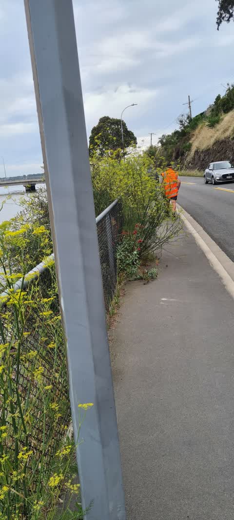
 Overgrown Vegetation —
 vegetation along this narrow strip of road if forcing cyclists out infront of cars
 Dumped Rubbish —
 Dumped Bike Frame
 Fallen Tree —
 limb off this Ngaio requires removal.
 Park - General Request —
 Bollard is broken
 Fallen Tree —
 - Fallen Tree —
 Park - General Request —
 This requires some attention. Wind has blown these cardboard covers about - some into the river... also lots of blown rubbish too. Thanks
 Dumped Rubbish —
 See photo
 Dumped Rubbish —
  Damaged Road —
 There is a lump of concrete that has caused myself to crash my scooter and end up in A&E mid this week. After talking to few locals they h
- Dumped Rubbish —
- Trees - General —
- Park - General Request —
- Trees - General —
- Fallen Tree —
- Dumped Rubbish —
- Damaged Road —
- Damaged Road —
- Damaged Road —
- Damaged Road —
- Litter —
- Graffiti —
 Roading/Streets —
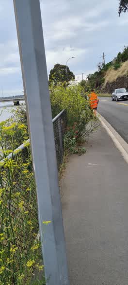
 Sections of the footpath are blocked by overgrowth along this section of road
- Roading/Streets —
Broom growing alongside the fence needs to be trimmed
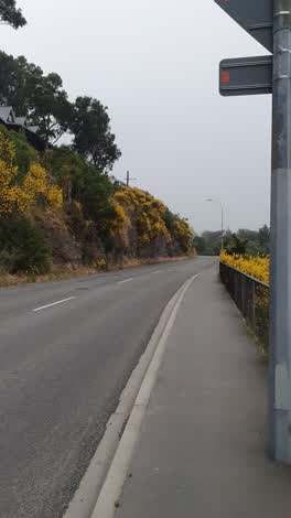 Roading/Streets —
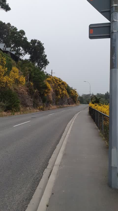
 I think Bridle Path road has been neglected. Eg. Broom and Gorse growing on a suburban street? Could this be attended to please?
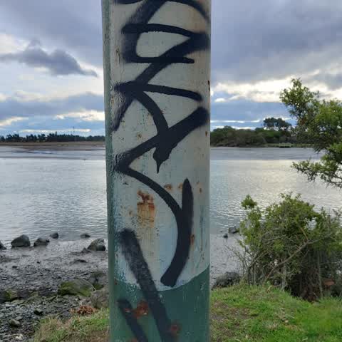
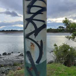 Graffiti —
 Power pole by 285 bridle path rd
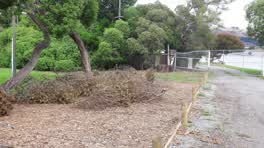 Parks —
 Pruning incomplete (or unauthorised) on reserve.
- Rubbish/Recycling —
dumped on roadside
Rubbish/Recycling —
285
Rubbish/Recycling —
Discarded half car body
Roading/Streets —
This pothole, extending out from the edge of the road, is getting better quite quickly.
Also reported on Bridle Path Road
- 225 Bridle Path Road — 97 reports
- 256 Bridle Path Road — 40 reports
- 269 Bridle Path Road — 27 reports
- 275 Bridle Path Road — 22 reports
- 279 Bridle Path Road — 20 reports
- 271 Bridle Path Road — 20 reports
- 281 Bridle Path Road — 12 reports
- 270 Bridle Path Road — 11 reports
The street’s crash record
NZTA’s record names Bridle Path Road in 12 crashes that hurt somebody since 2006 — 1 person killed, 4 seriously hurt.
The green nearby
- Ferrymead Reserve — 13 m to the edge · Botanic · 1 ha
- Settlers Reserve — 132 m to the edge · 13 ha
- Scott Park Ferrymead — 355 m to the edge · 2 ha
- Te Awakura Reserve — 396 m to the edge
- Cannon Hill Reserve — 470 m to the edge · 3 ha
Parks within half a kilometre, measured to the boundary — the council’s open data.
On the doorstep
- Ferrymead Dental Centre — 200 m away · Dentists
- Mount Pleasant Bed & Breakfast — 315 m away · B&Bs
- Claddagh — 354 m away · Bars & pubs
- Nobanno — 368 m away · Restaurants
Businesses within four hundred metres, measured at the pin — OpenStreetMap and the council directories.
The bus nearby
- Bridle Path Rd near Cannon Hill Cres — 199 m away · route 155
- Bridle Path Rd near Ferrymead Park Dr — 264 m away · route 155
The closest Metro stops, within four hundred and fifty metres.
The tracks through here
- Walk and bike track through Ferrymead — 190 m to the line · walk · bike
- Walk and bike track through Ferrymead — 336 m to the line · walk · bike
- Walk and bike track through Ferrymead — 336 m to the line · walk · bike
- Walk and bike track through Ferrymead — 383 m to the line · walk · bike
- Walk and bike track through Ferrymead — 411 m to the line · walk · bike
Tracks whose line passes within half a kilometre, measured to the line itself — the council’s open data.
The named ground
Named water within 500 m of this address, measured to the line or the edge; the council’s own structure register — bridges, boardwalks and steps standing nearby — the open map’s record.
The remembered names nearby
- New Zealand’S First Railway This Stone Marks the Site — 16 m away ·
NEW ZEALAND’S FIRST RAILWAY THIS STONE MARKS THE SITE OF FERRYMEAD WHARF AND RAILWAY STATI
· 2009
Inscribed plaques within two hundred and fifty metres — the register’s pins, not surveyed spots. The whole roll is at /plaques.
What was here — Dwelling and Setting, Ferrymead House
73 m away · 285 Bridle Path Road · located to ±9 m · the place’s own record →
On the register. Nothing researched here yet.
The civic layer
This ground votes in Heathcote ward — the Spreydon-Cashmere-Heathcote community board. Ward lines don’t always follow suburb lines; this one is measured at the pin, not the suburb’s centre.
What stood on this ground → · On the map → · From the air — the Crown’s aerials back to 1936; search the address on RetroLens →
Questions, answered briefly
31 council reports on record since January 2018 — most often dumped rubbish (5), damaged road (5), roading/streets (4).
Ferrymead, Christchurch — on Bridle Path Road.
The heritage register names a place at or beside it — Dwelling and Setting, Ferrymead House.
Ferrymead Reserve — 13 m to its edge, 1 ha.