279 Bridle Path Road, Ferrymead
20 reports on record since June 2017 · 16 with photographs. The street’s heaviest record is 225 Bridle Path Road — 97 reports on file. Indicative rating valuation and school zones, hazards, bin day and what stood here before.
What gets reported here
- Water Leak — 5
- Damaged Road — 4
- Sewer - Leak / Blockage — 2
- Rubbish/Recycling — 2
- Pothole — 1
- Pavement - Damaged — 1
Photographed here 16 on record


Reported here
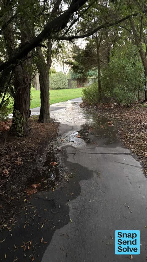
 Water Leak —
 Water leak
 Water Leak —
 Water leak coming from mains box
 Water Leak —
 Water leak
 Dumped Rubbish —
 Many empty wine bottles, broken wine bottles, empty cans, empty wine boxes, women’s boots and supermarket bags. Next to old toilet block.
 Damaged Road —
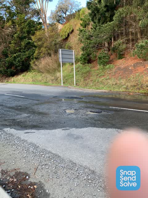
  Pothole —
 3 Small potholes. Repair before they get worse
 Water Leak —
 Water leak
 Sewer - Leak / Blockage —
 Sewage leaking from back of building
 Graffiti on a fence, building or structure —
 On water treatment tank?
 Sewer - Leak / Blockage —
 Water leaking from back of building, smells like sewage
 Graffiti somewhere else —
 On fence near bus stop on bridle path road.
- Damaged Road —
- Damaged Road —
- Damaged Road —
- Water Leak —
 Pavement - Damaged —
 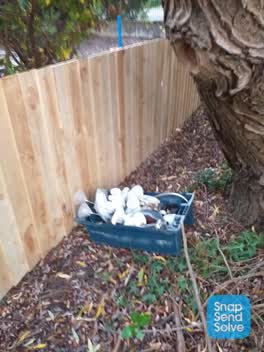 Rubbish/Recycling —
 Household stuff dumped by water treatment plant bridlepath road heathcote
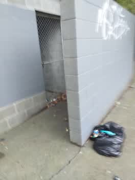 Rubbish/Recycling —
 Rubbish etc. In closed toilet looks like it's a shelter for someone
Graffiti —
Over weekend
Parks —
Damage to turf opposite to cannon hill cres
Also reported on Bridle Path Road
- 225 Bridle Path Road — 97 reports
- 256 Bridle Path Road — 40 reports
- 289 Bridle Path Road — 31 reports
- 269 Bridle Path Road — 27 reports
- 275 Bridle Path Road — 22 reports
- 271 Bridle Path Road — 20 reports
- 281 Bridle Path Road — 12 reports
- 270 Bridle Path Road — 11 reports
The street’s crash record
NZTA’s record names Bridle Path Road in 12 crashes that hurt somebody since 2006 — 1 person killed, 4 seriously hurt.
The green nearby
- Ferrymead Reserve — you are in it · Botanic · 1 ha
- Cannon Hill Reserve — 241 m to the edge · 3 ha
- Settlers Reserve — 288 m to the edge · 13 ha
- Old School Reserve — 459 m to the edge · 3 ha
Parks within half a kilometre, measured to the boundary — the council’s open data.
On the doorstep
- Mount Pleasant Bed & Breakfast — 227 m away · B&Bs
- Ferrymead Night Market — 281 m away · Markets
- Ferrymead Dental Centre — 393 m away · Dentists
Businesses within four hundred metres, measured at the pin — OpenStreetMap and the council directories.
The bus nearby
- Bridle Path Rd near Ferrymead Park Dr — 37 m away · route 155
- Bridle Path Rd near Cannon Hill Cres — 53 m away · route 155
The closest Metro stops, within four hundred and fifty metres.
The tracks through here
- Walk and bike track through Ferrymead — 383 m to the line · walk · bike
Tracks whose line passes within half a kilometre, measured to the line itself — the council’s open data.
The named ground
Named water within 500 m of this address, measured to the line or the edge; the council’s own structure register — bridges, boardwalks and steps standing nearby — the open map’s record.
The remembered names nearby
- Christchurch / City Council Your People Your City — 158 m away ·
CHRISTCHURCH / CITY COUNCIL YOUR PEOPLE YOUR CITY
· 2013 - Ferrymead / Christchurch — 174 m away ·
FERRYMEAD / CHRISTCHURCH
· 2013 - New Zealand’S First Railway This Stone Marks the Site — 212 m away ·
NEW ZEALAND’S FIRST RAILWAY THIS STONE MARKS THE SITE OF FERRYMEAD WHARF AND RAILWAY STATI
· 2009
Inscribed plaques within two hundred and fifty metres — the register’s pins, not surveyed spots. The whole roll is at /plaques.
What was here — Dwelling and Setting, Ferrymead House
169 m away · 285 Bridle Path Road · located to ±9 m · the place’s own record →
On the register. Nothing researched here yet.
The civic layer
This ground votes in Heathcote ward — the Spreydon-Cashmere-Heathcote community board. Ward lines don’t always follow suburb lines; this one is measured at the pin, not the suburb’s centre.
What stood on this ground → · On the map → · From the air — the Crown’s aerials back to 1936; search the address on RetroLens →
Questions, answered briefly
20 council reports on record since June 2017 — most often water leak (5), damaged road (4), sewer - leak / blockage (2).
Ferrymead, Christchurch — on Bridle Path Road.
The heritage register names a place at or beside it — Dwelling and Setting, Ferrymead House.
Ferrymead Reserve — the address is inside it, 1 ha.