50 Ferrymead Park Drive, Ferrymead
33 reports on record since December 2016 · 25 with photographs. The street’s heaviest record is 101 Ferrymead Park Drive — 73 reports on file. Indicative rating valuation and school zones, hazards, bin day and what stood here before.
What gets reported here
- Roading/Streets — 5
- Graffiti — 5
- Rubbish/Recycling — 4
- Dumped Rubbish — 4
- Wastewater/Stormwater — 3
- General Request — 2
Photographed here 25 on record


Reported here
 Rubbish and Bins - General —
 Damaged recycling bin. hit by car.
 Graffiti on a sign, mural or public art —
  Fallen Tree —
 Tree has been blown over. now blocking drain.
 General Request —
 chain that locks the boating area has been stolen
 Dumped Rubbish —
 some cretin dumped 2 big bags
 Water General —
 Our 3 year old stepped straight into this hole in the grating. He’s ok but could have been very nasty as home is bigger than his foot or bot
 Dumped Rubbish —
  General Request —
 My partner uses a disability scooter The drainpipe approach is too high for the scooter. Please build up the path at the approach to each s
 Vandalism - General —
 Someone did serious burnouts in this carpark. Lots of pieces of tyres and bit of car remain.
- Litter —
- Street Gutters / Storm Water —
- Abandoned Vehicle —
- Dumped Rubbish —
- Graffiti —
 Flooding —
 Gates need opening to let water out, to lower lake level, as flooding around the lake
 Graffiti —
 Graffiti on signage
- Street Light Outage —
Light outside Silos Cafe Port Hills Road has been out for two weeks now.
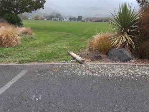
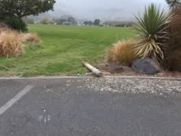 Roading/Streets —
 Yesterday morning I was at Ferrymead Park and came across a bollard that had been removed by some one. It appears to have been pulled from t
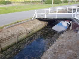 Wastewater/Stormwater —
 The wall of the drain is leaning into the drain a lot and a board has sprung out.
 Dumped Rubbish —
 car parts dumped at ferrymead car park by heritage park
Graffiti —
Roading/Streets —
Main parking/car park entrance sign knocked down. Needs to be concreted in solidly to withstand vandals.
Roading/Streets —
sign knocked down.
Roading/Streets —
Roadside knocked down by rail crossing.
Roading/Streets —
Give Way sign on ground beside Heritage Park office
Rubbish/Recycling —
Rubbish dumped on side of road
Rubbish/Recycling —
In car park
Rubbish/Recycling —
Don't say you cannot track this offender. Stupid enough to leave lots of ID.
Rubbish/Recycling —
Graffiti —
Graffiti —
- Wastewater/Stormwater —
Water bubbling out of ground next to railway line
- Wastewater/Stormwater —
Also reported on Ferrymead Park Drive
- 101 Ferrymead Park Drive — 73 reports
- 121 Ferrymead Park Drive — 64 reports
- 81 Ferrymead Park Drive — 31 reports
- 68 Ferrymead Park Drive — 30 reports
- 61 Ferrymead Park Drive — 18 reports
- 70 Ferrymead Park Drive — 15 reports
- 60 Ferrymead Park Drive — 11 reports
- 126 Ferrymead Park Drive — 10 reports
The street’s crash record
NZTA’s record names Ferrymead Park Drive in 5 crashes that hurt somebody since 2006 — 1 person killed, 1 seriously hurt.
The green nearby
- Ferrymead Park — 278 m to the edge · Regional · 77 ha
- Laing Reserve — 462 m to the edge
Parks within half a kilometre, measured to the boundary — the council’s open data.
On the doorstep
- Ferrymead Heritage Park — 47 m away · Attractions
- Monsters and Zombies indoor mini golf — 87 m away · Attractions
- Wow Burger & Pizza — 91 m away · Fast food
- Ferrymead Events Centre — 164 m away · Venues & events
Businesses within four hundred metres, measured at the pin — OpenStreetMap and the council directories.
The named ground
Named water within 500 m of this address, measured to the line or the edge; the council’s own structure register — bridges, boardwalks and steps standing nearby — the open map’s record.
The civic layer
This ground votes in Heathcote ward — the Spreydon-Cashmere-Heathcote community board. Ward lines don’t always follow suburb lines; this one is measured at the pin, not the suburb’s centre.
What stood on this ground → · On the map → · From the air — the Crown’s aerials back to 1936; search the address on RetroLens →
Questions, answered briefly
33 council reports on record since December 2016 — most often roading/streets (5), graffiti (5), rubbish/recycling (4).
Ferrymead, Christchurch — on Ferrymead Park Drive.
Nothing on the heritage register at this exact spot — the record around this ground →
Ferrymead Park — 278 m to its edge, 77 ha.